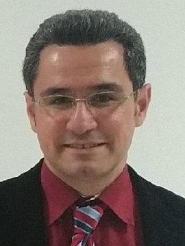
Prof. Dr. Mahdi Motagh

Funktion und Aufgaben:
Professor für "Radarfernerkundung" an der Leibniz Universität Hannover und GFZLeiter der Arbeitsgruppe 'Radar und optische Fernerkundung zur Analyse von Geohazards' am GFZ
Wissenschaftliche Interessen:
- Fernerkundung mit Radarinterferometrie (InSAR)
- Landabsenkung und anthropogene Oberflächendeformationen
- Gravitative Massenbewegungen und Hangrutschungen
- Gletscherdynamik
- Neotektonik, Erdbeben- und Vulkanprozesse
Karriere:
04.2017-present Professor for Radar Remote Sensing at Leibniz University Hannover and GFZ11.2011-04.2017 Senior Research Scientist, Department of Geodesy, GFZ
09.2009-11.2011 Postdoctoral Research Scientist, Department of Geodesy (section 1.4), GFZ
06.2007-09.2009 Postdoctoral Research Scientist, Department of Geophysics (section 2.1), GFZ
11.2003-06.2007 PhD student, Department of Geophysics (GFZ) and University of Potsdam, Germany
10.2002-11.2003 Research Assistant, Institute of Geodesy and Photogrammetry, University of Braunschweig, Germany
10.2000-06.2002 Part-time Instructor at the Department of Surveying and Geomatics Engineering, University of Tehran, Iran
Möglichkeiten für Graduierte und Postdocs:
Wenn Sie einen Master oder PhD haben und Interesse an der Anwendung von Radarfernerkundung für geowissenschaftliche und ingenieurwissenschaftliche Themen haben, kontaktieren Sie mich bitte unter motagh(at)gfz-potsdam.de. Gerne unterstütze ich Sie und diskutiere mit Ihnen Anträge und Möglichkeiten für Forschungsstipendien und -projekte (DAAD, DFG, BMBF,…). Studierende mit einem B.Sc.-Abschluss in Vermessung, Geodäsie, Geoinformatik, Bauingenieurwesen oder verwandten Fachrichtungen können sich für den internationalen Masterstudiengang Geodäsie und Geoinformatik an der Leibniz Universität Hannover bewerben.
Werdegang / Ausbildung:
PhD in Earth Sciences, Department of Earth Sciences, Potsdam University, Germany (conferred 2007), Thesis title “Tectonic and non-tectonic deformation monitoring using Satellite Radar Interferometry”Master of Science in Geodesy, Department of Surveying and Geomatics Engineering, Faculty of Engineering, University of Tehran, Iran (conferred 2000 with First Class Honors), Thesis title “Comparison of 5 methods for modification of Stokes' Integral”
Bachelor of Science in Surveying Engineering, Department of Surveying and Geomatics Engineering, Faculty of Engineering, University of Tehran, Iran (conferred 1997 with First Class Honors)
Projekte:
2021-2023 MultiSaT4SLOWS: Multi-Satellite Imaging for Satellite-based Landslide Occurrence and Warning Service, funded by the Helmholtz Impulse and Networking Fund
2020-2024 SAR4Infra: Development of an automated remote sensing processing chain for the detection and monitoring of hazards
related to traffic infrastructure in Schleswig-Holstein, funded by Federal Ministry of Transport and Digital Infrastructure
2020-2022 AI4flood: Artificial intelligence for flood mapping using SAR, funded by Helmholtz Association
2020-2021 TECVOLSA: Tectonics and Volcanoes in South America, funded by Helmholtz Association
02-06.2020 Assessment of the sinkhole risk in the mining area of Solotvyno, Zakarpattya region, Ukraine, funded by JRC for Copernicus Emergency Management Service
2019-2023 Landslide hazard assessment in Badong, China, funded by CSC program
2019-2020 Land subsidence hazard in Delhi, India, funded by DAAD-India IIT program
2019-2020 Subsidence and coal fire hazards in Jharia Coalfields, India, funded by DAAD-India IIT program
2019-2020 Remote sensing analysis of permafrost degradation in Sanjiangyuan, China, funded by CSC program
2018-2022 HEIBRiDS: a joint graduate program in Data Science between the Einstein Center Digital Future (ECDF) and the Helmholtz Association, funded by Helmholtz Association
2018-2019 InSAR for hazard assessment due to open-pit mining, funded by Sino-German (CSC-DAAD) program
2018-2019 Sinkhole and ground deformation monitoring in Wuhan, funded by CSC program
2016-2017 Imaging Geodesy and Infrastructure Monitoring, funded by Shenzhen Water Science and Technology Development
2013-2017 HGF Alliance “Remote Sensing and Earth System Dynamics”, funded by Helmholtz Association
2011-2012 SAR-EDU - A German education initiative for applied Synthetic Aperture Radar remote sensing

