The German Research Foundation (DFG) funds the research unit “Clock Metrology: A Novel Approach to TIME in Geodesy” (Speaker: Prof. Ulrich Schreiber, TU Munich) with in total ten projects, four of them with the participation of GFZ Department 1 “Geodesy”, Sec. 1.1., 1.2., and 1.3. The duration will be four years with the option of an extension of another four years.
The overall goal of this research unit is the determination of highly accurate and long-term stable geodetic reference frames. Global reference frames are the metrological basis for Earth system monitoring and other applications, for instance, the quantification of change processes in the Earth’s system, and positioning and navigation on Earth and in space. This topic is of high societal relevance; therefore, the United Nations adopted the UN resolution “Global Geodetic Reference Frame for Sustainable Development” (GGRF, www.unggrf.org) on February 26, 2015.
Global geodetic reference frames are determined by a combination of measurements of the four main space-geodetic techniques all based on time measurements. The combination is usually done utilizing local surveys, so-called local ties, at globally distributed stations observing different techniques. However, systematic errors limit the accuracy of the combined solution, the geodetic reference frame. Within the research unit, “time coherence” between the space-geodetic techniques will be introduced as a novel tie, called clock tie.
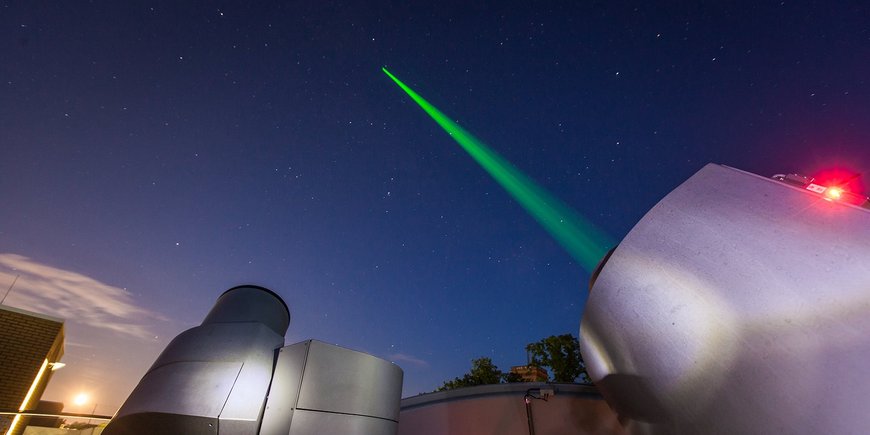
Closure measurements utilizing a common clock and common reference point for the space geodetic techniques will be performed first at the Geodetic Observatory Wettzell, Germany. It is planned that Wettzell will be connected to the Satellite Laser Ranging Station in Potsdam by means of a satellite link (ACES mission / Atomic Clock Ensemble in Space) via time transfer. The satellite laser ranging station at the German Research Centre for Geosciences in Potsdam will in turn be connected via fiber lines to the highly precise and stable time system of the Physikalisch-Technische Bundesanstalt PTB, the German National Metrological Institute. It will allow a quasi-error-free combination of the space-geodetic techniques and a significantly improved geodetic reference frame, the basis for the accurate observation of our planet Earth.
Speaker of DFG Research Unit: Prof. Ulrich Schreiber, TU Munich


![[Translate to English:] Torsten Sachs in front of a climate station on a field](/fileadmin/_processed_/3/9/csm__TorstenSachs_bearbeitet_GS_4a1365ef84.jpeg)
![[Translate to English:] left image flood at the Ahrtal: image from above, several houses are flooded; left image:: Heidi Kreibich;](/fileadmin/_processed_/4/4/csm_Bild2_9af0130e9f.png)
![[Translate to English:] Start der Vega Rakete](/fileadmin/_processed_/6/4/csm_20231201-kachel_Vega-VV23-launch_ESA-CNES-Arianespace_706716b68c.jpeg)
![[Translate to English:] Poster exhibition at the Brandenburg Hydrogen Day at the GFZ, some participants in the foreground](/fileadmin/_processed_/6/5/csm_Erster_Brandenburgischer_Wasserstofftag_GFZ_402fcec95e.jpeg)
![[Translate to English:] Group picture of the participants](/fileadmin/_processed_/9/4/csm_20231108_CAWa-Workshop-Tashkent_Gruppenbild_99ea779d8a.jpeg)
![[Translate to English:] [Translate to English:] Hörsaal](/fileadmin/_processed_/e/6/csm_H%C3%B6rsal_e21ac645fb.jpeg)
![[Translate to English:] The Delegations in the Historic Library on the Telegrafenberg. In the back there are from left to right, the Dutch Ambassador for Germany, Ronald van Roeden, the Dutch Minister for Education, Culture and Science, Robbert Dijkgraaf and the scientific director of the GFZ, Susanne Buiter.](/fileadmin/_processed_/d/b/csm_Kachel-2_9eba4b4212.jpeg)
