


A new eruption in the region around Grindavik in southwest Iceland was already predicted back in October 2023. On the one hand, the earthquakes had increased, and on the other, an uplift was visible in the satellite radar data. The highlight in November of this year was a rupture that ran through the small town of Grindavík, among other places. Since then, a larger eruption was expected. The eruption that occurred in the morning hours of December 19 (CET) was the fourth eruption in a row. Previous eruptions occurred further east, both in the summer of 2023 and in 2022 and 2021.
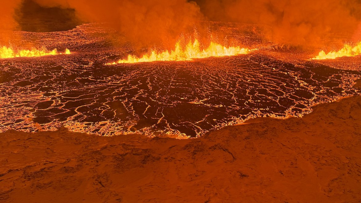
This new eruption is significantly larger, with significantly higher eruption rates, significantly higher lava flows and a 3500 m long section of a 14 km long fissure that runs northeast-southwest almost parallel to the main road in Grindavík. The earthquakes in the early hours of 19 December show a southward continuation of the lava flow. The small town of Grindavík was evacuated at the beginning of November. The concern now is, on the one hand, that the eruption will move into this town. On the other hand, large quantities of gases will be emitted. As the eruption occurred southwest of the capital Reykjavík, it is possible that residents in Reykjavík will also be asked to stay inside if the winds are unfavorable. There is also a risk of damage to the nearby geothermal plant; despite the rapid construction of earth walls to dam up the lava flows.
Type of eruption
The current eruption is an effusive eruption. Effusive means that lava flows are fluid, moving slowly and following the topography. The initial location of the eruption is north of the weather divide, so that lava flows tend to move northwards. However, this situation can change quickly, and earthquake shifts to the south in particular must be monitored carefully. At present, volcanic activity is not expected to become explosive, as it was the case with the eruption of Eyjafjallajökull in 2010.
The GFZ on site
The region around the small town of Grindavík has already been known as a seismically unstable region for four years. Scientists have also observed an uplift in the last three years. In contrast to the 2020 uplift, this time the uplift was much stronger. It was around ten times larger. The size of the uplift was also significantly larger than in previous years. A stronger eruption was therefore to be expected. For this reason, the GFZ has been present on site with its basic research since the beginning of November 2023. At that time, a new fissure had just opened up, which also reached the town of Grindavík. The cause of this fissure is still being discussed.
What has been observed so far?
Magma accumulates at depth until it eventually ruptures and magma can then migrate to the surface. A magma fissure, a vein intrusion, had already opened on 11 November 2023. This intrusion was relatively long at around 14 km and it was already assumed at the time that the eruption that can now be observed would occur. Nevertheless, at that time, the magma seemed to be stuck at a depth of a few hundred meters. In the meantime, improved data show that the magma was stuck at a depth of 500-900 meters. It did not reach the surface. However, many faults have been reactivated on the earth's surface in this way. Many buildings in Grindavík have been damaged.
Our scientists have compared these new faults that we see in the satellite data with an archived photo dataset (aerial photographs). This data was already recorded in the 1950s and 1960s. Even then, fissures were already visible at this location. In the decades that followed, the town of Grindavik was built so that these fissures were no longer visible. However, the deformation activity in November 2023 exposed them again.
Current data from the Grindavík region
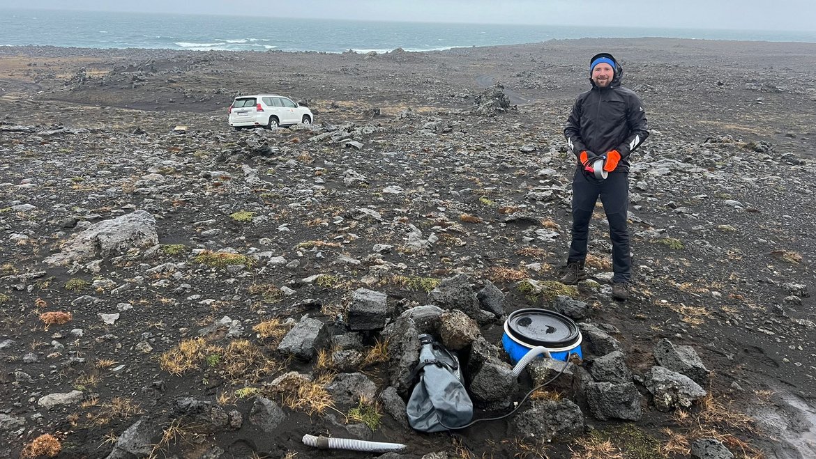
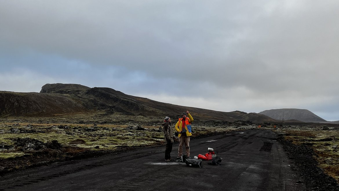
In November 2023, the GFZ sent three teams to install seismometers near Grindavik. Overflights were also carried out with drones to precisely measure the topography/morphology. Drones can take images that overlap and from which very high-resolution digital terrain models can be produced. GFZ scientists have created digital twins of the volcanoes, which has worked very well thanks to the support of Icelandic partners, especially in authorizing drone flights in the restricted area.
Investigating temperature anomalies
The GFZ drones are also equipped with radiometric thermal cameras, for example. They can be used to detect temperature anomalies below 0.5° Celsius. Surprisingly, we were unable to detect any temperature anomalies during the GFZ mission in mid-November. Temperature anomalies were caused solely by the water pipes bursting as a result of severe expansion
Fiber optic cable for recording seismic activity
Another GFZ team already has experience in Iceland. The scientists have used this fibre optic cables in precisely this region of Iceland in 2015 and in 2020 (see articles of 2018 "A bright and vibrant future for seismology" and 2020 "Earthquake in Iceland registered via fibre optic telephone cable"). Therefore, there was already close contact with our partners (Iceland Geosurvey, ISOR) and the local telecommunications company (Mila). The method is working by connecting a device (interrogator) which sends coherent light pulses (like flashes) within the fibre. The light scatters (goes in all directions) at inhomogeneities in glas property (refractive index*) naturally acquired when the fibre is built. After light is scattered, part of it returns to the interrogator, where it is analysed. When the ground experience strain change (e.g., vibrations) the inhomogeneity distribution in the fibre changes making the fibre glas properties change, and thus light property change as well. In this way, strain along the fibre can be measured. Our acquisition is currently set up so that strain is measured every 4 meter along the fiber optic cable. The cable is 15 kilometers long. This means that 15,000 meters = 3750 "seismometers" are currently collecting strain data along the cable. This makes it possible to locate earthquakes with increased precision.
*The refractive index is defining how the light is propagating within the fibre glas.
Data from the start of the eruption
Thanks to the early installation of the measuring devices, the scientists now have data from the start of an eruption. This makes the data particularly exciting. GFZ scientists can only access the data available online at the moment. Nevertheless, further data is currently being collected on an ongoing basis, which can be evaluated at a later date. The broadband seismometers, which record the smallest tremors, will have to be visited again as soon as it becomes safer to do so. At the moment, it is not clear in which direction the fissure will continue to expand.
HART mission: investigating the reactivation of existing structures
One of the main objectives of the GFZ HART mission (Hazard and Risk Team) is to better understand the reactivation of pre-existing structures. In other volcanic regions, there are most likely just such hidden structures. However, Iceland is particularly suitable because there are good outcrops on the earth's surface and we can carry out basic research. At the same time, we have access to aerial photographs that have been archived for 80 years. The data is freely available.
Support for researchers - local partners
With our GFZ fundamental research, we also support local science. With current events like this, the few Icelandic professors have their hands full. At the same time, they are interested in procedures that the local scientists lack. These are, for example, the drones equipped with thermal cameras. The seismologists also installed GFZ devices in November exactly where there were still gaps (especially in the western area of the Reykjanes Peninsula).
The GFZ is working very closely with the University of Iceland. One of our GFZ deployment teams is working together with ISOR (Iceland Geothermal Energy GeoSurvey | ÍSOR), an institute for geothermal exploration. They also cooperate with British scientists from the University of Cambridge and Czech colleagues.
[The paragraph 'Fiber optic cable for recording seismic activity' has been edited 21.12.2023]
++++++++++++++++++++++++++++++++++
Update 21.12.2023
The eruption is over (for now). However, a new uplift phase can now (21.12.23) be seen again. The magma chamber is swelling again. At this point, it is difficult to predict the continuation of the eruption (Icelandic Meteorological Office).
Further Information from the Icelandic Meteorological Office
19 December at 18:30 UTC
The eruption continues to weaken. New aerial images of the area show that there are now three vents erupting southeast of Stóra-Skógfell, down from the previous five. The lava has mostly flowed east from the eruption site, but there is also a lava tongue flowing west from the region north of Stóra-Skógfell.
Since the eruption began, about 320 earthquakes have been measured over the magma channels. The largest earthquake, with a magnitude of 4.1, occurred at 23:25 on Monday. After midnight, seismic activity significantly decreased, and since 12:00 today, only 10 earthquakes have been recorded in the region. Following the eruption at Sundhnúksgíga, the land in Svartsengi subsided more than 5 cm. Previously, the land had risen there by about 35 cm since the formation of the magma channel on November 10. It is too early to determine if magma will continue to accumulate under Svartsengi and whether the land will start to rise again.
While the eruption continues at Sundhnúksgíga, there is an increased likelihood that more vents may open along the original fissure as well as further north or south. Looking back at the lead-up to the eruption reveals that there were approximately 90 minutes between the first indicators and the start of the eruption. Therefore, the warning time for new vent openings at Sundhnúk could be very short.
Task Force Team / Contributing GFZ scientist:
- Benjamin Männel, Markus Ramatschi, Andreas Brack, Mario D'Acquisto: GNSS field sites, installations of GNSS instruments, processing and data analysis for geodesy.
- Mahdi Motagh, Magdalena Stefanova Vassileva: Satellite InSAR for crustal movement monitoring.
- Alina Shevchenko, Mahdi Motagh: Innovative radar drone observations for detection of underground cavities and comparison to Pleiades and photo archives.
- Thomas Walter, Ben deJarnatt, Maria Hurley: Time-lapse camera field site installations and drone surveys, development of station deployment with drones.
- Torsten Dahm, Simone Cesca, Marius Isken, Pinar Büyükakpinar: Seismic moment tensor analysis of propagating and interacting fractures. Ten smart realtime stations (QuakeSaver) to be installed on Iceland in public buildings.
- Charlotte Krawczyk, Philippe Jousset, Sergio Diaz, Christopher Wollin: Fiber optic measurements of a large deforming volcano.
- Jürgen Matzka: Geomagnetic surveying using field observations and drones for monitoring cooling conditions in a magma filled fracture.


![[Translate to English:] Hörsaal](/fileadmin/_processed_/e/6/csm_H%C3%B6rsal_f1d7c412b9.webp "[Translate to English:]")


