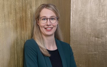
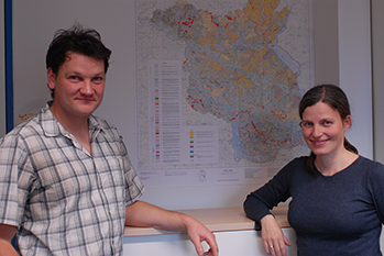
Dr. Elisabeth Dietze and Dr. Michael Dietze work as geographers at GFZ sections „Climate Dynamics and Landscape Evolution“ and „Geomorphology“, respectively. They made available an algorithm for endmember-modeling of grain sizes – EMMAgeo – via open source software. In this interview they explain what exactly this algorithm is and how it can be applied for climate and environmental research.
GFZ: You both work as geomorphologists or sedimentologists, respectively, at GFZ. What exactly does a geomorphologist do?
Dr. Michael Dietze: As a geomorphologist you deal with the formation of the Earth’s surface; with the single forms a landscape is made of, their origins, with the characteristic features of these landscape forms, and finally, with the formation history of a landscape as a whole.
GFZ: What is the specific focus that you deal with as a sedimentologist?
Dr. Elisabeth Dietze: As a sedimentologist you investigate landscape forms by analyzing the composition of these forms that often consist of sediments. These sediments reveal a lot about their forming processes. You look at different sediment parameters, such as the mineral composition or grain sizes. It is, thus, possible to draw conclusions on the origin of sediments, and at the same time on the transport processes.
GFZ: You have now developed a software package named EMMAgeo for endmember modeling of sediments. My first question is what exactly is endmember modeling?
E. Dietze: Basically, endmember modeling is a method that allows to statistically de-mix mixed processes or data and to thereby segregate “background noise” from the actual signal. We now applied this on grain size data. However, this method can be used in several other disciplines as well, for example in remote sensing.
M. Dietze: The whole story goes back to Geert Jan Weltje, who developed an endmember modeling approach based on the computer language FORTRAN, 18 years ago. To make this approach available to other working groups that do not have access to the FORTRAN software, Elisabeth’s working group at FU Berlin* transferred this algorithm to MATLAB software. The source code was disclosed so that others could modify the algorithm.
What we did together now is that we made the whole thing freely accessible, also free of charge. We therefore transferred the MATLAB script to the computer language R, added new functions, options for documentation, and examples so that now everyone interested can get from the measured data set to the endmember modeling output, e.g. the actual data signals, and to interpretable grain size distribution data.
GFZ: What kind of signals do you read from the sediments? And what information do you get by applying EMMAgeo?
E. Dietze: We get information on where the sediment comes from, by which process it was transported – e.g. by wind or running water -, by how much energy or how far it was transported. The larger one particle, the more energy is needed to transport it. Each transport process tends to produce characteristic grain size distributions. And vice versa the grain size distribution can be used to obtain insight into the transport process.
The problem is, however, that often there is more than one process involved so that the characteristic grain size distributions within a sample are mixed. This is where EMMAgeo comes to play. The endmember algorithm in the new R-package can segregate these mixed signals back to its original grain size compositions.
What we see when using the new algorithm is, for example, that we often find maxima just at the classical limits of grain size classes; between sand and silt. This means that a large amount of grains within a sample lies just between two grain size classes. This is something you would not be able to detect if you only look at mean values, as was done before. Endmember modeling now keeps the information of every measured grain size class and thereby bypasses this problem.
M. Dietze: The classical limits between grain sizes are, whatsoever, set somewhat “randomly”. You cannot just tell that a natural process stops at 200 µm or 63 µm, abruptly, and that all that is larger than 63 µm is exclusively transported by just one type of transport process. Much rather, distribution processes are continuous processes. This is what our model can show much more precisely.
GFZ: How do you measure grain sizes, what is the method used?
M. Dietze: Measuring grain sizes is one of the oldest and most classical problems in geomorphology and sedimentology. Usually, the spectra of measured grain sizes lie between below one micrometer up to several millimeters in size. Classically, the coarse part larger than 63 µm is measured by sieve analysis, the fine part via sedimentation or density analysis within a sediment-water mix. Both approaches are rather time-consuming – measuring one single sample needs up to one day – and only a few grain size classes, 7 to 20, can be determined by these analyses.
New approaches that have existed for about 20 to 30 years use the technique of laser diffraction. One laser beam is diffracted by a particle. The diffraction angle is larger, the smaller one particle is. With this technique grain sizes can be separated into more than one hundred classes.
Another method takes photographs of grains in free fall with more than one hundred pictures per second. So all grains can be digitalized and described by 300 grain size classes. Since some months we now have two of these machines at GFZ. After successful testing, we have now started cooperating with several working groups at GFZ and also with external institutions, and we investigate different geomorphological systems and archives.
GFZ: Are there other things that EMMAgeo can do better than other approaches? Are there new things that can now be examined?
E. Dietze: EMMAgeo stands out because you now cannot only de-mix and thereby identify transport processes, but also quantify to what extend each transport process contributed to one sample. Important for us is that by using EMMAgeo, uncertainty in de-mixing can be estimated. We call this „robust endmember modeling“.
We furthermore tested and validated the algorithm with natural samples. Therefore, we mixed four types of sediments with known origins in the lab and de-mixed them successfully statistically by using EMMAgeo. Depending on the sediment type we achieved good to very good results within these tests, both in identifying and in quantifying. So EMMAgeo serves as a very reliable, most exact, and fast tool for robust de-mixing of grain sizes.
GFZ: Can you describe concrete projects where you have applied the new algorithm?
E. Dietze: In the DFG Priority Program on the Tibetan Plateau “TiP“, we investigated a lake in northeastern Tibet, where there are sections on the beach where fluvial sediments, aeolian sediments (N.B. transported by wind), and lake sediments intermingle. By using EMMAgeo we were able to reconstruct sea level fluctuations based on the de-mixed grain sizes. This gave us the information that 9,000 years ago the Asian monsoon was extremely strong; sea levels were extremely high during that time.
In another project we reconstructed sediment transportation processes in a desert area as well as overprinting processes due to soil formation. So in this case the characteristic endmember data allowed us to reconstruct specific weathering processes and therewith decipher the formation process of a desert soil. This again makes it possible to draw conclusions on the environmental conditions that prevailed during the time the soil was formed. Strong weathering and intense soil formation hint to humid environmental conditions, much more intense than today.
In current projects we use EMMAgeo for the analysis of sediments that were sampled on submillimeter-base. We apply EMMAgeo on Mesozoic delta sediments from several drill cores, and we analyze sediments that were mixed by slope shifting processes.
GFZ: Why is this information from the sediments needed?
E. Dietze: Eventually, information from sediments on landscape evolution is needed to understand past climate changes in specific regions. Landscape changes depend on prevailing climate, driven by processes whose grain size signature can be analyzed by us. If you know about the past you can make predictions for the future, climate models can be supplied with data from sediments.
GFZ: Ms. Dietze, Mr. Dietze, I would like to thank you for talking with us.
Both: Thank you for the interview.
*from 2008 to 2012, Dr. Elisabeth Dietze worked at the Institute of Geographical Sciences at the FU Berlin, before she came to GFZ in 2012.
The interview was led by Ariane Kujau


![[Translate to English:] Torsten Sachs in front of a climate station on a field](/fileadmin/_processed_/3/9/csm__TorstenSachs_bearbeitet_GS_4a1365ef84.jpeg)
![[Translate to English:] left image flood at the Ahrtal: image from above, several houses are flooded; left image:: Heidi Kreibich;](/fileadmin/_processed_/4/4/csm_Bild2_9af0130e9f.png)
![[Translate to English:] Start der Vega Rakete](/fileadmin/_processed_/6/4/csm_20231201-kachel_Vega-VV23-launch_ESA-CNES-Arianespace_706716b68c.jpeg)
![[Translate to English:] Poster exhibition at the Brandenburg Hydrogen Day at the GFZ, some participants in the foreground](/fileadmin/_processed_/6/5/csm_Erster_Brandenburgischer_Wasserstofftag_GFZ_402fcec95e.jpeg)
![[Translate to English:] Group picture of the participants](/fileadmin/_processed_/9/4/csm_20231108_CAWa-Workshop-Tashkent_Gruppenbild_99ea779d8a.jpeg)
![[Translate to English:] [Translate to English:] Hörsaal](/fileadmin/_processed_/e/6/csm_H%C3%B6rsal_e21ac645fb.jpeg)
![[Translate to English:] The Delegations in the Historic Library on the Telegrafenberg. In the back there are from left to right, the Dutch Ambassador for Germany, Ronald van Roeden, the Dutch Minister for Education, Culture and Science, Robbert Dijkgraaf and the scientific director of the GFZ, Susanne Buiter.](/fileadmin/_processed_/d/b/csm_Kachel-2_9eba4b4212.jpeg)
