

Overview
A multi-national and interdisciplinary project to study the crustal structure and geodynamics of the Dead Sea Transform. The project is coordinated by the GeoForschungsZentrum (GFZ) Potsdam (Germany), in cooperation with Tel Aviv University (Israel), the Hebrew University (Israel), the Geophysical Institute of Israel, the Natural Resources Authority (Jordan), the An-Najah National University (Palestine), and several Universities in Germany.
Time frame
- 2000 - 2012
Funding
- DFG - German Research Foundation
- GFZ - Helmholtz Centre Potsdam - GFZ German Research Centre for Geosciences
- Minerva Stiftung
Principal Investigators
- M. Weber (GFZ)
Personnel
- Nils Maerklin (GFZ)
- Dagmar Kesten (GFZ)
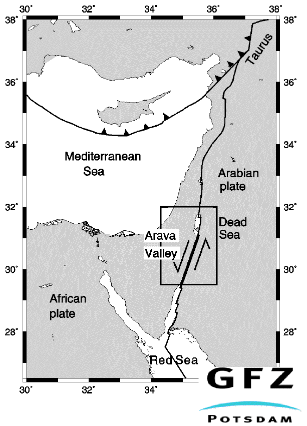
Figure 1
Tectonic setting of the eastern Mediterranean and the Middle East. The inset shows the locations of Figures 2 and 4.(Figure by T. Ryberg and M. Weber)
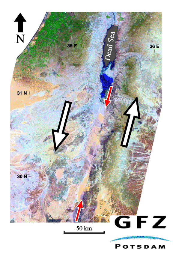
Figure 2
Landsat TM Mosaic of the Dead Sea, the Arava Valley, and the surrounding area (see also Figure 1).The coverage shows Israel and the Palestine Territories on the left and Jordan on the right. The white arrows indicate the left-lateral motion along the DST.Present-day motion is approximately 4 +/- 2 mm/yr (Klinger et al. 2000a,b) between the African plate (left) and the Arabian plate (right). The linear structure indicated by the red arrows, striking at 15 deg N in the Arava Valley, is the Arava Fault (image courtesy of M. Munier, GFZ).
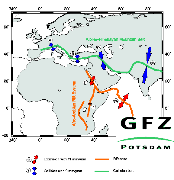
Figure 3
The Alpine-Himalayan mountain belt (collision belt) and Afro-Arabian rift system (rift zone). Relative plate motion is given in mm/year based on NUVEL-1. The study area in the Middle East is indicated by the circle (Figure by M. Weber and S. Sobolev).

Figure 4
Historical earthquakes in the Middle East (red dots with year and magnitude ) according to Ellenblum et al. (1998) and Klinger et al (2000b); localizations of large earthquakes of the last century (red stars); and all events with magnitude Ml > 2 from 1981 - 1998 (white dots, A. Hofstetter, personal communication). Cities are given by black squares. The DESERT Profile (DESERT Team 2000 ) is given by the green dots.
