

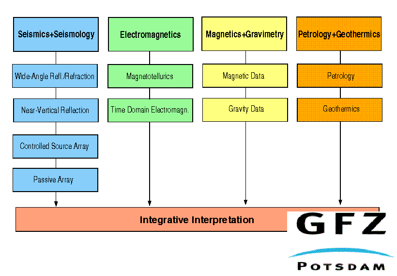
Figure 1
Projects (1 to 5) and sub-projects of the Dead Sea Rift Transect, (Figure by M. Baumann and M. Weber).
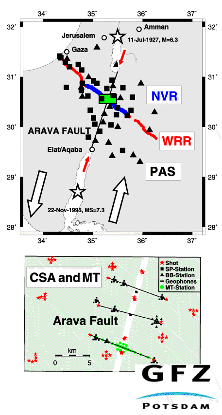
Figure 2
(Top) Coincident geophysical experiments in the Middle East. The wideangle reflection/refraction profile (WRR, the central part coincides with NVR, the outer parts are marked by red dots) crossing the Palestine Territories, Israel, and Jordan is ~300 km long. The near-vertical reflection profile (NVR, blue line) covers ~100 km. The full squares (triangles) indicate the locations of short-period (broad-band) seismic stations of the passive array experiment (PAS). The green box, 25 km x 16 km,represents the location of the controlled source array experiment (CSA) and the magnetotelluric pilot study (MT). Stars indicate large earthquakes. The Arava Fault is indicated as a thin black line and by the two red arrows. The white arrows indicate the left-lateral motion of 105 km between the African and Arabian plates. (Bottom) Blow-up of the green box (top) showing the configuration of seismic shots points (red stars) and receivers (black symbols) of the CSA experiment and the MT stations (green dots).The WRR and NVR profiles run along the southern CSA line.