

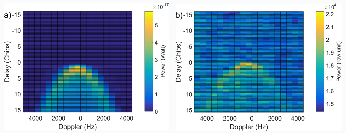
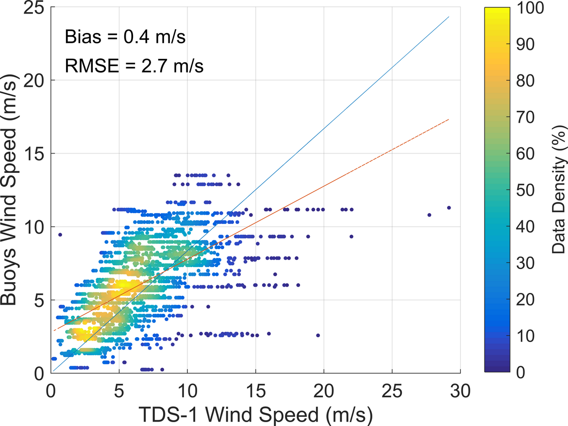
Current meteorological models dramatically fail to resolve the fast storm growth evolutions in severe weather events. This fact is caused by the lack of high-resolution observational data in the current operational Data Assimilation (DA) systems and deficiencies in the collection of real-time data from inner core of hurricanes. This fact is due to the heavy clouds and intense precipitations. GNSS scatterometry can be structurally able to provide the unaffected wind information due to the none-sensitivity to atmospheric attenuation, while other scatterometers are affected during such phenomena [Portabella et al., 2012]. Zavorotny and Voronovich [2000] theoretically have modeled the power of a scattered GPS signal as a function of geometrical properties, wind speed and direction. Figure 1 displays a modelled Doppler Delay Map (DDM) (i.e. the map of GNSS signals scattered from the ocean surface) and one measured on board the U.K. TechDemoSat-1 satellite (TDS-1, Unwind et al., 2016). Figure 2 compares the TDS-1 and ocean buoys wind speeds.
By the supports from geoscientific Geo.X network in the German Berlin-Potsdam region, the Young Academy Fellow program, this research project addresses the retrieval of wind information by GNSS-R techniques. The errors will be characterized [Asgarimehr et al., 2017] and GNSS-R data assimilation into weather models and the improvements in storm scale predictions will be evaluated. These investigations have started by studying TechDemoSat-1 (TDS-1) GNSS-R based winds. The eight-satellite GNSS-R mission CYGNSS (Cyclone Global Navigation Satellite System, launch: 19 December, 2016) data allow the continuation of the study with 630,000 DDMs per 48 hours.
References
Asgarimehr, M., J. Wickert, and S. Reich (2017), Rain Effects on TechDemoSat-1 wind speeds: Toward improved GNSS Scatterometry, Submitted paper to IEEE Geoscience and Remote Sensing Letters (under review).
Portabella, M., A. Stoffelen, W. Lin, A. Turiel, A. Verhoef, J. Verspeek, and J. Ballabrera-Poy (2012), Rain effects on ASCAT-retrieved winds: Toward an improved quality control, IEEE Transactions on Geoscience and Remote Sensing, 50(7), 2495-2506
Unwin, M., P. Jales, J. Tye, C. Gommenginger, G. Foti, and J. Rosello, Spaceborne GNSS-Reflectometry on TechDemoSat-1: Early Mission Operations and Exploitation, IEEE Journal of Selected Topics in Applied Earth Observations and Remote Sensing, 9, 10, pp. 4525-4539, doi: 10.1109/JSTARS.2016.2603846, 2016.
Zavorotny, V. U., and A. G. Voronovich (2000), Scattering of GPS signals from the ocean with wind remote sensing application, IEEE Transactions on Geoscience and Remote Sensing, 38(2), 951-964

