Knowledge transfer into practice
Since September 2021 our Learning and exchange website FERN.Lern is online. There, you can find all important information about the SAPIENS project. In addition, it provides an overview of all earth oberservation knowledge transfer projects at the German Research Centre for Geosciences Potsdam (GFZ) and serves as a platform hosting the learning content created within the different projects thus far.
On the FERN.Lern Forum, you can discuss the individual learning formats of SAPIENS, KONSAB and Copernicus training for environmental authorities with us, ask questions, share criticism and ideas, initiate discussions or simply read along. Help us bring the forum to life and register!
Our interactive online training courses and workshops on the use of free satellite data in November 2021 and February 2022 were very well attended. For those interested, our instructional content created within SAPIENS in the form of videos, manuals and tutorials (all in German language) is constantly available free of charge on the FERN.Lern website.
COPERNICUS satellite data: from science to application
Free remote sensing data, such as the data from the Copernicus Sentinel missions, provide up-to-date, spatial environmental information on land and water, biomass, soil and much more. This data can support decision-making processes at many different levels and in many institutions. Local authorities or NGOs, for example, can use this knowledge to draw their own conclusions about the state of the environment and act accordingly.
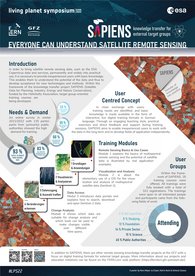
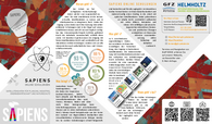
The amount of freely available remote sensing data is growing exponentially, but its use is still poorly integrated into everyday work and decision-making processes. The SAPIENS project aimed to make expert knowledge about the handling and interpretation of satellite data available to all interested parties in the form of interactive, easily understandable online training courses.
With SAPIENS, a demand-oriented training programme in the field of satellite remote sensing was offered. In close dialogue with users (e.g. NGOs, public authorities), knowledge gaps were identified and the corresponding material made available in the form of easy-to-use digital training formats. Together with interested partners from industry, NGOs and public administration, pilot projects were developed and the content, learning objectives and digital learning formats were adapted to the respective needs. The goal was and is to provide help for self-help, so that users can then process and use satellite data independently.
![[Translate to English:] Sentinel-2 Satellit](/fileadmin/_processed_/6/d/csm_Sentinel-2_ProWissen__copyright_60b283cba6.jpeg)
Videos of the Training Modules
You can find the training videos on the FERN.Lern Website and the FERN.Lern Youtube channel.

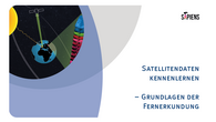
Getting to know satellite data – Basics of remote sensing
(The manual on module 1)
What is remote sensing? What do satellites “see”? And how can optical satellite data be used? These questions and more are answered in the first training manual document “Basics of remote sensing” in German language. It gives an introduction to remote sensing with many further web links and application examples.
View & Download

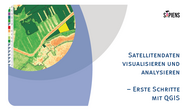
Visualizing and analyzing satellite data – First steps with QGIS
(The manual on module 2)
Processing satellite data in a GIS is not that complicated. The second document in the series SAPIENS: Satellite Data for Planning, Industry, Energy Management and Nature Conservation provides an introduction to the free geoinformation system QGIS and describes basic steps in processing optical satellite data. Step by step we explain how to use QGIS to display the data in different band combinations and calculate indices and how to symbolize, crop and export them, with many additional tips, further web links and an excursion to vector data and open geodata.
View & Download
![[Translate to English:] Titelblatt](/fileadmin/_processed_/8/a/csm_SAPIENS_H3_28c50fc2ce.png)
Find suitable satellite data - The CODE-DE data portal
(The manual on module 3)
The CODE-DE data portal is a central point of contact for Copernicus data in Germany. Free of charge and in German language, users are provided access to satellite data in various ways. In the third document of the series SAPIENS: Satellite Data for Planning, Industry, Energy and Nature Conservation we show how to search, find, visualize and download appropriate satellite data using the EO Browser and EO Finder of CODE-DE.
View & Download
![[Translate to English:] Titelblatt](/fileadmin/_processed_/d/9/csm_SAPIENS_H5_b1fcd526b0.png)
Processing Satellite Data - The Sentinel Application Platform SNAP
(The extra manual)
When satellite data need to be processed, the free software SNAP provided by ESA is very helpful, especially for sentinel data. But how does the English-language program work? The extra manual from the series SAPIENS: Satellite Data for Planning, Industry, Energy Management and Nature Conservation clearly explains the most important steps and functions. We show how to load satellite scenes, visualize them, correct them atmospherically, edit them with a wide variety of tools, and automate common work steps. An entire chapter is also dedicated to the variety of indices available in SNAP.
View & Download


![[Translate to English:] SAPIENS](/fileadmin/_processed_/d/2/csm_Titelbanner_SAPIENS-Webseite_extended_ac20edec54.png)


