

3D-Deutschland
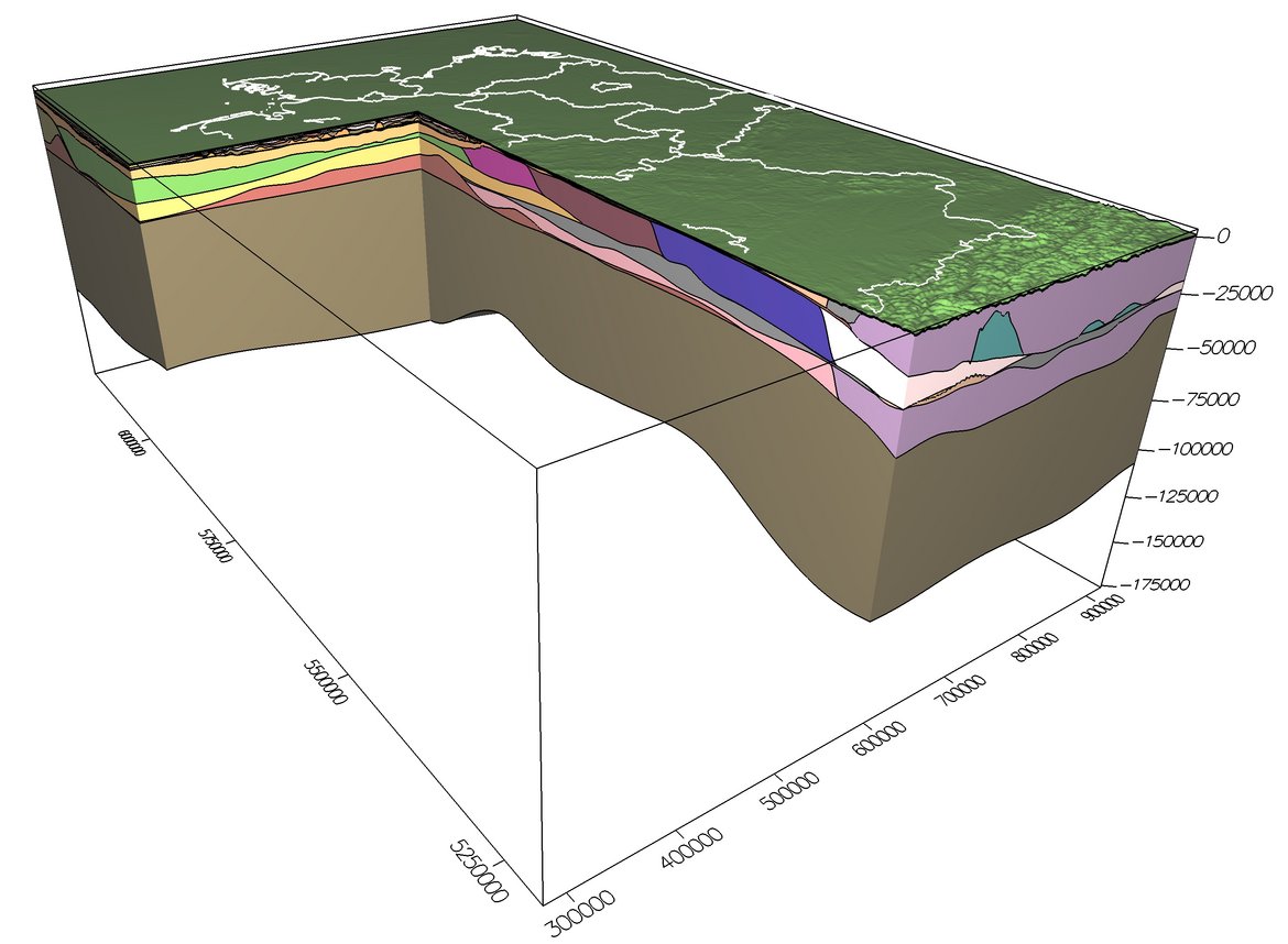
In the 3-D-Deutschland (3-D-D) project previous results on sub-domains are combined into a 3-D lithospheric-scale structural model 3-D-D that covers the entire surface of Germany and extends 1000 km in North-South direction, 643 km in East-West direction and down to 133 km in depth (Figure 1).
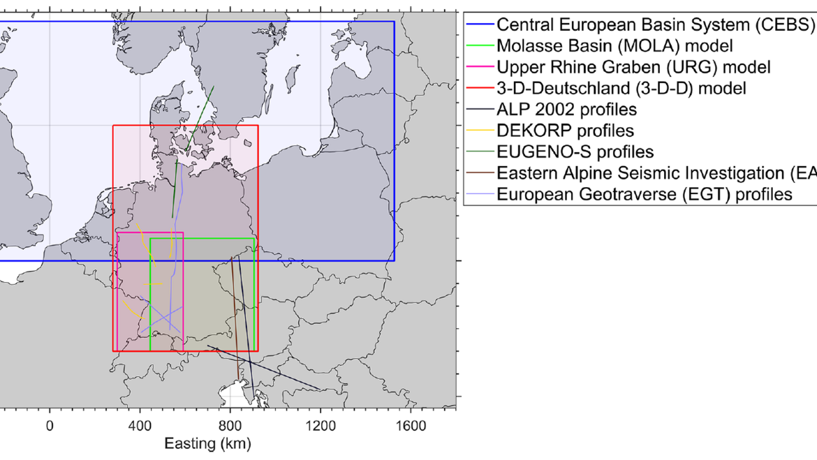
The combined regional 3D models of the Central European Basin System, the Upper Rhine Graben and the Molasse Basin together with the Alpine area were assembled by integration of various available input data: geological and geophysical datasets, geological maps, borehole data, seismic profiles, isopach maps and existing smaller-scale models. On top of that, each regional model was independently constrained by 3-D gravity and thermal modelling using the gravity modelling software IGMAS+ and the finite-element thermal simulator GOLEM.
The lithostratigraphic division of the joint 3-D-D model (Figure 2) resolves sedimentary, crustal and mantle units and was once more cross-checked by 3-D gravity and thermal modelling to overcome boundary effects related to the smaller individual source models. Structural discrepancies between the source models were consistently eliminated using seismic profiles across the boundaries of regional models.
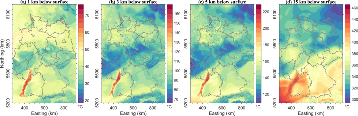
Conductive thermal field modelling demonstrates how the heterogeneous distribution of thermal properties associated with the different lithological units causes significant variations of temperature at the same depth level (Figure 3). This distribution is mainly affected by the blanketing effect of low conductive sediments, by the variability in radiogenic heat production and thickness in the upper crust (Variscan and Alpine domains) and by the depth to the thermal lithosphere-asthenosphere boundary.
The derived 3-D-D model can serve as a data-consistent background for smaller-scale models or used to improve boundary conditions for local structural, geothermal and stress field studies. It also can be useful as a basis for rheological modelling helping to relate observed seismicity with the strength distribution.
Project results open a door to an integrative and multi-disciplinary analysis of spatial variability as well as potential geohazards below the territory of Germany and help to develop an efficient approach for sustainable use of the geo-resources, thus contributing to the POF IV topics 3 and 8.
Funding:
POF IV Topics 3 and 8, internal funding
Publications:
Anikiev, D., Lechel, A., Gomez Dacal, M. L., Bott, J., Cacace, M., & Scheck-Wenderoth, M. (2019). A three-dimensional lithospheric-scale thermal model of Germany. Advances in Geosciences, 49, 225–234. doi: 10.5194/adgeo-49-225-2019
Anikiev, Denis; Lechel, Adrian; Gomez Dacal, Maria Laura; Bott, Judith; Cacace, Mauro; Scheck-Wenderoth, Magdalena (2019): 3-D-Deutschland (3-D-D): A three-dimensional lithospheric-scale thermal model of Germany. GFZ Data Services. doi: 10.5880/GFZ.4.5.2019.005
Related projects:
• SpannEnd (Section 2.6). See also: https://www.spannend-projekt.de
• IGMAS+ (Section 4.5). See also: https://www.gfz-potsdam.de/igmas

