

North Myanmar Seismic Imaging
Fellowship, CSC - China Scholarship Council
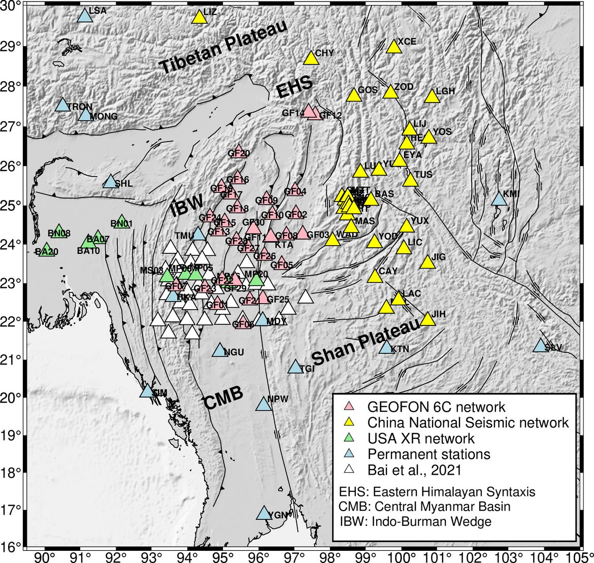
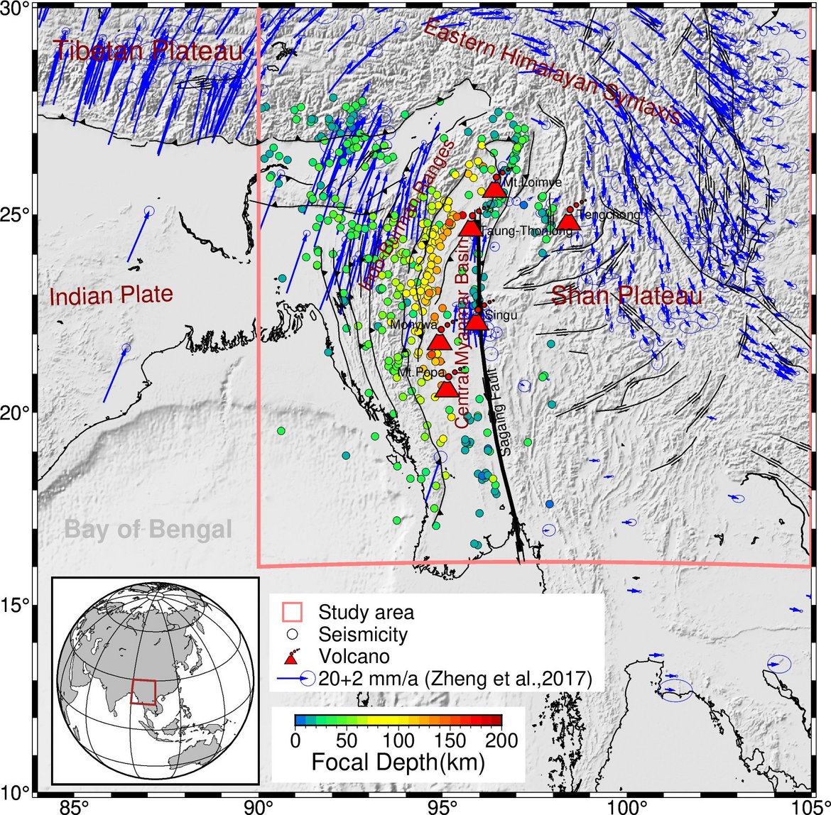
The main goal of the project is to study the seismic structure of the crust and mantle lithosphere under northern Myanmar by local seismic networks. Myanmar is one of the most complicated and active tectonic regions in the world, and exposed to a high seismic hazard. The Burmese arc consists of the Indo-Burman Ranges, an accretionary wedge, in the west and the Central Myanmar Basin in the east. It is bounded in the east by the seismically active Sagaing Fault. East of this fault the Shan Plateau forms part of the Asian plate. Intermediate-depth seismicity below Myanmar occurs at depths up to ~150 km and is generally understood to be related to the subducting Burma slab. An important open question concerns the transition from oceanic subduction to continental subduction/collision along the Burmense arc. This project analyses 30 broadband stations deployed by the GFZ and DMH as a temporary network (FDSN code 6C 2019-2021), a temporary array involving 32 stations from Data Management Centre of China National Seismic Network at Institute of Geophysics (SEISDMC), 10 stations from the USA (a subset of the TRIPARTITE experiment, FDSN code XR) and 18 permanent stations. The proposed scientific work includes ambient noise tomography, receiver function and body wave tomography to image the crust and mantle structures beneath northern Myanmar.
Time frame
- 2021 - 2025
Principal Investigator
- Yanling Liang (Stipendiat)
Host
- Dr. Xiaohui Yuan (GFZ)
- Prof. Dr. Frederik Tilmann (GFZ)
Funding
- CSC - China Scholarship Council
Partner
- Department of Meteorology and Hydrology, Naypyidaw (Contact: Dr Oo Than)
- China University of Geosciences (Contact: Dr Wei Li)
- University of Missouri (Contact: Eric Sandvol)
Research Unit(s) (POF/MESI/GIPP)


