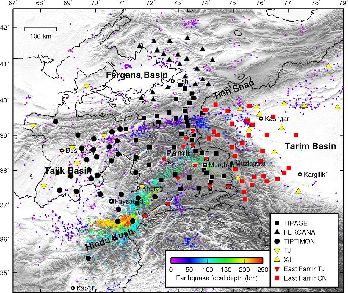
East Pamir Seismic Experiment
The primary goal of the project is to study seismic structure of the crust and mantle lithosphere as well as seismotectonics of the eastern Pamir by a local seismic network. The Pamir region in central Asia may be the best location on Earth to observe lithospheric deformation during orogeny in progress. This mountain range and high plateau were formed at the tip of the western Indian promontory through Cenozoic shortening of a magnitude similar to the adjacent Himalaya-Tibet system. The Pamir-Hindu Kush region is one of the very few places on Earth, where vigorous intermediate depth (100-300 km) seismicity occurs in an intra-continental setting. The experiment contains a seismic array of 30 broadband stations in the Chinese Pamir, operated from 2015 to 2017, and an additional 12 stations in eastern and southern Tajikistan, operated from 2016 to 2017. With the acquired data we will
- image the eastern edge of the subduction of the continental crust and the lithospheric deformation beneath the eastern margin of the Pamir and how it contacts to the rigid Tarim Basin block;
- study the northern front of the northward advancing Indian plate and the role it plays in this continental collision zone;
- accurately locate aftershocks of the 2015 Mw 7.2 Sarez earthquake.
The proposed scientific work includes teleseismic receiver function, seismic tomography, shear wave splitting, local earthquake location, source mechanism and tomography.