ReMon - Remote Monitoring of Tailings Using Satellites and Drones
Funding by: ZIM Network "Central Innovation Programm for small and medium-sized enterprises (SMEs)"
Funding ID: 16KN057538
Project executing or management agency: VDI/VDE/IT Projektträger des Bundesministeriums für Wirtschaft und Energie
Funding period:: 01.08.2018 - 31.10.2022
Project partners: Helmholtz Zentrum Potsdam - GFZ Deutsches GeoForschungsZentrum, Universität Potsdam und BEAK Consultants GmbH
There is an increasing demand for industrial and consumer goods worldwide, which is accompanied by an increase in mining activities for the extraction of resources. The resulting mining dumps serve to retain unused overburden and to accumulate process waste, which in turn can represent a new source of raw materials at a later point in time. In order to avoid unwanted discharges and interactions with the surrounding landscape, mining dumps must be spatially separated from their surroundings. Therefore, it is also necessary to monitor the dumps spatially and chemically with a high temporal resolution. This cannot be achieved by previous methods, which are primarily based on local sampling and subsequent laboratory analysis. In addition, previous methods are time-consuming, cost-intensive and inaccurate with regard to area-based statements. Even geophysical area measurements are only used for a limited time due to cost and resolution reasons.
Within the ReMon project a drone based data acquisition by means of two sensors with simultaneous data acquisition is being developed. A VNIR hyperspectral sensor from Cubert GmbH and a thermal infrared sensor from FLIR Systems Ltd. will be integrated on a drone platform from Coptersquad (CORTEX AS-X8 Multikopter).
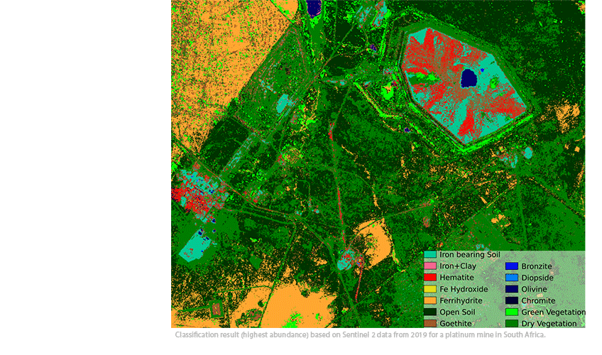
The generated spectral and geochemical surface data will be linked with available geophysical depth information using the artificial neural networks of the advangeo® Prediction Software. The satellite data are used as an integrated element and, if necessary, as an early warning signal in the event of spatial and/or chemical changes in the tailings piles.


