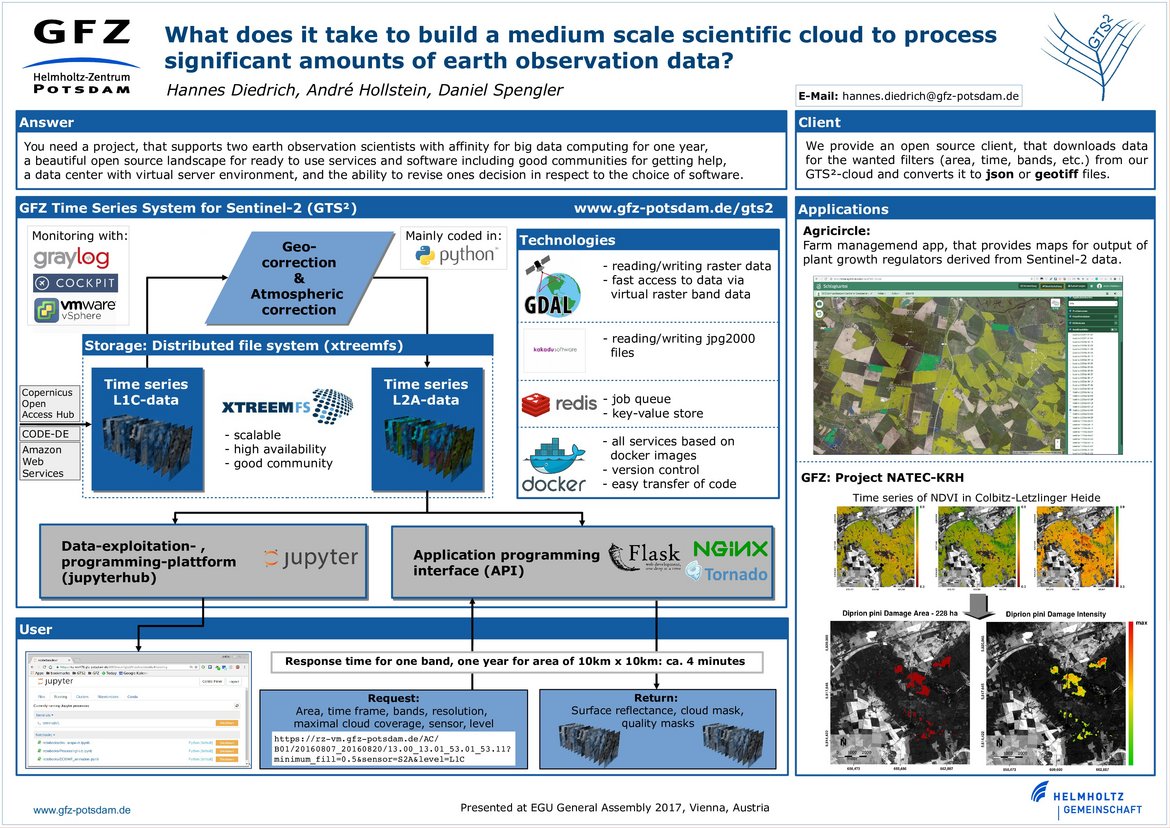
GFZ Time Series System for Sentinel-2
In the GTS² project, Sentinel-2 surface reflectance data is processed and provided to users via a simple to use web application programming interface (API). The GTS² project is developed in collaboration with AgriCircle, an agriculture start-up based in Switzerland.
Our aim is to serve a variety of users and applications such as agricultural monitoring services or surveillance of hazards such as floods or landslides. The service consists of several components:
- the atmospheric correction algorithm including processing tools like cloud mask generation
- the web API including all necessary services in the background
- a processing queue which allows to process and reprocess data rapidly.
The sophisticated atmospheric correction algorithm accounts for scattering on atmospheric particles, absorption of gases such as water vapour and ozone and converts Sentinel2 Level-1C data, provided by the European Space Agency (ESA), to Level-2A surface reflectance data. A Bayesian-based cloud screening procedure detects clouds and provides probabilities of cirrus.
Sentinel-2 Level-2A will be available in spatial resolutions of 10 m, 20 m and 60 m depending on the channel. The repeat cycle of Sentinel-2A is about 10 days. Once Sentinel-2B is launched, this will increase to about 5 days. For reading and writing of Sentinel-2 data that is stored in jpg2000 format, we use the Kakadu software.

The Sentinel-2 data can be accessed via a web API that is able to return all available data for a provided area of interest and time interval.
To store the data on our data server internally, XtreemFS, a distributed and high available file system is used. XtreemFS allows a quick adaption to higher data storage requirements. The local data center (GFZ Rechenzentrum) is hosting the hardware.
The core team consists of scientists working in the remote sensing group of Prof. Dr. Luis Guanter:
Dr. Daniel Spengler, Dr. André Hollstein, Dr. Hannes Diedrich
This project is closely linked to our efforts in including state-of-the-art big-data processing into the world of remote-sensing via the GeoMultiSens project.
While the core processing algorithms are custom and tailored to the needs of the project, other parts are based on standard open-source technologies whenever possible.