Objective: Satellite remote sensing is continuously monitoring the Earth’s surface producing very large volumes of remote sensing data. GeoMultiSens exploits current scientific and technological advances in Big Data infrastructures, parallel computing environments, Visual Analytics and links them with the potential of satellite remote sensing data to address global challenges such as deforestation, loss of biodiversity, and mega cities. The goal of the Big Data system GeoMultiSens is to enable scientists to study changes of the Earth’s surface on high-resolution scenes.
In cooperation with Helmholtz-Centre Potsdam GFZ German Research Centre for Geosciences, Humboldt University Berlin (HU) and Zuse Institut Berlin (ZIB)
Funding period: 01.09.2014 - 31.12.2017
Funded by: Federal Ministry of Education and Research (BMBF), Joint project: IKT 2020 - Research for innovation
Results:
- Final Report: Sips, M., et. al. (2018): GeoMultiSens - Skalierbare multisensorale Analyse von Geofernerkundungsdaten, GFZ Helmholtz-Zentrum Potsdam: Potsdam. DOI: http://doi.org/10.2314/GBV:1028376081
- Publication:
- Sips, M., Köthur, P., Eggert, D. (2016): Toward a Visual Analytics Approach to Support Multi-Sensor Analysis in Remote Sensing Science. - Datenbank Spektrum, 16, 3, p. 219-225.
- Scheffler, D., Sips, M., Behling, R., Dransch, D., Eggert, D., Fajerski, J., Freytag, J.-C.,; Griffiths, P., Hollstein, A., Hostert, P., Köthur, P., Peters, M., Pflugmacher, D., Rabe, A., Reinefeld, A., Schintke, F., Segl, K. (2016): GeoMultiSens – Scalable Multisensoral Analysis of Satellite Remote Sensing Data. - In: ESA Living Planet Symposium, EO Open Science Posters, 2016
- Eggert, D., Sips, M., Köthur, P. (2016): Towards Visual Analytics for Multi-Sensor Analysis of Remote Sensing Archives. - In: Middel, A., Rink, K., Zeckzer, D. (Eds.), Workshop on Visualisation in Environmental Sciences (EnvirVis) 2016, (Eurographics Proceedings), p. 7-11.
- Schmidtke, R., Laubender, G., Steinke, T. (2016): Big Data Analytics on Cray XC Series DataWarp using Hadoop, Spark and Flink. - In: Cray User Group (CUG) 2016 Proceedings.
- Talks:
- GeoMultiSens project - open source, scalable and modular Big Data system, D. Eggert, UFZ & DLR: Workshop on Earth Observation Data, März 2017, Leipzig.
- Big-Data and Small-Data Processing of Earth Observation Products: Application to Sentinel-2A and Agriculture, A. Hollstein, UFZ & DLR: Workshop on Earth Observation Data, März 2017, Leipzig.
- Wie Unternehmen von Geofernerkundungsdaten profitieren können. - IHK Berlin und Bitkom Big Data Summit Berlin (zusammen mit Andre Hollstein), September 2016, Berlin.
- GeoMultiSens – Scalable Multisensoral Analysis of Satellite Remote Sensing Data. - In: ESA Earth Observation Open Science 2016 Conference, Frascati, Italy, Sept 2016.
- Skalierbare Analyse von Fernerkundungsdaten. - In: VDI - Arbeitskreis Mess- und Automatisierungstechnik, Juni 2016.
- GeoMulitSens - Scalable Analysis of Big Remote Sensing Data. - In: Big Data All-Hands-Meeting, Dresden, Juni 2016.
- Towards Visual Analytics for Multi-Sensor Analysis of Remote Sensing Archives. - In: Big Data All-Hands-Meeting, Dresden, Juni 2016.
- "GeoMultiSens – Scalable Multisensoral Analysis of Satellite Remote Sensing Data. - In: ESA Earth Observation Open Science 2016 Conference, Frascati, Italy, Sept 2016."
- In the media:
- Geoinformatics - GFZ German Research Center for GeoSciences - GeoMultiSens. - In: Germany - Excellence in Big Data, bitkom Report, Juni 2016.
- Skalierbare Analyse von Fernerkundungsdaten. - In: Gauss-Allianz Infobrief, Nr. 38, September 2015.
- Neue Projekte: GeoMultiSens - Skalierbare multisensorale Analyse von Geofernerkundungsdaten. - In: GZF-Journal "System Erde", Heft 2, 2014
- Video: GeoMultiSens - Skalierbare multisensorale Analyse von Geofernerkundungsdaten (youtube)
- Flyer:GeoMulitSens - Skalierbare multisensorale Anayse von Geofernerkundungsdaten (pdf german)
- Softwarepublications:
- Sips, M.; et. al. (2018): GeoMultiSens: Scalable Multi-Sensor Analysis Platform for Remote Sensing Data. V. 1.0.0. GFZ German Research Centre for Geosciences. http://doi.org/10.5880/GFZ.1.5.2018.005
- Eggert, Daniel; Sips, Mike; Dransch, Doris (2018): gms-index-mediator: a R-tree-based in-memory index for fast spatio-temporal queries for the GeoMultiSens platform. V. 1.0.0. GFZ German Research Centre for Geosciences. http://doi.org/10.5880/GFZ.1.5.2018.004
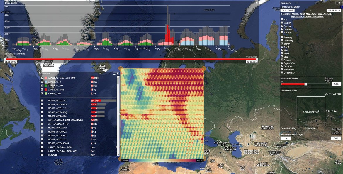
- Eggert, Daniel; Sips, Mike; Dransch, Doris (2018): gms-vis: a web-based visual-analytics approach for input data assessment, job parameter definition and progress monitoring for the GeoMultiSens platform. V. 1.0.0. GFZ German Research Centre for Geosciences. http://doi.org/10.5880/GFZ.1.5.2018.001
- Award:
- GeoMultiSens has been selected for the Bitkom, Smart Data Forum, and Germany Trade & Invest report "Germany Excellence in Big Data". The report presents the research focuses on more than 30 scientific organizations, and projects, products and strategies technology vendors to an international audience.
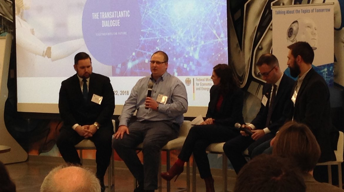
- The Canadian German Chamber of Industry & Commerce (CGCIC) invites Mike Sips (Section 1.5 Geoinformatics) as one of five German experts as speaker for a conference on Big Data, Cybersecurity and Artificial Intelligence in Ottawa, Canada. The speakers should share their ideas, experiences and visions from a German perspective. Mike Sips presents GeoMultiSens, a Big Data technology for multi-sensor analysis of optical remote sensing data developed at GFZ. The Canadian attendees of the conference are targeted to 200 experts.
- Open-Source: https://git.gfz-potsdam.de/geomultisens/gms-meta