Geomechanical Properties of Rocks

Based on geomechanics, rock physics, rheology and material sciences, we investigate deformation and transport phenomena in rocks of the Earth's crust. Over a wide range of temporal and spatial scales, we attempt to understand the physical processes that govern these phenomena. Extensive experiments take place in the laboratory, using different deformation apparatuses designed to simulate the deformation behavior in the brittle upper part and in the ductile lower part of the crust and uppermost mantle. Understanding of the underlying processes helps to get insight into fundamental geoscientific issues, like nucleation of earthquakes, slow slip and source mechanics, localization and creep processes in high temperature shear zones, but also to answer more applied questions, for example induced seismicity and the mechanics of reservoir rocks with respect to enhanced geothermal systems, shale gas and nuclear waste disposal. We also collect data in the field, e.g., in underground labs, mining areas and active fault zones by means of seismic recordings and microstructural studies of deformed rocks, which helps to upscale laboratory-derived geomechanical properties. Our investigations contribute to a variety of scientific subjects related to plate tectonics, natural hazards and georesources.
Scale-invariant Faulting Mechanisms
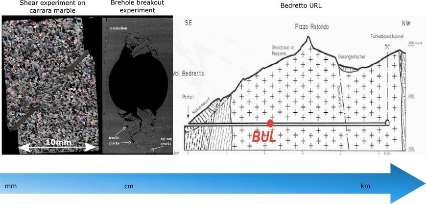
A key question in seismology is what governs the physics of earthquake nucleation and propagation at all scales, and how elastic strain energy accumulated before an earthquake is partitioned into seismic wave radiation and other types of energy during the faulting process. We want to understand how external factors such as the local stress state or the properties of a fault affect this energy partitioning into wave radiation, fracture creation and heat. This leads to a broad spectrum of observed faulting behaviours including potentially hazardous earthquakes. To understand faulting mechanics and rupture processes, an integrated geomechanical-seismological data analysis approach is applied by our group at all scales. In other words, we combine knowledge gained from fully controlled laboratory experiments on rock samples with that from in-situ small-scale field experiments, and studies of induced and natural earthquakes.
Seismic and Aseismic Deformation in the Brittle Crust: Implications for Anthropogenic and Natural Hazard

The Helmholtz Young Investigators Group SAIDAN has the following research topics: (1) Generating a thorough, quantitative understanding on deformation processes ranging from aseismic slip to brittle failure in earthquakes. (2) Characterizing precursory processes preceding the occurrence of large earthquakes in relation to both plate-bounding transform faults and reservoir engineering activities. These topics are being investigated within two very different environments:
1 Strike-slip plate boundaries
The occurrence of large damaging earthquakes near densely populated regions can result in dramatic numbers of human casualties, damage to key infrastructure (e.g. hospitals, roads) and the loss of accommodation for hundreds of thousands citizens. The largest earthquake magnitudes on Earth reach magnitudes M~9 and exclusively occur along subduction zones. In contrast, strike-slip transform faults tend to rupture in earthquakes with magnitudes not exceeding M~8 [e.g. Wesnousky, 1988; Martínez-Garzón et al., 2015; Bohnhoff et al., 2016]. However, the latter generally pose a larger hazard and risk since they can rupture along the Earths’ surface and due to their eventual proximity to densely-populated mega-cities. Well-known examples are the San Francisco Bay Area and the Los Angeles basin along the San Andreas Fault in California or the Istanbul-Marmara region near the North Anatolian Fault Zone in Turkey. High-resolution monitoring and near-real time analysis of ongoing seismic and aseismic deformation in these areas is an essential pre-requisite to better determine the local seismic potential and to optimize risk-reduction infrastructure. A large focus of SAIDAN is the study of tectonic deformation at the North Anatolian Fault. The North Anatolian Fault Zone (NAFZ) in Turkey represents a ~1100 km long right-lateral strike-slip plate boundary [Barka et al., 2002; Sengör, 2005] slipping at an average rate of 20-30 mm/yr [McClusky et al., 2000; Ergintav et al., 2014]. The Sea of Marmara region in northwestern Turkey currently represents a ‘seismic gap’ with a high probability for an M>7 earthquake in direct proximity to the Istanbul Metropolitan region with its >13 million inhabitants. At its eastern portion close to Istanbul (Princes Islands fault), a locked fault portion representing a potential nucleation point for the pending Marmara earthquake was identified from absence of microseismicity and from GPS data [Bohnhoff et al., 2013; Ergintav et al., 2014]. Towards the western part of the Marmara section there are first indications for fault creep [Schmittbuhl et al., 2016; Bohnhoff et al., in press]. However, to date, no information on potential low-frequency signals embedded in the crustal deformation of the whole region exists. The area immediately to the south of the locked Princes Islands fault recently hosted a MW 4.2 earthquake that showed pre-shock activity indicating an emergent failure process [Malin et al., in review].
2 Fluid-induced seismicity
Fluid-injection into the subsurface in the frame of reservoir-engineering activities for hydrocarbon and geothermal energy production has resulted in the reactivation of previously unknown critically stressed and thus hazardous faults. In Oklahoma and Kansas (US), a dramatic increase of induced seismicity including four M>5 earthquakes has been seen over the last years. This increased the seismic hazard of the nearby settlements and key-infrastructure, triggering significant public awareness and acceptance issues. SAIDAN aims at investigating the earthquake physics and quantifying the proportion of seismic versus aseismic slip release in fluid-injection environments and investigating the resulting maximum magnitude of the induced earthquakes and the subsequent hazard. To do that, geothermal environments such as The Geysers and Salton Sea are investigated, as well as regions where fluid-induced seismicity is prominent, such as in southern Kansas.
Underground Seismic

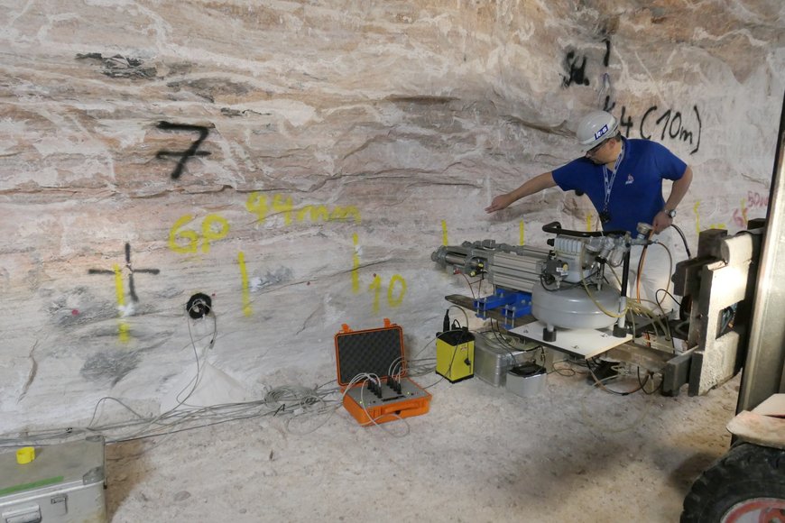
High-resolution seismic 3D-exploration of geological structures in the underground is applied is mining, tunnel as well as shaft construction and scientific drilling. Beside commercial systems in-house developed evaluation software, seismic sources and receiver technique is available. Complex and flexible seismic measurements on surfaces and in boreholes can be realized in the underground and above ground. To better characterize fault zones like for instance fluid containing structures research and development is emphasized on measurement geometry, evaluation routines and measurement technique.
ICDP OSG - Operational Support for Scientific Drilling Projects

ICDP's Operational Support Group (OSG) is a team of scientists, engineers and technicians to assist in planning and management of continental scientific drilling projects. The OSG provides support in the fields of :
- Planning and design of drilling
- Maintainance and provision of ICDP equipment
- Downhole logging service
- Data and sample management (DIS, Drilling Information System)
- Training

