


Urbane Stadtbiotopmodellierung
(Den Text gibt es leider nur auf Englisch)
Automated classification of urban biotopes from remote sensing data
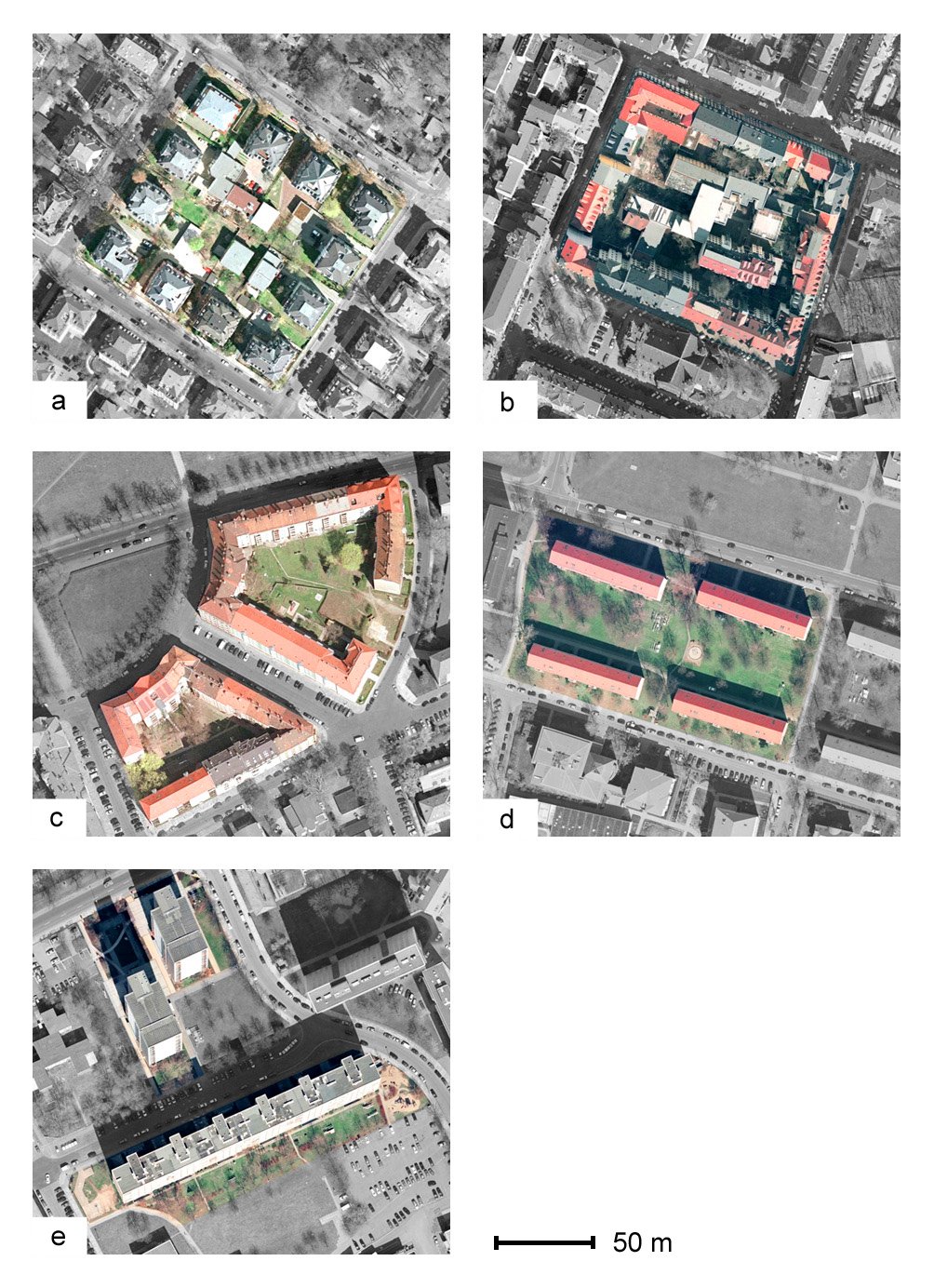
Urban biotope maps are of high importance for ecological urban planning and well established in Germany. Most of the bigger cities accomplished initial mappings of urban biotopes, which can be thought of as city structure types categorized by their ecological value and functions, over the last 20 years using a detailed and complex mapping key. In common practice, area-wide mapping and monitoring of urban biotopes is based on visual interpretation of colour-infrared aerial photographs and field investigations. Since this procedure is very time-consuming and costly it often cannot keep up with the pace of urban development. Against this background, there are astonishingly few investigations dealing with the automation of these mappings by an automated analysis of remote sensing data although such automation, even of parts of the mapping procedure, holds the potential of being faster, reproducible and objective.
Our work focuses on the development of an automated update system for these maps. The essential part of such a system has to be a method for the automatic identification of urban biotope types based on remote sensing data. The developed method needs three types of input data: (1) detailed mappings of urban surface cover types; [see Identification of Urban Surfaces], (2) a high resolution digital elevation model (DEM) and (3) the existing biotope map.
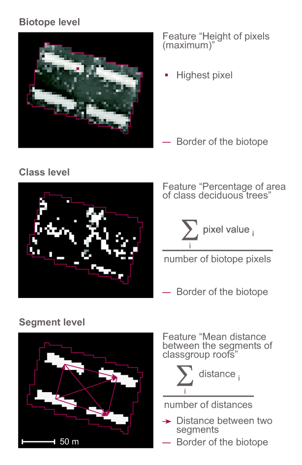
Urban biotopes (Figure 1), defined as areas of uniform environmental conditions providing habitat for a specific community of plants and animals, cannot be classified pixel-by-pixel because they consist of different surface cover types. To determine the type of a biotope, the composition of the biotope of different surface cover types has to be analyzed as well as their arrangement within the biotope. It is described numerically with quantitative features (Figure 2). For each biotope type a characteristic set of features is selected automatically that form the basis for individual fuzzy logic models for the identification of every biotope type.
Kontakt

Kontakt

Kontakt
