

SSIP - Salton Seismic Imaging Project
Time frame
- 2011 - 2018
Funding
- NFS, USGS, SCEC
Principal Investigators
- John Hole (Virginia Tech), Joann Stock (CALTECH), Gary Fuis (USGS), Neal Discroll, Graham Kent, Simon Klemperer, Antonio Gonzalez-Fernandez, Octavio Lazaro-Mancilla
Personnel
- Klaus Bauer (GFZ Potsdam)
- Trond Ryberg (GFZ Potsdam)
Cooperations
- USGS Menlo Park, CALTECH, Virginia Tech, University of Louisiana
Methods & Equipment
- seismic Pre-stack Depth Migration (Bauer et al., 2013)
Publikations/Results
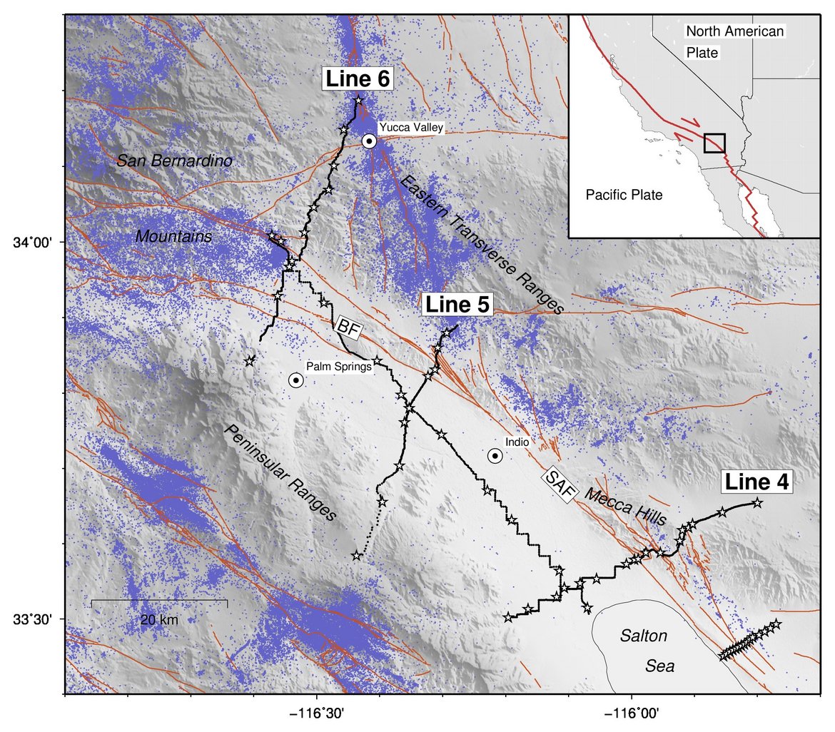
- We derived direct images of sub-vertical fault structures of the San Andreas fault system in the northern Salton Trough (Southern California). The SAF is imaged along Line 4, through the Mecca Hills, as a number of steeply dipping fault segments that collectively form a flower structure, above 5 km depth, that sole into a moderately NE-dipping fault below that depth.
- Fuis, G.S., Bauer K., Goldman, M.R., Ryberg, T., Langenheim, V.E., Scheier, D.S., Rymer, M.J., Stock, J.M., Hole, J.A., Catchings, R.D. Graves, R.W., Aagaard, B. (2017): Subsurface Geometry of the San Andreas Fault in Southern California: Results from the Salton Seismic Imaging Project (SSIP) and Strong Ground Motion Expectations. Bulletin of the Seismological Society of America, 107(4), 1642-1662. http://doi.org/10.1785/0120160309
Acknowledgment
- SSIP is supported by National Science Foundation (NFS), U.S. Geological Survey (USGS) and Southern California Earthquake Center (SCEC).
