

Crustal structure model for Germany
This project, which is being carried out as part of the effort of the Working Group "Crustal Structure Maps of Europe" of Sub-Commission D "Crust and Upper Mantle Structure" of the European Seismological Commission (ESC) is divided into two parts. The first part involves the making of a crustal thickness map for Germany from wide-angle reflection / refraction data, near-vertical incidence reflection data and receiver functions data. The second part involves the making of a 3-D, P-wave velocity, crustal structure model for Germany from wide-angle reflection / refraction data.
Crustal thickness map for Germany
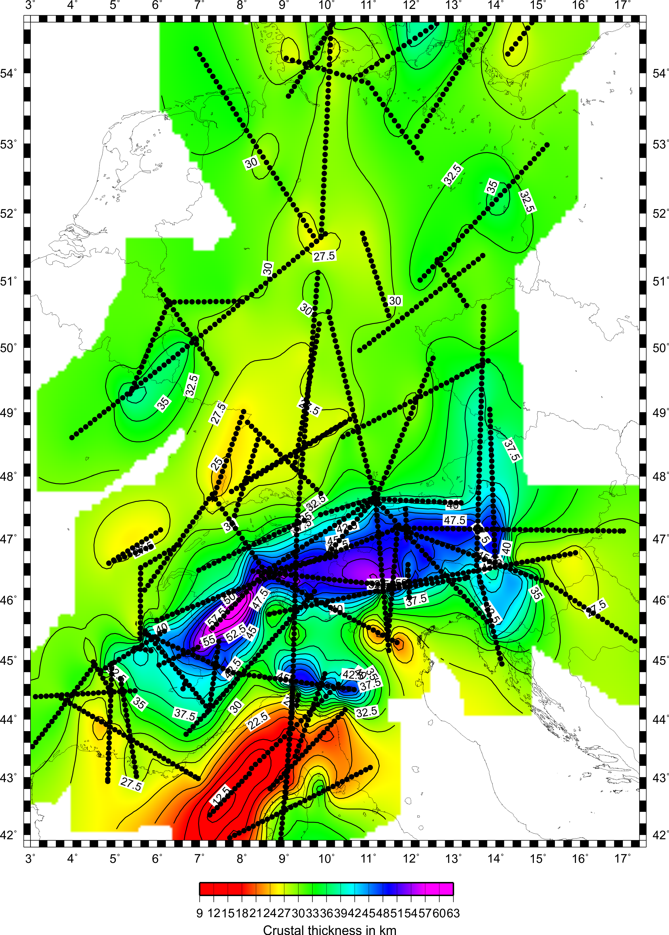
So far, 261 data points have been compiled in the crustal thickness map for Germany. 174 of these points are from wide-angle reflection / refraction data, 57 from near-vertical incidence reflection data and 30 from receiver functions data. Using the GMT software (Wessel & Smith 1991), a contoured map has been produced from the 261 data points. A list of the data points is available as well as a list of the references from which data were obtained. As more data points become available, the lists and map will be updated. This map has also been incorporated into a new Moho depth map for the European plate (Grad et al. 2009, see also http://www.igf.fuw.edu.pl/igf/index.php?option=com_content&view=article&id=292&Itemid=225&lang=en)
Crustal structure model for Germany
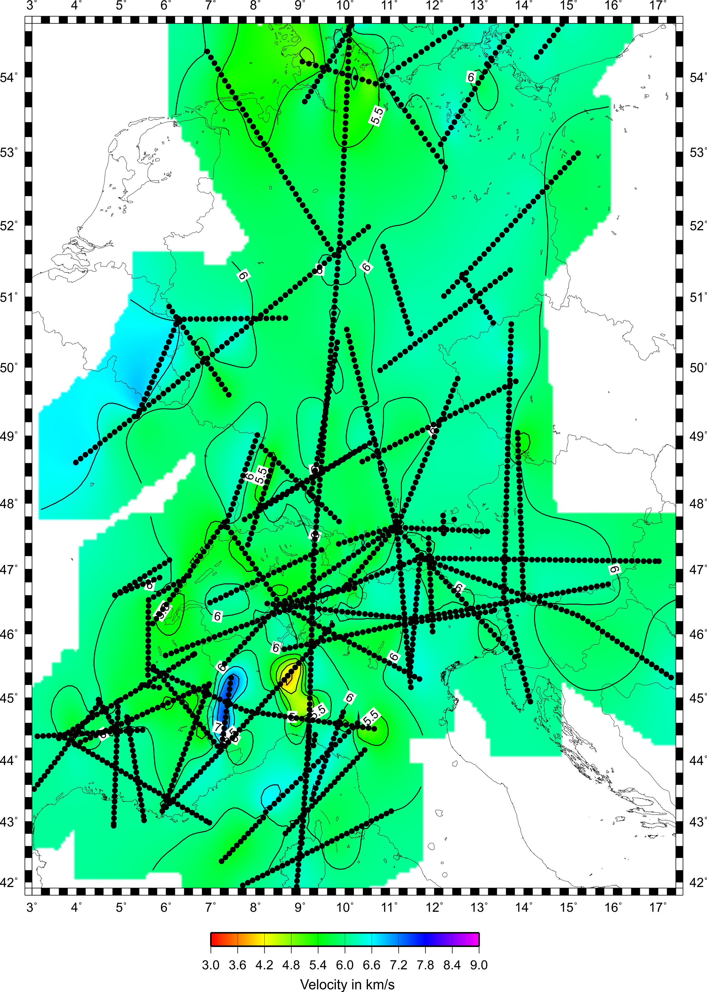
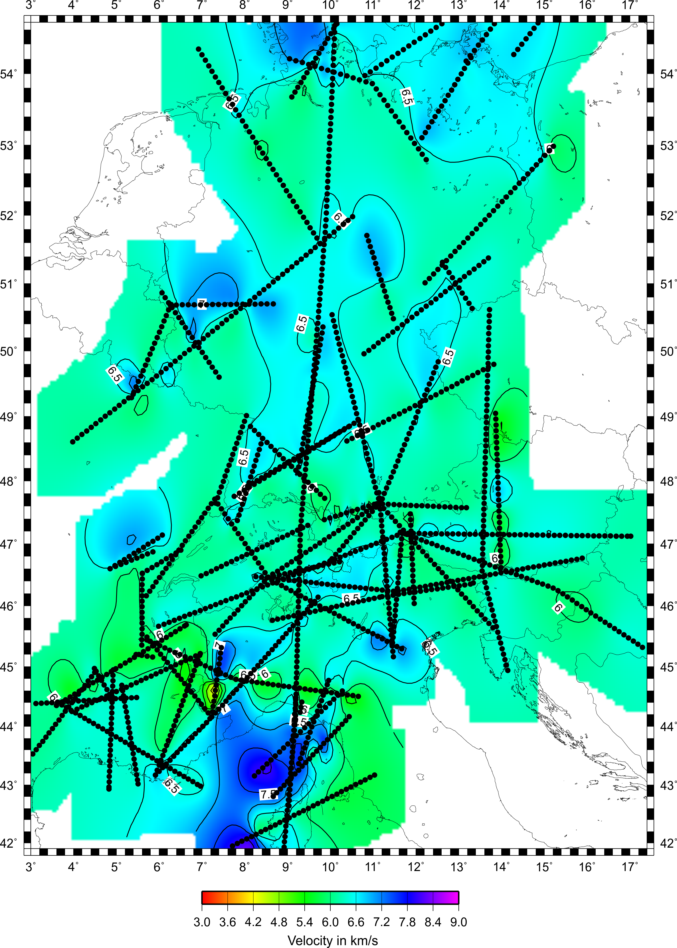
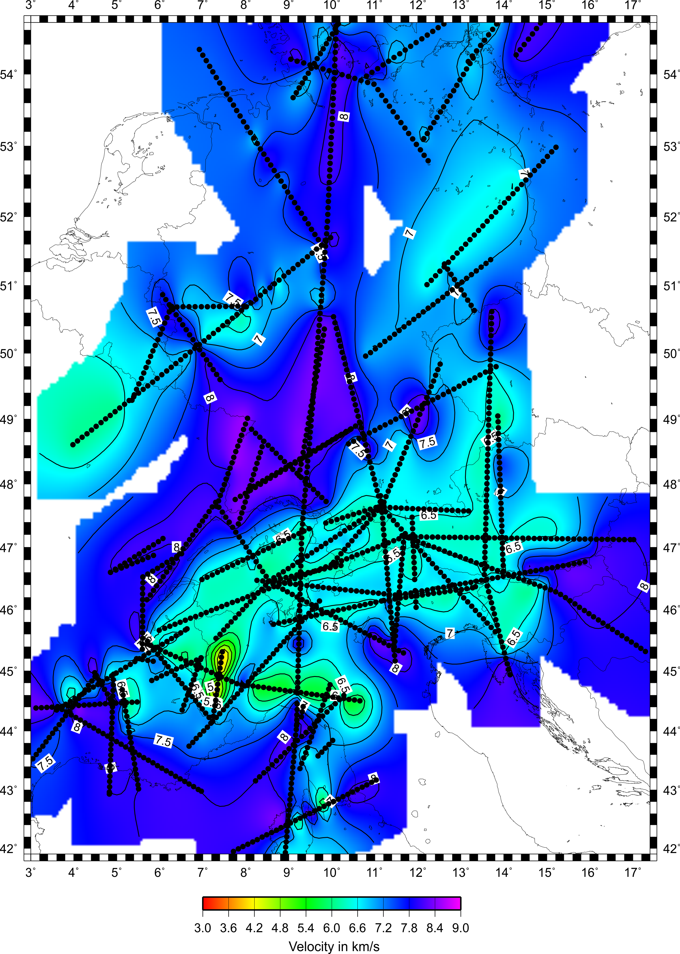
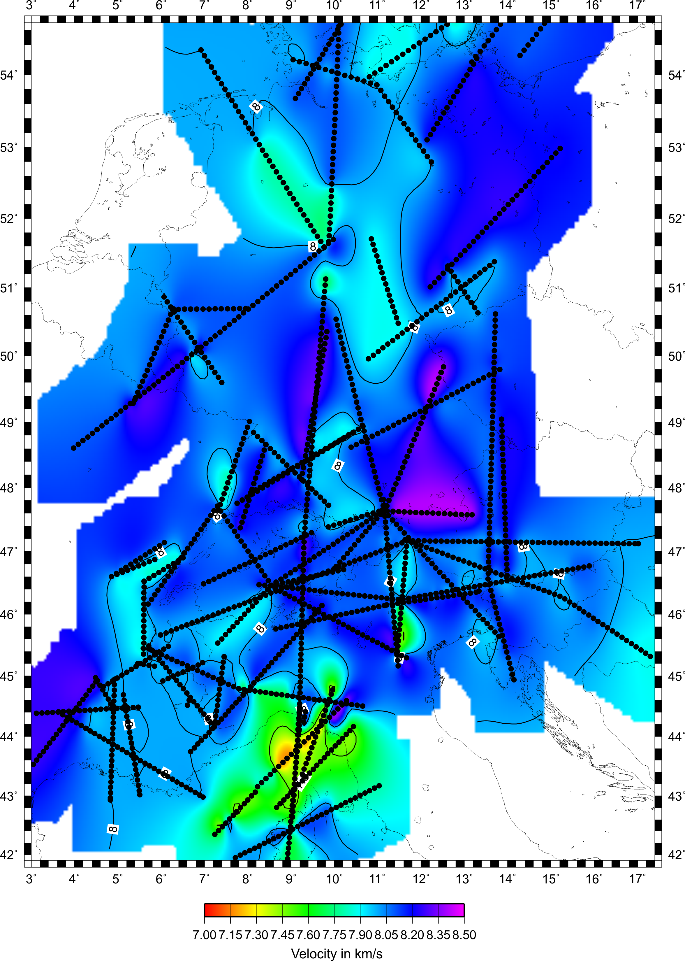
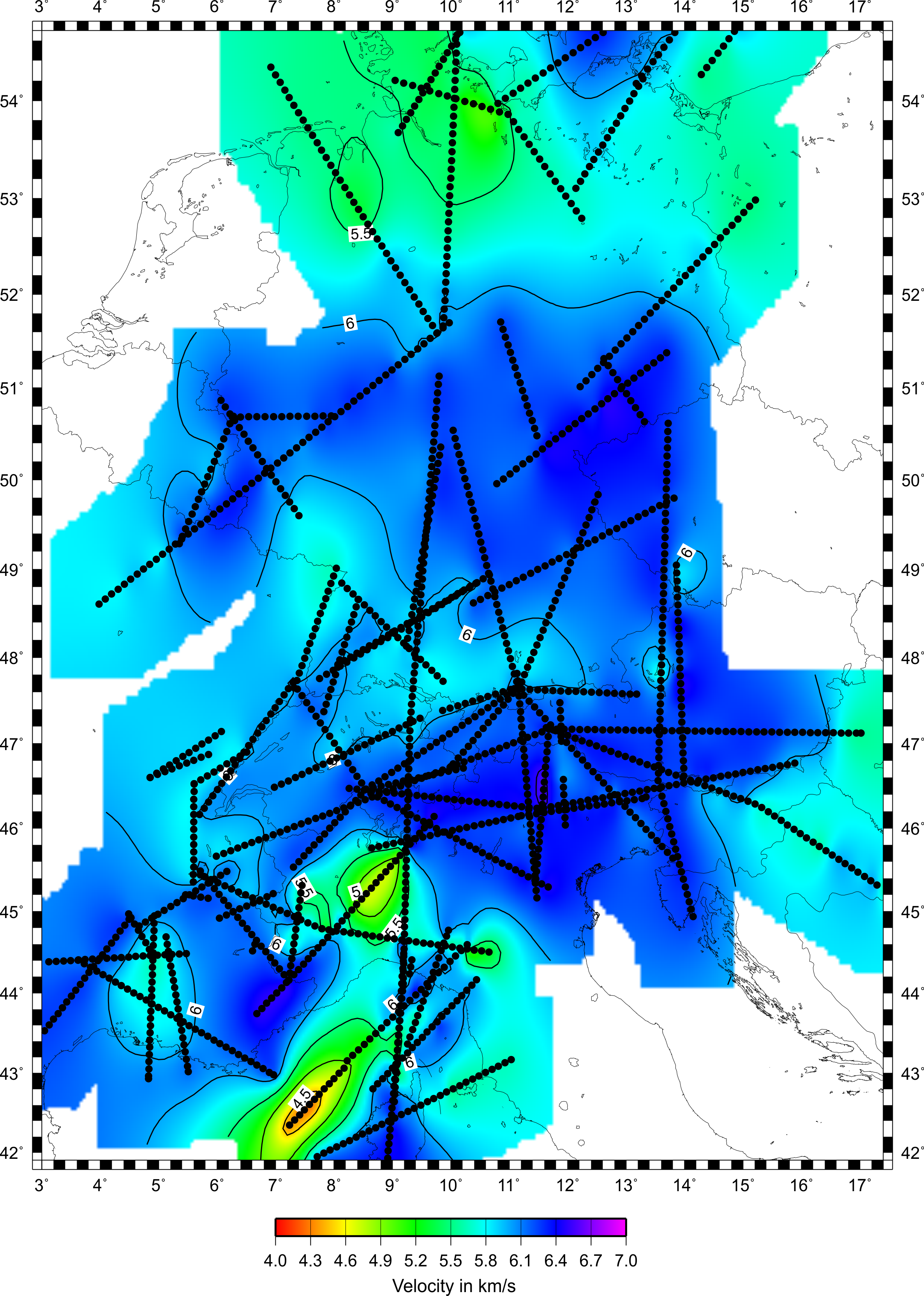
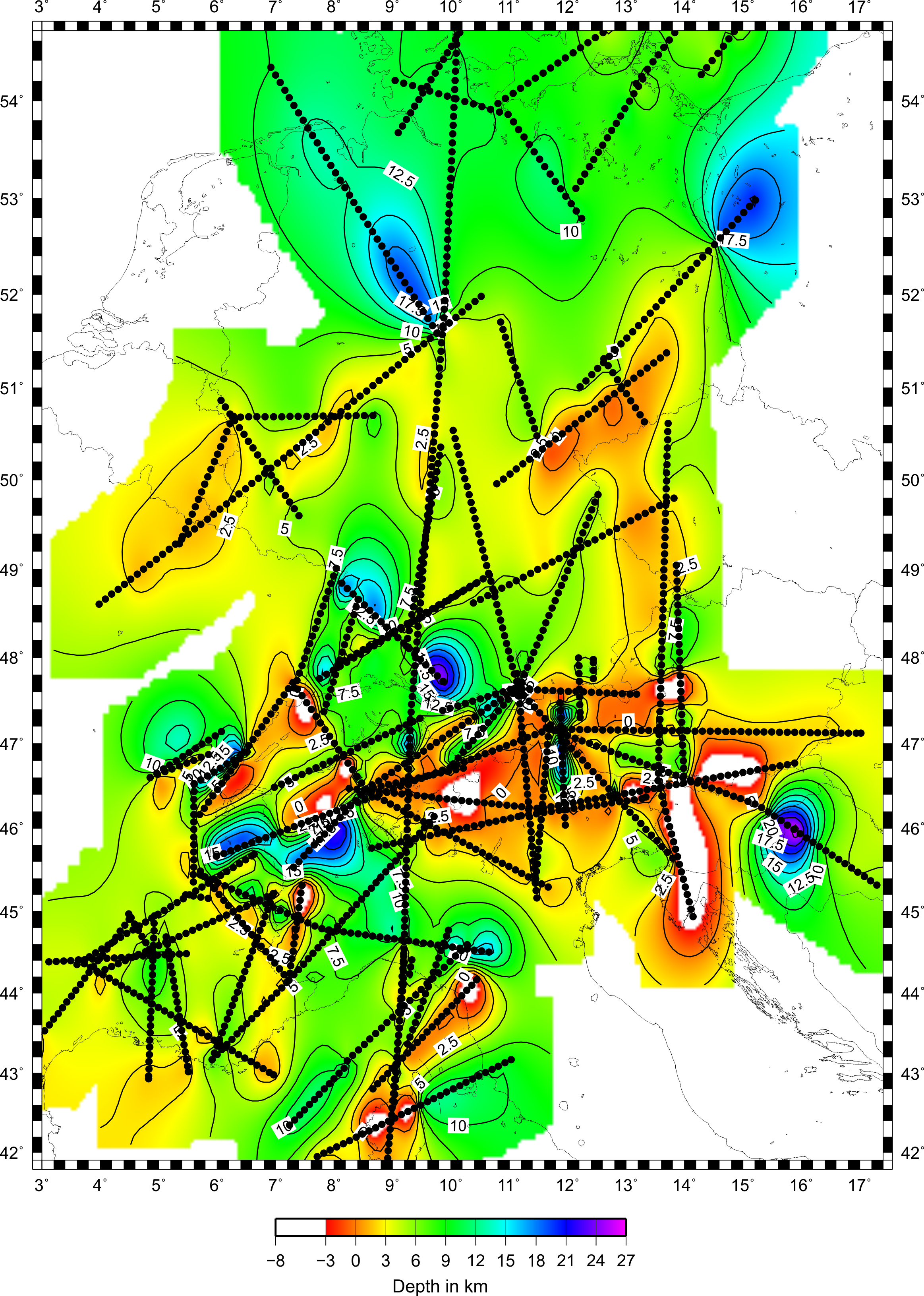
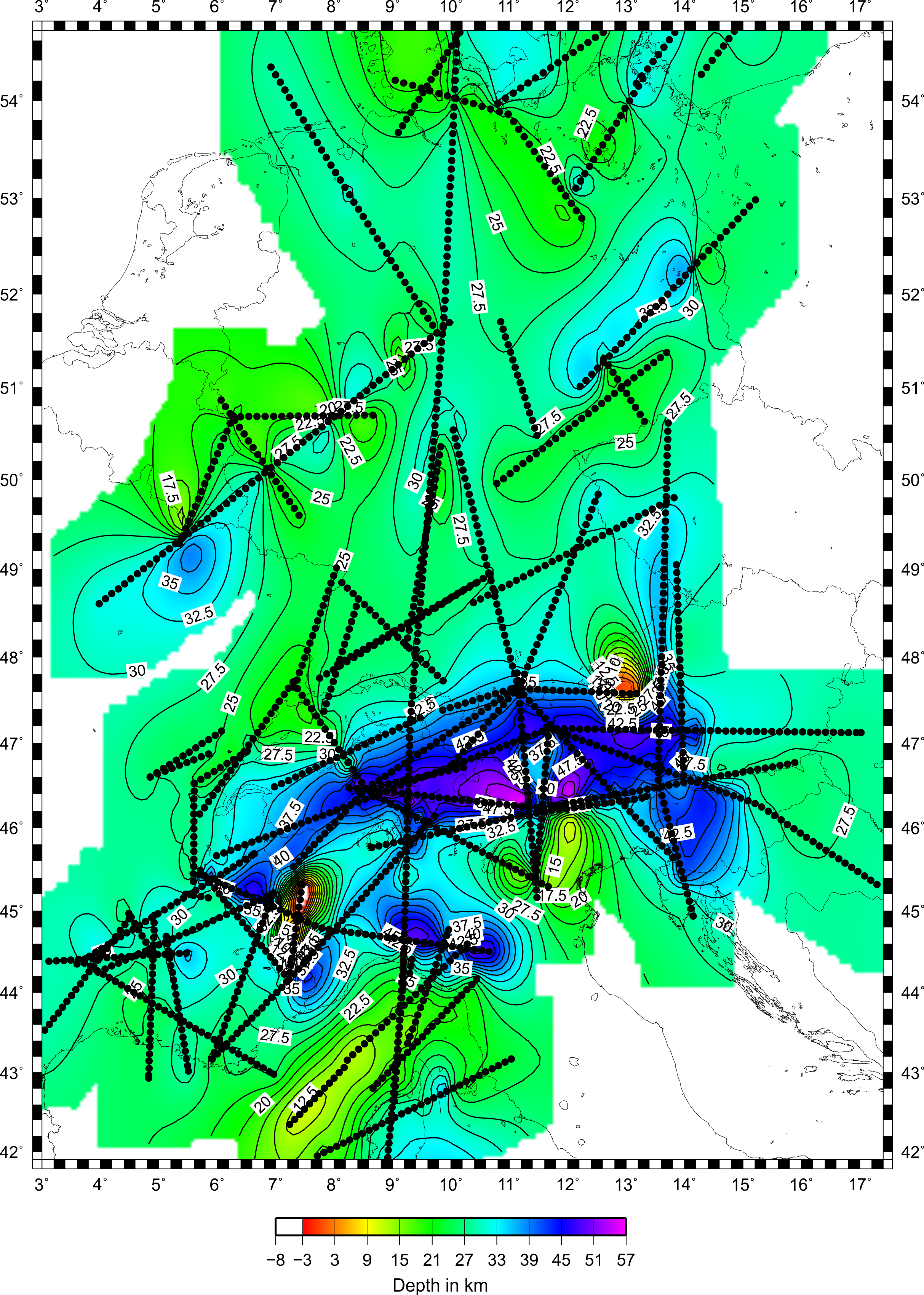
So far, 28 2-D wide-angle reflection / refraction models have been digitized and incorporated in the data base used to make the model. Again using the GMT software (Wessel & Smith 1991), preliminary contoured maps of P-wave velocity at 5,20, 25 and 30 km depth, crustal thickness, Pn and average crustal velocities and depths to the 6 km/s and 7 km/s velocity surfaces have been produced. A list of the models already digitized is available. As more models are digitized, the list and maps will be updated. Anyone interested in obtaining the 3-D model should contact me at james.mechie@gfz-potsdam.de
Alpine extension of crustal structure model
Recently, 51 profiles from the Alpine region have been added to the model. Again using the GMT software (Wessel & Smith 1991), preliminary contoured maps of P-wave velocity at 10, 20, 30, 40 and 50 km depth, crustal thickness, Pn and average crustal velocities and depths to the 6 km/s and 7 km/s velocity surfaces have been produced. A list of the added profiles is available. Anyone interested in obtaining the 3-D model should contact me at james.mechie@gfz-potsdam.de
Acknowledgments
I would like to acknowledge the aid of Carolin Böse who digitised and quality checked 9 of the 28 profiles used in the study. I would also like to acknowledge the help of Trond Ryberg in creating the maps with the GMT software. For the Alpine extension to the model, Jonas Pätzel digitized 38 of the profiles and quality checked all 51 profiles.
References
- Grad, M., Tiira, T. & ESC Working Group, 2009. The Moho depth map of the European plate. Geophys. J. Int., 176: 279-292, doi:10.1111/j.1365-246X.2008.03919.x.
- Wessel, P. & Smith, W.H.F., 1991. Free software helps map and display data. EOS Trans. Am. Geophys.Union, 72: 441, 445-446.
Referencing this work
- Mechie, J., 2007. A 3-D, P-wave velocity, crustal structure model for Germany derived from seismic refraction / wide-angle reflection data. 67th Annual Meeting of the German Geophysical Society (DGG), Aachen, 26-29.03.2007.