

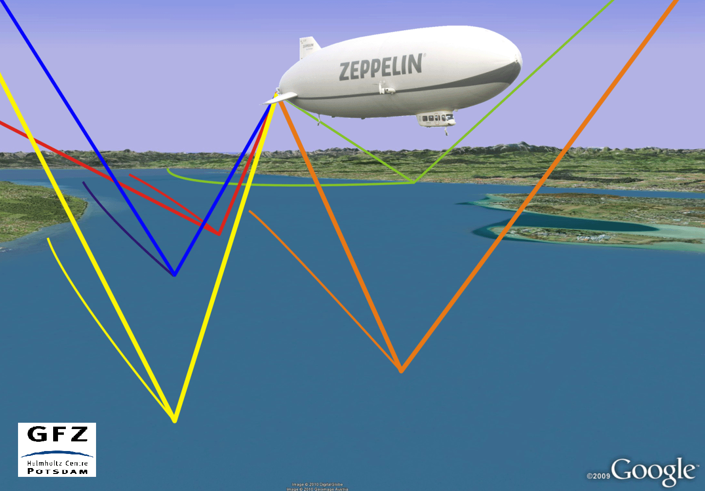
Between October 2010 and May 2014 three airship flight campaigns for GNSS reflectometry (GNSS-R) were lead by GFZ in cooperation with DLR and Zeppelin Luftschifftechnik (ZLT). The flights were performed in the Lake Constance region near Friedrichshafen, Southern Germany. Flight platforms offer a better spatial coverage of the GNSS-R observations compared to the ground based data. In addition the equipment was tested for succeeding flight campaigns with the German research aircraft HALO. Furthermore the flight experiments are a crucial step for future satellite based reflectometry measurements for remote sensing on a global scale.
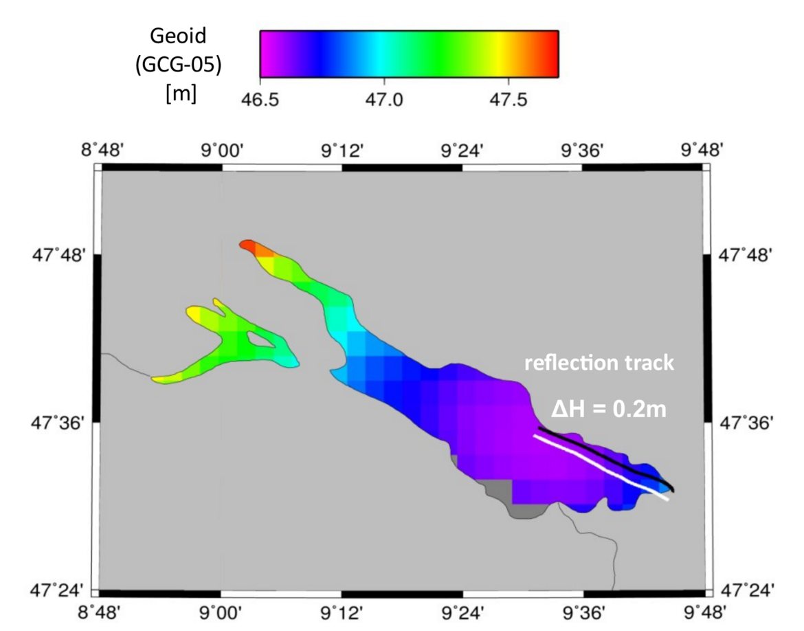
The Zeppelin airship is a relatively slowly moving platform (<100km/h) and has an excellent. Therefore it can quite easily pilot height anomalies on the rather small lake surface. Based on Doppler retrievals the absolute lake level was estimated [1]. Anomalies of the geoid, see Fig. 2, were resolved cmbining carrier phase observations and reference heights from tide gauge measurements [2].
References
[1] Semmling, A. M.; Wickert, J.; Schön, S.; Stosius, R.; Gerber, T.; Markgraf, M.; Ge, M. & Beyerle, G. A zeppelin experiment to study airborne altimetry using specular Global Navigation Satellite System reflections, Radio Science, 2013, 48, 427–440, 2013.
[2] Semmling, A. M.; Beyerle, G.; Beckheinrich, J.; Ge, M. & Wickert, J.
Airborne GNSS Reflectometry using Crossover Reference Points for Carrier Phase Altimetry
Proceedings of IEEE International Geoscience and Remote Sensing Symposium (IGARSS), Quebec City (QC), Canada, IEEE, 2014, 3786-3789
