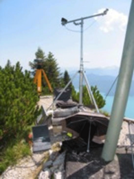
Fahrenberg is a mountain in the Bavarian Alps (47.61° N; 11.32° E). Its summit rises 1625 m above mean sea level. At the foot of the moutain lake Walchensee spreads on an area of about 16 km² with a lake level of about 800 m above mean sea level. The vicinity of lake and mountain offers an ideal location for Reflectometry experiments with the GORS receiver.
Publicationens:
- Helm, A. et al. „GORS - A GNSS Occultation, Reflectometry and Scatterometry Space Receiver“ ION GNSS 2007, pp. 2011-2021, 2007.
- Helm, A.: Ground-based GPS altimetry with the L1 OpenGPS receiver using carrier phase-delay observations of reflected GPS signals, GFZ German Research Centre for Geosciences, Scientific Technical Report, vol. 8, No. 10, PhD Thesis, 2008.
More information can be found on the German website of the project.


