

Retrievals for GNSS Ice Detection (ReGID)
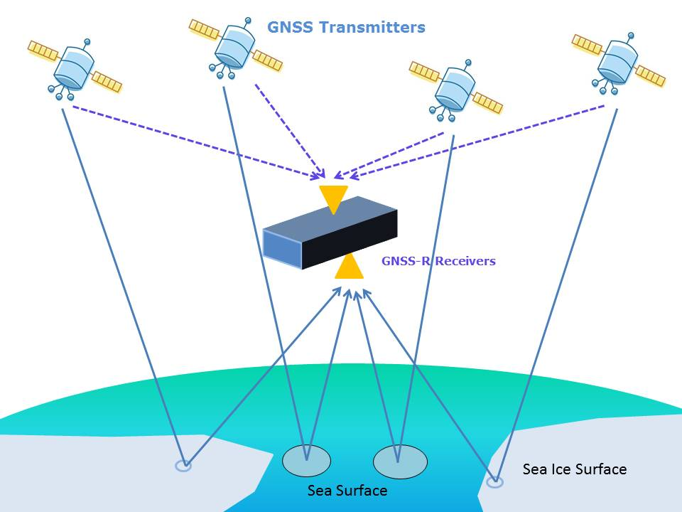
Global Navigation Satellite System (GNSS) has been widely used to provide positioning, navigation and timing services in civil and military domains since it became fully operational in 1995. In addition to these fundamental services and applications, GNSS can be also used for remote sensing of atmospheric parameters. For instance by observing refraction of GNSS signals from LEO satellites. This GNSS based remote sensing technique is GNSS radio occultation (GNSS-RO), which is used to estimate the tropospheric water vapor, temperature, pressure, and ionospheric total electron content (TEC) with a high vertical resolution on a global scale. Reflected GNSS signals, usually regarded as a source of positioning error, can be used to retrieve the geophysical surface parameters. This remote sensing technique is called GNSS Reflectometry (GNSS-R). The ocean’s surface characteristics (i.e., ocean surface height, roughness, wind speed and wind direction) can be estimated by GNSS-R. Also land applications such as the retrieval of ground vegetation condition and soil moisture are under investigation. Ice surface parameters, derived from reflected signals, are the topic of our study within the ReGID project.
The aim is to retrieve main parameters of sea ice (i.e. thickness, concentration, surface roughness and ice permittivity). These parameters can be combined to help characterize different ice types including new ice, young ice, thin first-year ice, first-year ice, and multiyear ice. Sea ice thickness is a key parameter for classification and characterization of sea ice masses, which influence the temperature and circulation pattern of both the ocean and atmosphere and thus can be used for analysis of the Earth’s climate.
In a first approach a retrieval, based on differential Delay Doppler Maps (dDDM), is used for sea ice coverage detection. The retrieval is demonstrated using U.K. TechDemoSat-1 (TDS-1) data (available online: www.merrbys.co.uk) analyzing reflection events. The ice coverage detection results are validated against data from the National Snow & Ice Center, USA (http://nsidc.org).
In a second approach, we currently develop a retrieval approach that uses the coherent reflection power to detect and classify sea ice. The retrieval includes sea ice permittivity and roughness as parameters, which are important for sea ice classification and characterization. Results of the retrieval are compared to co-located ice concentration measurements. The comparison shows that reflection power loss increases with the increase of sea ice concentration. The ReGID development is a cooperation project with Wuhan university and is beneficial to process the data gathered during the ArGID (Arctic GNSS Ice Detection) measurements.
