

The Atmospheric Model for GNSS (the component which describes the propagation of the radio signals in the atmosphere) consists of a tropospheric and an ionospheric part.
Troposphere: The pressure, temperature and humidity fields are provided from a global Numerical Weather Model (NWM), the Global Forecast System (GFS) of the National Centers for Environmental Prediction (NCEP) (www.ncep.noaa.gov). We use a ray-trace algorithm (Zus et al., 2014) and compute station-specific zenith hydrostatic (wet) delays, derive the hydrostatic (wet) mapping function coefficients and the horizontal delay gradient components. In post-processing mode we use the NWM analysis whereas in real-time mode we use NWM short-range forecasts. On the importance of the tropospheric delay model in the GNSS analysis the reader is referred to Zus et al., 2021.
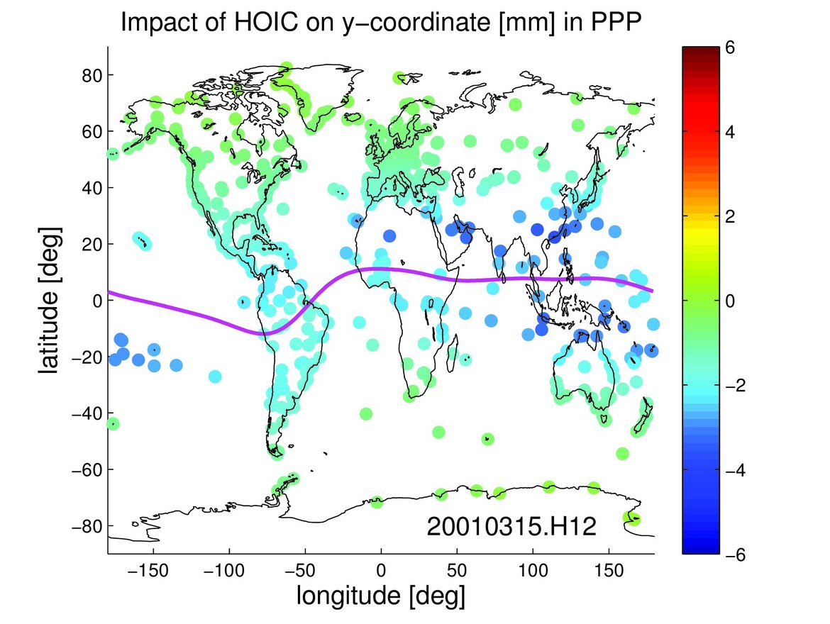
Ionosphere: The electron density field is provided from a climatological model, the latest version of the International Reference Ionosphere (IRI) (http://iri.gsfc.nasa.gov/), and Earth's magnetic field is provided from the 12th generation of the International Geomagnetic Reference Field (IGRF) (http://www.ngdc.noaa.gov/IAGA/vmod/igrf.html). We use a ray-trace algorithm to derive ionospheric delay parameters which can then be used to perform higher-order ionospheric corrections in precise applications (Zus et al., 2017).
Data availability: Tropospheric and ionospheric delay parameters derived for specific stations are available upon request. The GFZ-VMF1, which is a solution based on the Vienna Mapping Function 1 (VMF1) (http://vmf.geo.tuwien.ac.at/) concept and utilizing the reanalysis ERA5 (https://www.ecmwf.int/en/forecasts/datasets/reanalysis-datasets/era5), is available immediately at
ftp://ftp.gfz-potsdam.de/pub/home/GNSS/products/gfz-vmf1/
A preliminary data set containing Higher-Order Ionospheric Corrections (HOIC) for any location near the Earth's surface (grid with a resolution of 2.5° times 5°) is available at ftp://ftp.gfz-potsdam.de/pub/home/GNSS/products/gfz-hoic/
Contact: zusflo@gfz-potsdam.de
References:
Zus, F., Dick, G., Dousa, J., Heise, S., and Wickert, J.: The rapid and precise computation of GPS slant total delays and mapping factors utilizing a numerical weather model, Radio Sci., 49, 207–216, doi:10.1002/2013RS005280, 2014.
Zus, F., Z. Deng, and J. Wickert: The impact of higher-order ionospheric effects on estimated tropospheric parameters in Precise Point Positioning, Radio Sci., 52, doi:10.1002/2017RS006254, 2017.
Zus, F., Balidakis, K., Dick, G., Wilgan, K., and Wickert, J.: Impact of Tropospheric Mismodelling in GNSS Precise Point Positioning: A Simulation Study Utilizing Ray-Traced Tropospheric Delays from a High-Resolution NWM, Remote Sens, 13, 3944, doi.org/10.3390/rs13193944, 2021.
