

African LAB
Imaging the topography of the Lithosphere-Asthenosphere Boundary beneath South Africa
Time frame: 2012 - 2016
Summary
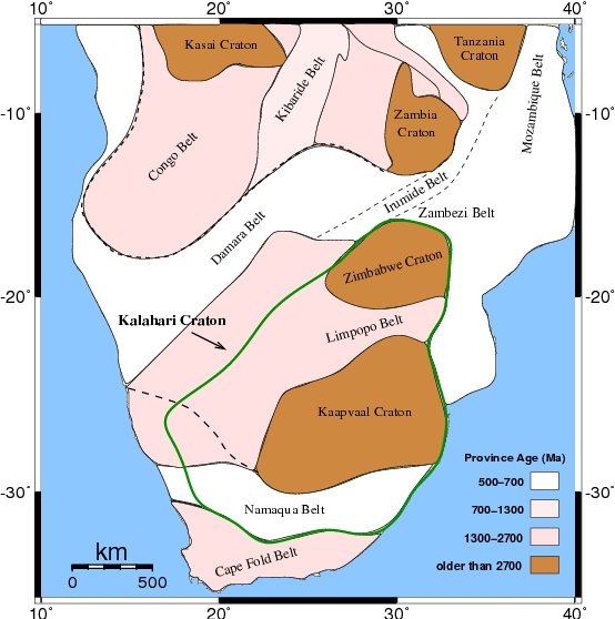
The aim of this project is to study the structure of the mantle lithosphere beneath South Africa. South Africa's lithosphere preserves a nearly un-interrupted geological history of more than 3.5 billion years and comprises a diversity of geological terranes with different ages from early Archean to Phanerozoic. Archean and Proterozoic shields form the oldest parts of the crust and lithosphere and are the key to a better understanding of the Earth's lithosphere. No high resolution image of the Lithosphere-Asthenosphere Boundary (LAB) exists yet in this geodynamically active region, although for understanding the global tectonics, knowledge of the complete structure of lithospheric plates is required rather than only the more easily accessible crustal structure. This goal will be achieved using the novel technique of S receiver function. This technique employing S-to-P conversions appears promising for detecting the LAB and has already proven its power for mapping the LAB in the tectonically different regions. Due to the available data from more than 200 permanent and temporary broadband stations in South Africa, it is now possible to obtain maps of the LAB topography with so far unprecedented resolution. We will obtain detailed images of geodynamic processes and significantly improve the knowledge of continental lithospheric evolution.
Principle Investigators
Prof. Dr. Rainer Kind (GFZ Potsdam/FU Berlin)
Collaborations
Dr. Lars Ceranna (BGR Hannover)
Prof. Dr. Andrew Nyblade (Department of Geosciences, Penn State)
Prof. Dr. George Rümpker (Goethe-University Frankfurt)
