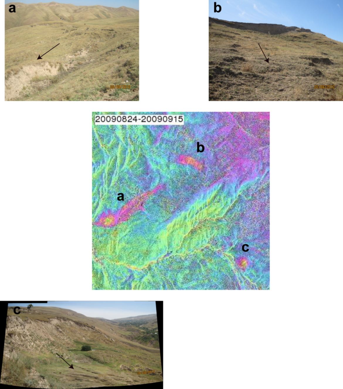
Landslides
High-resolution SAR images are key to assess landslide hazards in mountainous regions. In this regard we have focused over the past years on the applicability of different SAR data for quantitative assessment of ground deformation related to landslides and to detect new signs of postfailure deformation related to landslide reactivation processes.