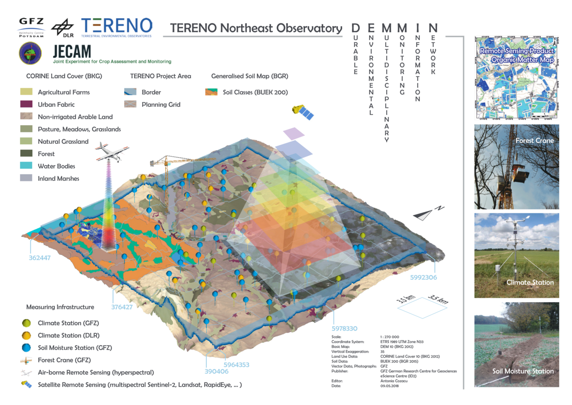
Integration of in-situ and remote sensing data (TERENO)
We are working on modelling to capture changes in the spatial evapotranspiration in temporal (daily) and spatial distribution (from point to area) as one of the key parameters in regional hydrological and climatological modelling (TERENO). Additionally, possible external factors influencing evapotranspiration performance are analyzed. Currently, the research focus in this area is on the acquisition of near-surface soil, vegetation and water parameters derived from multitemporal and multisensor remote sensing data. Aiming on understanding the agrarian ecosystem and placing agricultural production and its relevance for society into the center point of research work.
The projects of the working group currently cover the following main topics:
- Derivation of vegetation and soil parameters for agricultural use (AgriSens DEMMIN 4.0)
- Vegetation analysis and biodiversity in natural landscapes (NaTec - KRH)
- Validation of remote sensing derived land surface products (HYPERNETS)
The main research area for all our ongoing research is the TERENO Observatory North-East German Lowlands (TERENO-NO). Most of the research is based on the Durable Environmental Multidisciplinary Monitoring Information Network - DEMMIN® (53°52' N; 13°13'E). This area is also the central test area of the BMEL funded digital experimental field AgriSens DEMMIN 4.0 and an international JECAM test area.