Mapping Spatiotemporal Interactions of Biodiversity Indicators
Funding by: Federal Ministry of Education and Research - BMBF
Funding ID: 01LC1602A
Project executing or management agency: German Aerospace Center - DLR
Funding period: 01.02.2017 – 31.01.2023
Project partners: Heinz Sielmann Stiftung; ecostrat GmbH, Riemann Produktdesign
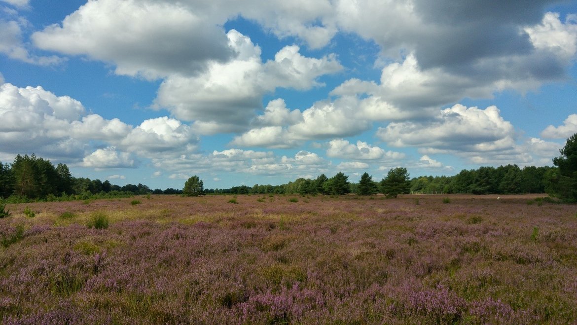
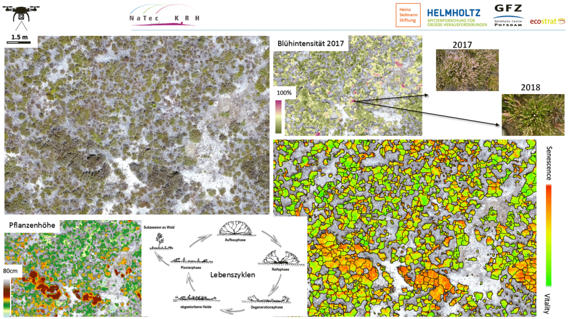
On the former military training area, Kyritz-Ruppiner Heide, the use of different remote sensing sensors is tested in order to spatially map ecological dynamics from individual plant traits to broad scale habitat distributions and habitat quality assessment schemes. Recent nature conservation is thereby complemented by habitat management activities (such as mowing, grazing, tree removal) that reshape habitats and control ecological processes in order to preserve a favorable conservation status. Within the project an autonomous working machine for heathland management will be constructed. Remote sensing will be utilized to map induced landscape changes that are required to monitor biodiversity indicators in the legal framework of protected areas (such as Natura 2000) at different scales. We develop statistical models to derive spatiotemporal patterns of species composition and habit parameters after management implementation. The project focuses on different aspect of the biosphere:
A) Spatial prediction of plant species distribution and vegetation parameters (e.g. scrub encroachment, vitality, senescence); Technique: Spectroscopy – hyperspectral
B) Habitat modeling of animal species on the basis of habitat parameters and presence/absence mapping; Technique: machine learning from spectral signatures
C) Mapping of ecological restoration potentials (e.g. undergrowth, tree species); Technique: LIDAR
D) Development of a remote sensing based biodiversity monitoring system (e.g. mapping Natura 2000 habitats, Biotope types and diversity indicators); Technique: Satellites–multispectral
E) Mapping of military ordnance debris (e.g. abandoned ammunition, metal parts); Technique: UAV - multispectral, thermal, RADAR
F) Plant Trait quantification and ecological feedback modelling; Technique: UAV high-resolution RGB imagery
G) Ecological cybernetics from spatial statistics and change detection; Technique: multitemporal, -scale analyses from thematic maps
Publications:
Neumann, C. - Was wächst, wenn es nicht mehr kracht? – Biologische Vielfalt auf Truppenübungsplätzen
Neumann, C., Behling, R., Schindhelm, A., Itzerott, S., Weiss, G., Wichmann, M., Müller, J. - The colors of heath flowering – quantifying spatial patterns of phenology in Calluna life‐cycle phases using high‐resolution drone imagery