The HGF Alliance “Remote Sensing and Earth System Dynamics” aims at the development and evaluation of novel bio/geo-physical information products derived from data acquired by a new generation of remote sensing satellites; and their integration in Earth system models for improving understanding and modelling ability of global environmental processes and ecosystem change. The Earth system comprises a multitude of processes that are intimately meshed through complex interactions.
Spaceborne remote sensing sensors are predestined to produce bio-geo-information products on a global scale. The upcoming generation of spaceborne remote sensing configurations will be able to provide global data sets and products with unprecedented spatial and temporal resolution in the context of a consistent and systematic observation strategy. The integration of these data sets in existing environmental and climate science components will allow a new global view of the Earth system and its dynamics, initiating a performance leap in ecosystem and climate change modelling. The key objective of the proposed Alliance is to prepare the HGF centers and the national/international science community for the utilisation and integration of bio/geo-physical products provided by the next generation radar remote sensing missions (e.g. Tandem-L) into the study of natural and anthropogenic impact on Earth’s ecosystems.
Website HGF-EDA
Within the HGF Alliance the Remote Sensing section is involved in the research topics Hydrosphere and Geosphere.
Hydrosphere:
Contact persons: Dr. Daniel Spengler, Dr. Sibylle Itzerott
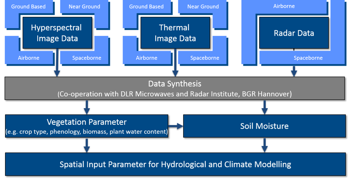
The overall technical goal of the research topic Hydrosphere is to enhance the understanding of hydrological processes by optimally exploiting current (e.g. SMOS, TerrarSAR-X) and planned (e.g. SMAP, Tandem-L) satellite missions. The remote sensing section is working in work package (WP) H7: ”The use of hyperspectral optical and L-band radar data for retrieving surface soil moisture at the field scale”.
Based on the dense net of agrometeorological and soil moisture stations, placed in different landscape types and land use conditions of the TERENO-NO test site DEMMIN following objectives are in focus:
• Retrieval of soil moisture from hyperspectral image data
• Analysing of parameters influencing the reflectance signal
• Parameter estimation and analysis using reflectance simulation based on artificial 3D canopy models
• Synergetic analysis of hyperspectral, thermal and radar data