

Data Fusion for yield potential maps (AgriFusion)
Funding: Federal Office for Agriculture and Food Germany
Status: laufend
Website: http://agrifusion.de/
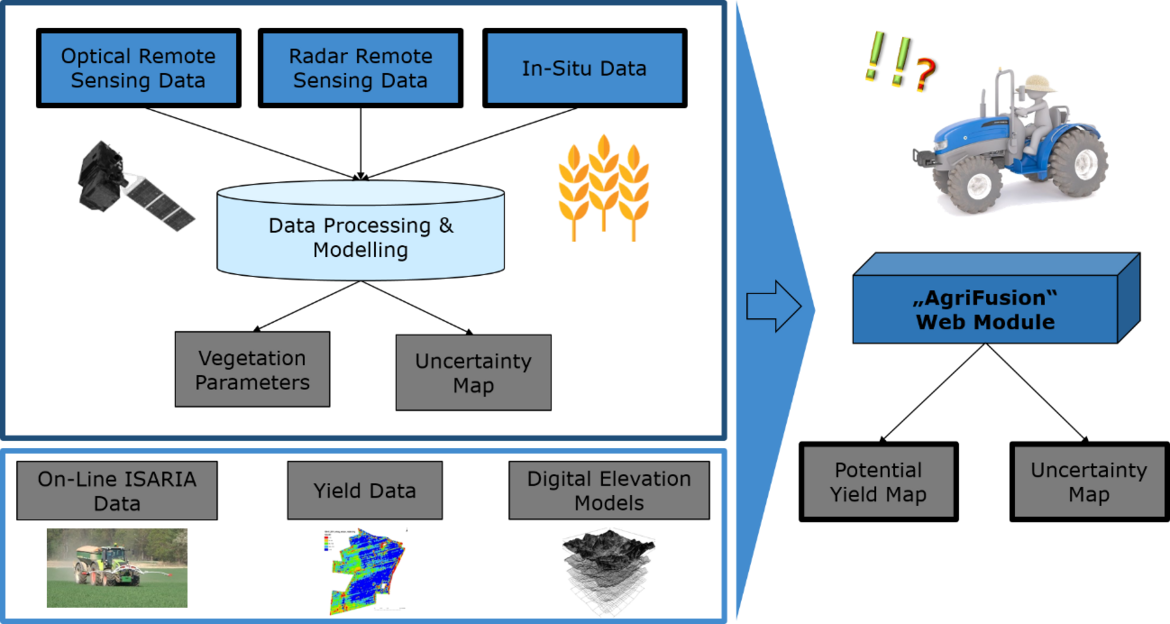
The aim of the AgriFusion project is to generate yield potential maps by merging yield mapping, remote sensing data, digital relief analysis and management data. The different data sources are provided by the project partners:
- Yield data (University Weihenstephan-Triesdorf)
- Remote sensing data (satellite data and UAV) (GFZ, AG Geodata)
- Digital elevation models (GeoInformationsDienst GmbH, scilands GmbH)
- On-line sensor data (ISARIA) (Fritzmeier Umwelttechnik GmbH)
One of the most important parameter for agricultural crop production is the expected yield potential of a specific crop species at each location. Based on the yield potential an optimization of the cultivation method and the specific production intensity can be performed. One of the biggest current obstacles is the efficient and synergistic processing and use of large amounts of spatial data of different spatial and temporal dimension, data availability and qualities.
At this point, the project AgriFusion sets and aims on the synergy of previously underutilized data sources (remote sensing, yield data, and digital terrain models) with existing data (for example, data of the soil evaluation, soil sampling) to make these data directly usable for agricultural production. For this purpose methods of data fusion will be used, which meet the challenges in agricultural holdings. The results of data interpretation and data fusion can be used directly by farmers and can be integrated into operational data structures. An outstanding feature of the fusion algorithm used - Transferable Belief Model (TBM) - is in addition to the resulting map (for example, the expected yield) to generate a map of the reliability of the result of the data fusion. The method is developed within the project AgriFusion and will be implemented and validated on two large (Mecklenburg-Vorpommern, Brandenburg) and also small scale farms (Bavaria).
The GeoForschungsZentrum Potsdam is responsible for the provision of derived information from remote sensing data. Optical satellite systems such as the satellites of the ESA mission Sentinel-2 are well suited for the estimation and quantification of agricultural relevant vegetation and soil parameters. Radar data from the ESA mission Sentinel-1 will further be used to close data gaps due to clouds. The focus lies on the development of methods for a meaningful combination of optical and radar remote sensing data to estimate vegetation parameters such as biomass, leaf area index or plant height.
