

AI4Flood
Funding by: Helmholtz Artificial Intelligence Cooperation Unit (HAICU)
Funding period: 01.10.2020-30.09.2022
Project partners: German Aerospace Center (DLR)
Flood mapping algorithms are usually based on thresholding algorithms such as Otsu thresholding and histogram levelling for the initialization of the classification process in SAR amplitude data. These thresholding processes are followed by clustering techniques like K- means or ISODATA for improving the segmentation of water and non-water areas. These methods are capable of extracting the flood extent if there is a significant contrast between water and non-water areas in the SAR data. However, the classification may lead to false positive (overestimation) if non-water areas are characterized by a similar low backscatter as open water surfaces.
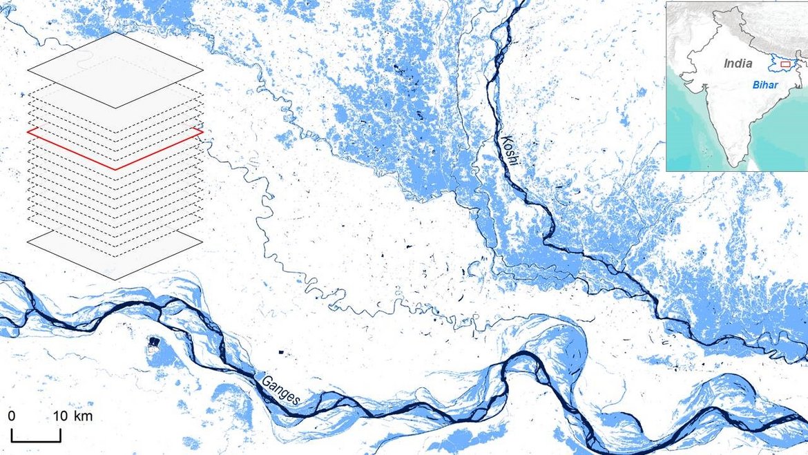
The main aim of the AI4flood project is to develop an automated system capable of extracting and detecting flooded areas in near-real time for generation of flood maps for rapid response activities in case of flood emergencies. The system will be built on the comprehensive methodological competences already existing at DLR and GFZ with the goal of combining Big Data management of SAR data and novel machine learning algorithms for automatic flood mapping in near-real time.
