Natural laboratory Central Asia – Tracking the tectonic fingerprint of continental collision
The Pamir-Hindu Kush region in Central Asia stands out due to its worldwide unique zone of intense intermediate depth seismicity, which accommodates earthquakes with hypocenters reaching down to 300 km depth. Contradicting the plate tectonic paradigm, this seismicity occurs far away from any (paleo-)oceanic basin and continental lithosphere appears to subduct by itself in a north-south compressional regime, imposed by the northward advancing Indian continent. The arcuate Pamir mountains formed on the Asian side of this collision, being pushed northward by up to 300 km by the advancing Indian indenter. By contrast, beneath the Hindu Kush thinned Indian lithosphere is currently subducting and detaching. Stresses due to ongoing collision are released seismically, inducing frequent large magnitude 7+ earthquakes both at crustal and sub-crustal levels. We are carrying out different research projects to understand the deformation and the feedback between crustal and deep lithospheric processes within this complexly deforming orogenic region (Figure 1). Our current research builds on the accomplished TIPTIMON, TIPAGE and FERGHANA projects and complements the ongoing CATENA project.
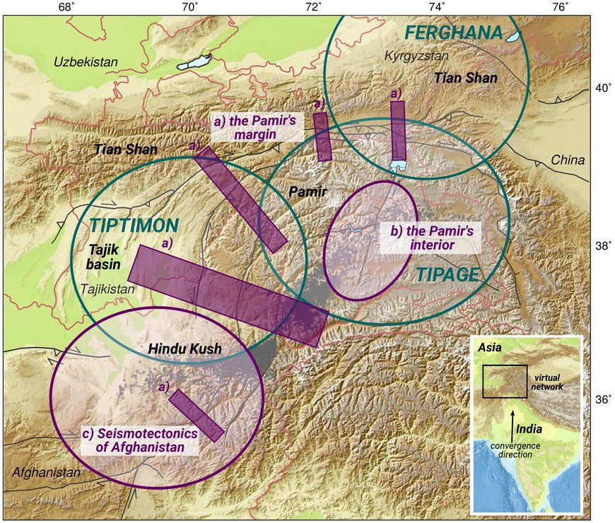
Fig1: Different projects summing up to the ‘Natural Laboratory Central Asia’. Purple: current projects; green: accomplished projects. Black dots: intermediate depth seismicity beneath Pamir and Hindu Kush.
a) The Pamir’s margin: Shortening rates constrained by geodesy
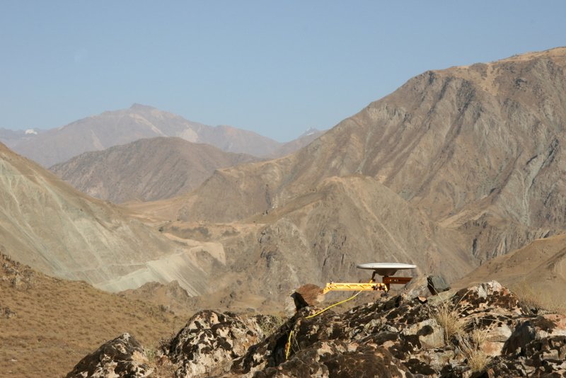
There are only few intercontinental faults that show higher slip-rates than observed at the Pamir’s northern margin with shortening rates of 10-15 mm/yr. Here, most of the northward advance of the Pamir is accommodated by the Pamir thrust system (FigA1). We want to find out if these structures are locked and how they continue further along the northwestern and western rim of the Pamir, where orogenic material is collapsing into the Tajik basin. Since 2013 we are collecting continuous and campaign GPS data along five profiles crossing the Pamir’s rim (Fig1, FigA2) to identify and quantify the active structures outlined by crustal seismicity. The data is then complemented with observations from InSAR time-series analysis.
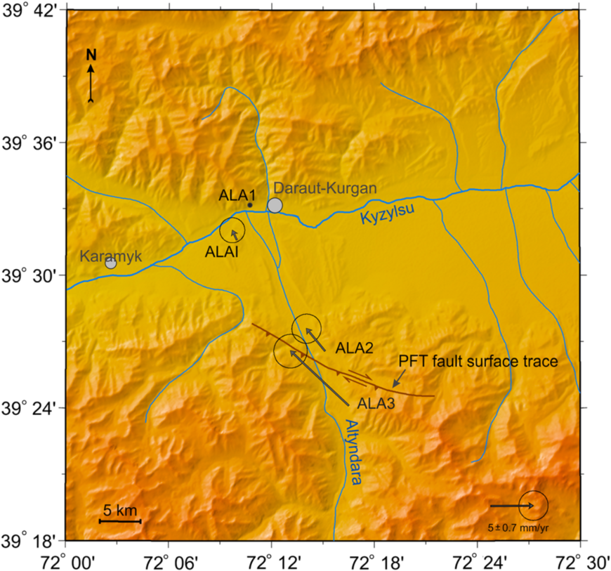
FigA1: Continuous GPS displacement rates across the Pamir Thrust system (PFT) (Zubovich et al., 2016)
PIs: Sabrina Metzger (4.1), Tilo Schöne (1.2)
Funding: GFZ Expedition funds, ACROSS, GCO-CA Project
Duration: 2013-2019 Main
Partners: Tajik Academy of Sciences, CAIAG Kirgistan
Publications: Zubovich, A., T. Schöne, S. Metzger, O. Mosienko, Sh. Mukhamediev, A. Sharshebaev, and C. Zech (2016), Tectonic interaction between the Pamir and Tien Shan observed by GPS, Tectonics, 35, 283–292, doi:10.1002/2015TC004055.
b) The Pamir’s interior: Interdisciplinar analysis of the 2015 M7.2 Sarez earthquake
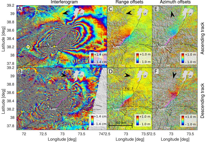
Compared to the active margin, the Pamir’s interior hosts only sparse crustal seismicity and low strain rates. But it is repeatedly struck by large earthquakes: In 1911, the M~7.3 Sarez earthquake produced a huge landslide, forming the natural dam of lake Sarez; in 2015, the area was struck by a M7.2 earthquake with a similar mechanism and location. Using on-site and satellite radar (InSAR) offset measurements (FigB1) combined with seismic source modeling we show that the recent earthquake ruptured the Sarez-Karakul fault system that separates the westward moving West Pamir from the internally rigid East Pamir (FigB2). Both of these events are most likely crustal expression of the underthrusting of the leading edge of the Indian mantle lithosphere. This project builds the basis of the CATENA project.
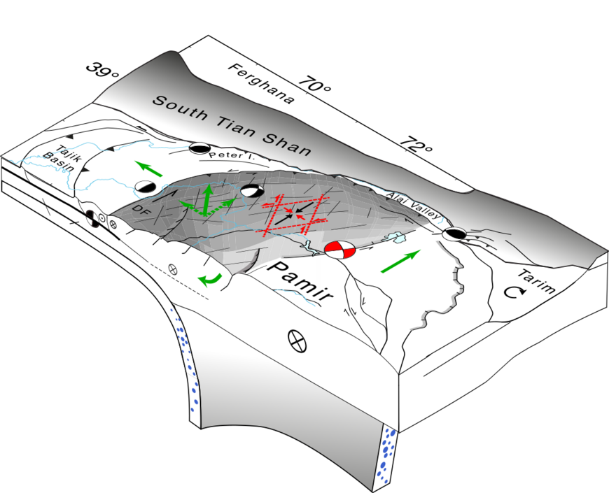
FigB2: Block diagram illustrating kinematics (green) and fault types. The eastern Pamir is pushed north en bloc; the western Pamir deforms internally, collapsing to the Tajik basin.
PIs: Sabrina Metzger (4.1), Bernd Schurr (4.1), Sofia-Katerina Kufner (4.1)
Funding: GFZ Expedition funds Project
Duration: 2015-2017 Main
Partners: Uni Kiel, TU Freiberg, Uni Montana, Beijing University
Publication: Metzger S., B. Schurr, L. Ratschbacher, H. Sudhaus, S.-K. Kufner, T. Schöne, Y. Zhang, M. Perry, and R. Bendick (2017), The 2015 Mw7.2 Sarez strike-slip earthquake in the Pamir interior: Response to the underthrusting of India's western promontory, Tectonics, 36, doi:10.1002/2017TC004581.
c) Seismotectonics of Afghanistan – Understanding continental slab break-off
Since spring 2017 we are in the process of implementing a temporal seismometer network, consisting of 15 short period instruments within NE-Afghanistan. With this network we aim to understand the dynamics of the ongoing slab break-off beneath the Hindu Kush and its seismotectonic implication. Resolving these features in detail was not possible before due to sparse station coverage in the Hindu Kush region; in particular at the western termination of the continental subduction zone.


