

HYGRA
The effect of water storage variations on in-situ gravity measurements and their use for hydrology
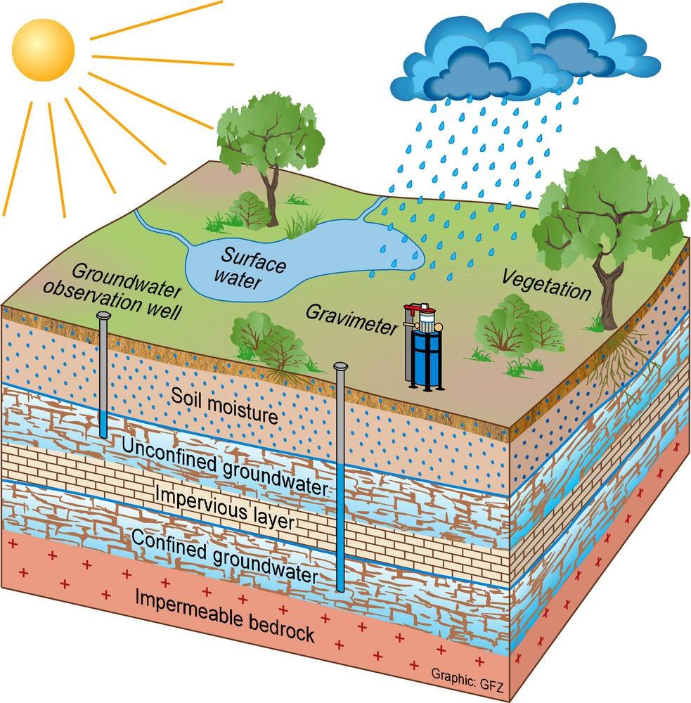
Quantifying water storage and its spatio-temporal dynamics is essential for understanding the water cycle, setting up water balances and for effective water use and water management. However, direct measurements of water storage changes is a challenging task. Water storage variations occur in the unsaturated soil and in the saprolite, in groundwater, snow cover and in surface water bodies. Monitoring all these individual storage compartments is laborious, and often restricted to point measurements that may not be representative for larger areas. Changes of water storage, in turn, have a gravitational effect due to mass attraction and surface deformation. Superconducting gravimeters (SG) observe temporal changes of the Earth’s gravity acceleration with a very high precision, precise enough to see variations of water storage. Nevertheless, SG measurements are an integral signal of mass changes, also the effects of Earth tides, polar motion, atmospheric and oceanic transport processes. Thus, it is challenge to figure out the hydrological signal. Also, SGs used to be geodetic instruments placed in observatories, thus reducing their sensitivity to water storage variations.
It is our objective to advance the applicability of ground-based gravimetry for hydrological process research and water management. We develop the use of superconducting gravimeters as field instruments dedicated to hydrological applications. In turn, we aim at reducing the hydrological effect from gravimeter time series to make them useful for other geodetic or geophysical applications. By multi-gravimeter setups including different gravimeter types, we strive for the assessment of water storage variations at larger spatial scales and the contribution of different storage compartments, ultimately closing the gap to satellite gravity missions.
Our research activities on hydrogravimetry currently is focused on the following study sites:
- Geodetic Observatory Wettzell, Germany
- South African Geodynamic Observatory Sutherland (SAGOS), Sutherland/South Africa
- Transportable Integrated Geodetic Observatory (TIGO), Concepción/Chile (concluded)
- Argentine-German Geodetic Observatory (AGGO), La Plata/Argentine
- TERENO-Northeast, Serrahn/Germany (in preparation)
- Theistareykir, Iceland
Methods used at the different sites include:
- Hydrological monitoring networks for water storage and water fluxes, including climate stations, cluster of soil moisture sensors, groundwater observation wells, lysimeters, river discharge gauging stations, snow monitoring, geophysics (ERT and GPR), GNSS reflectometry
- Physically-based and conceptual hydrological modelling from local (e.g. HYDRUS) to global (e.g. WaterGAP Global Hydrology Model WGHM) scales
- Gravimetric modelling of hydrological, atmospheric and oceanic effects on gravity observations
- Operation of superconducting gravimeters (iGrav), processing of gravimeter time series
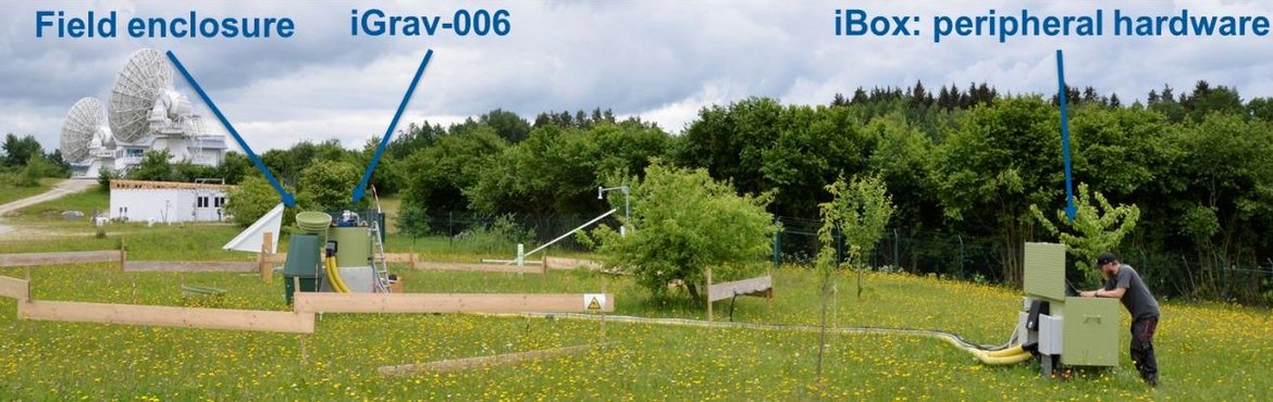
At the geodetic observatory Wettzell, we installed for the first time a superconducting gravimeter of the latest generation (iGrav by GWR Instruments, Inc.) in a field enclosure in February 2015. Results are presented in Güntner et al. (2017) .
