Quantification of near-surface processes
Quantification of near-surface processes to characterize changes in soil properties, erosion and the water balance
The objective of this project is to quantify near-surface processes for predicting soil degradation by erosion and changes in the water balance, in the context of dry environmental conditions. Field and laboratory experiments, remote sensing observations, and hydrological and erosion modelling are combined to improve process understanding and to further develop prognostic methods for the assessment of soil degradation. The study area is located in refilled landscapes left over from the Niederlausitzer coal-mining industry ( Brandenburg region, Eastern Germany ). The area is particularly suitable for this study because it is characterised by exceptionally dry climate conditions for Central European standards, and because it is free of vegetation or covered by sparse vegetation only.
Specific goals of the study are:
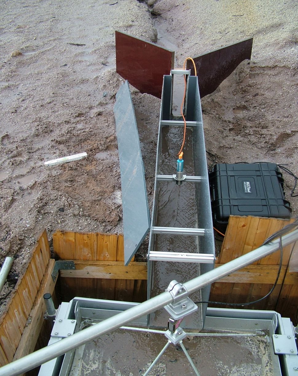
- Monitoring and modelling of near-surface processes to predict runoff generation and erosion by water.
- Coupling of remote sensing data with field measurements to derive information about soil surface characteristics, erosion status and near-surface soil moisture content.
- Examining the influence of soil moisture / dryness on soil-physical and hydrological parameters, such as hydrophobicity, surface crusts, infiltration capacity, water storage capacity.
Study area
The study area in Welzow-Süd (South-East of Germany, close to the town of Cottbus) of 4 ha in size was refilled in 2001 after mining by sediments of different origin and properties, with the major contributions being composed of two different sandy materials of Tertiary and Quaternary origin and, third, by clay deposits. The focus of the this study is on the sandy areas. While the Tertiary deposits are free of vegetation, an initial sparse vegetation cover of grasses has developed on the other areas. Runoff from the test site is episodic. These conditions, together with low annual rainfall volumes, make the test site a valuable pilot study area for the development of monitoring and modelling approaches to assess erosion and soil degradation processes in dryland areas.