DISFLOOD
Disaster Information System for Large-Scale Flood Events using Earth Observation (DISFLOOD)
Recent floods in Germany have demonstrated high vulnerabilities of cities and communities, touching many sectors such as infrastructure, communications, commerce, culture, industry, etc. The assessment of the characteristics of a flood situation, including its negative consequences, is a prerequisite for an effective flood management.
An assessment covering the complete spatial extent of a flood is especially difficult for large-scale events. In large-scale events, information about the flood and its consequences is spread across different institutions in different communities or regions. Usually, no coherent picture of the complete event exists. Satellite data allow deriving a superordinate picture of the complete spatial situation. Its combination with large-scale data sets, e.g. country-wide topographic and socio-economic data, makes it possible to provide sophisticated parameters for the characterisation of the flood risk.
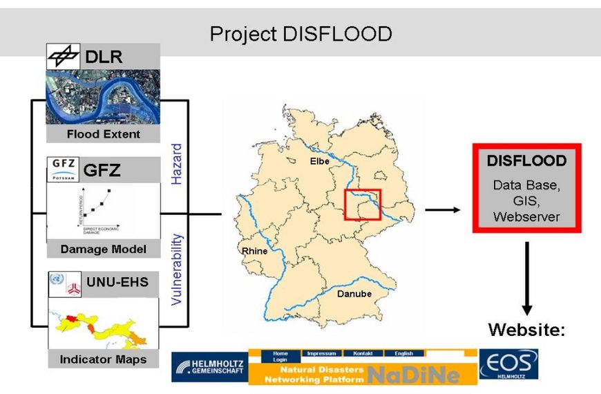
The co-operation project aims at developing a disaster information system for assessing the consequences of large-scale floods with the help of earth observation. The method will be implemented within a software system under the framework of NaDiNe .
The proposed information system will:
- Provide inundation areas based on satellite data
- Derive damage-influencing parameters such as inundation depth
- Estimate direct economic loss
- Provide vulnerability indicators
The work of DISFLOOD is carried out on the macro scale. The methodologies are developed for the River Elbe, respectively the Federal States Saxony and Saxony-Anhalt. They are meant to be potentially applicable for other large rivers in Germany such as Rhine and Danube . The spatial focus of DISFLOOD is on the sub national scale; hence communities will be the units of investigation.


