For information about the magnetotelluric studies click here
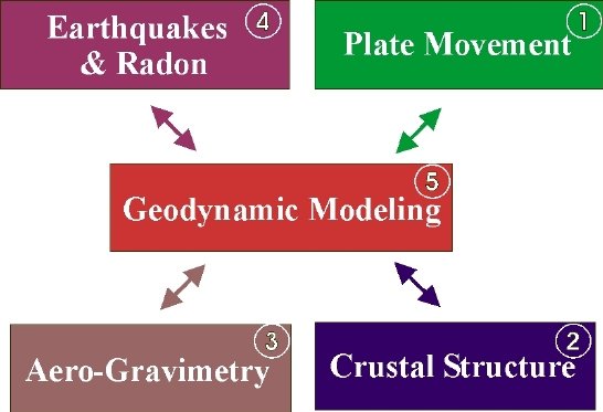
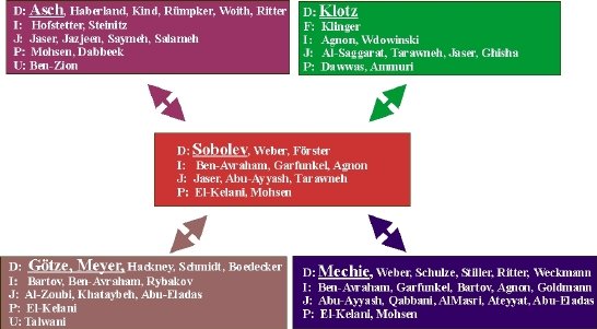
Figure 6b
Partners in DESIRE. Project coordinators are given in bold, underlined letters. Partners are given by country (D ‑ Germany, I ‑ Israel, J ‑ Jordan, P ‑ Palestine; F – France, U – USA).
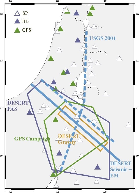
Figure 7
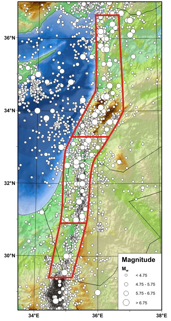
Previous experiments and existing seismological/GPS networks in the Middle East. GPS campaign (Green box; covered by France-Israel-Jordan (1999 - 2004)) and permanent GPS stations (Green triangles). DESERT-Seismic & EM (Full blue line; Wide-angle Reflection/Refraction profile, Near-Vertical Reflection, Controlled Source Array, Magnetotelluric profiles, Lotem/Shotem profiles). USGS 2004 (Dashed blue lines; Wide-angle Reflection/refraction profiles, USA-Israel-Jordan, fall 2004). DESERT-Gravity (Brown box, Detailed gravity survey; 2001-2002). Seismological networks of Israel and Jordan (Purple triangles; SP stations – open triangles, BB stations - full triangles; status 2004). DESERT-PAS (Purple box; covered by 59 temporary stations of the DESERT project; 2000-2001).
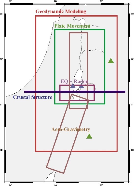
Figure 8a
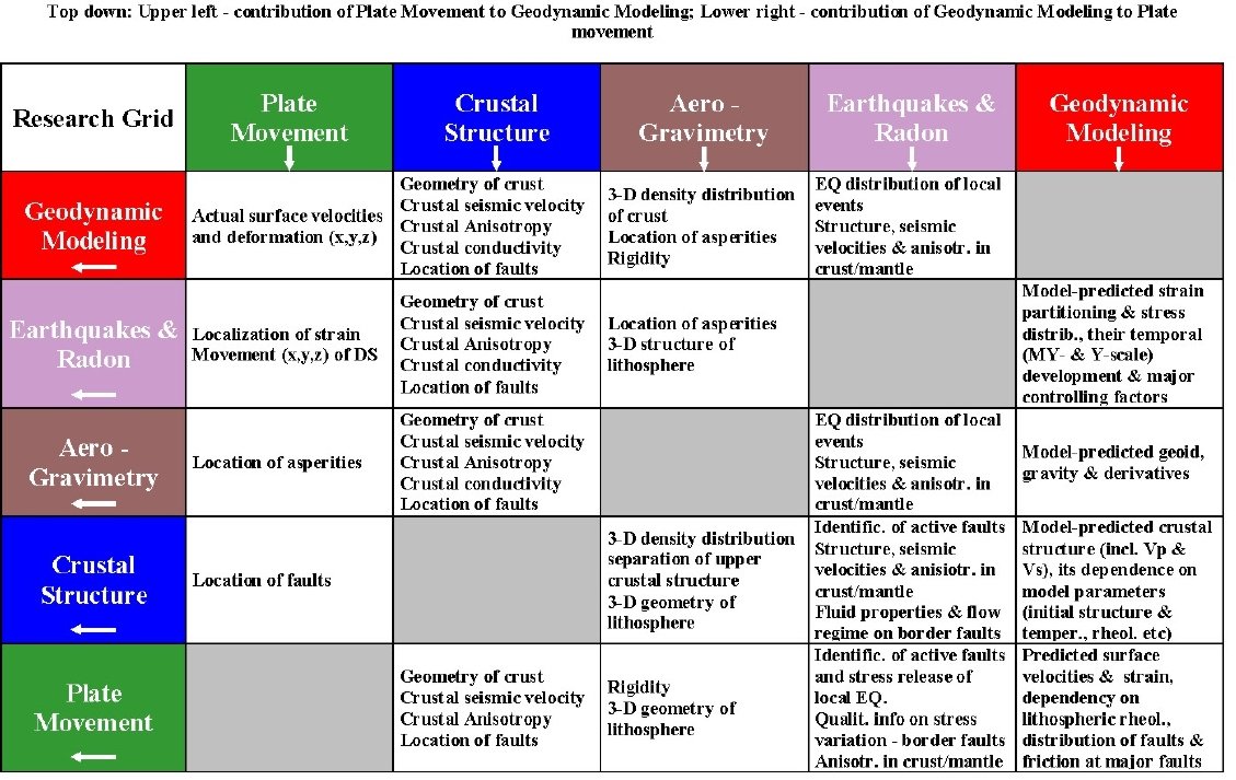
Proposed DESIRE experiments and projects. Plate Movement: GPS campaign (Green box; area to be covered) and permanent GPS stations in Jordan (Green triangles). Crustal Structure: Seismics (Blue line; Wide-angle Reflection/Refraction, Near-Vertical Reflection and MT). Aero-Gravimetry: (Brown boxes). Earthquakes & Radon: Temporary BB/SP-array and Multi-parameter stations (Purple box & purple triangles respectively). Geodynamic Modeling (Red box).