

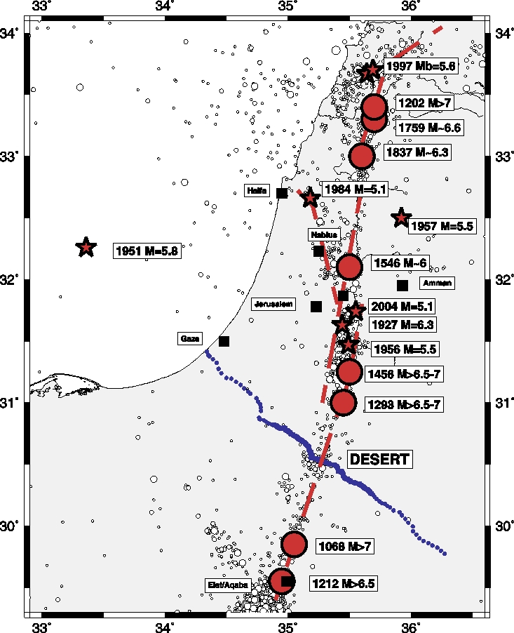
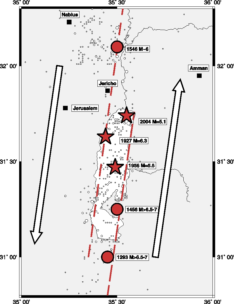
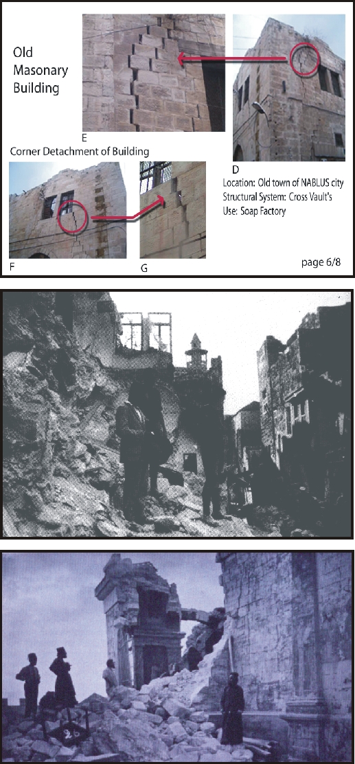
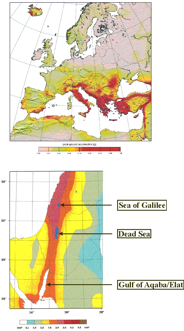
Studies of historical earthquakes of the past few thousand years, paleoseismic studies and instrumental earthquake studies of the last 100 years demonstrate that a number of damaging earthquakes have occurred along the Dead Sea Transform (DST), the large shear zone running from the Gulf of Aqaba/Eilat through the Dead Sea into the Lake of Galilee (Fig. 1). Seismicity shows a clustering in the Dead Sea Basin (DSB; Fig. 2), which is close to the population centers of Israel, Jordan and Palestine. The distance from the last big event in the Dead Sea (1927, M = 6.3) to Jericho, Jerusalem, Amman and Nablus is 25 km, 25 km, 60 km and 70 km respectively (see also Fig. 3 for examples of damage). Recent estimates suggest Mw » 7 earthquakes along the DST about every 200 years (Klinger et al. 2000b) and/or M = 6 earthquakes every 100 years (R. Hofstetter; personal communication). Earthquakes along the DST and in the Dead Sea Basin therefore pose a considerable seismic hazard to Israel, Jordan and Palestine (Fig. 4).
This area has for a long time been considered a world geological site. The Dead Sea Rift Transect project (DESERT), funded by the DFG and the GFZ from 2000 to 2004, therefore tackled some of the open questions related to the DST by crossing for the first time the national borders between Israel, Jordan and Palestine (see Fig. 1). The DESERT project showed that cooperation between the three local partners (Israel, Jordan, and Palestine) is possible despite the difficult political conditions. In order to study the DST in a place where it is relatively simple and accessible with only minor complications, the DESERT profile was located in the Arava/Araba Valley between the Red Sea and the Dead Sea. Some of the fundamental questions solved during DESERT were:
Q: What is the crustal structure in the Arava/Araba Valley?
A: Dipping Moho & small topography
Q: Does the DST cut through the whole crust?
A: Yes
Q: Does rifting play an important role in the dynamics?
A: No
Q: Are there similarities between the DST and the SAF?
A: Yes & No
SAF=San Andreas Fault
Where as DESERT was focused on a location where the DST appears most simple (i.e. dominated by pure strike-slip movement), GEO-DESIRE will focus on the Dead Sea Basin, one of the largest pull-apart basins in the world (Fig. 5): 120 km long, only 20 km wide and more than 10 km deep (the depth is still not known exactly). At this world geological site it will be possible to study and better understand the following important points:
- How crustal dynamics actually works at heterogeneous plate boundaries
- How large faults interact to create deep sediment basins
- How stress is transferred in such an environment to cause asperities and produce earthquakes.
The key to addressing the fundamental questions of geodynamics and plate tectonics raised above is an understanding of the dynamics on both small and lithospheric scale by realistic 4D Geodynamic Modeling. This modeling approach will integrate the results of GPS measurements, the imaging of the 3-D crustal structure by seismic and magnetotelluric methods, aero-gravimetry experiments, earthquake studies and radon monitoring. An overview of the structure of GEO-DESIRE is given in Fig. 6a. The coordinators from Germany (bold, underlines) and the partners are given in Fig. 6b.
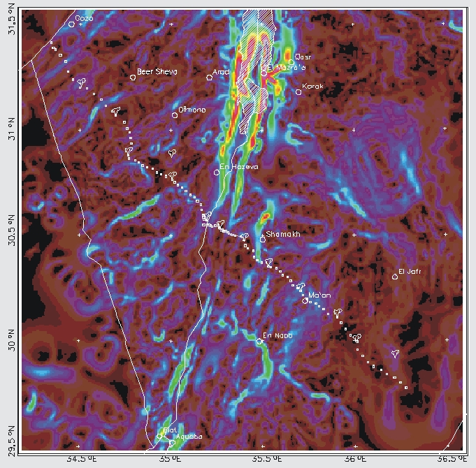
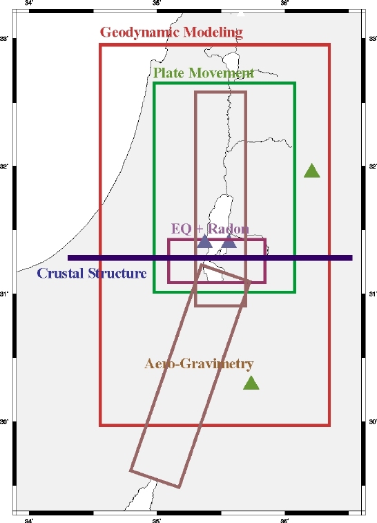
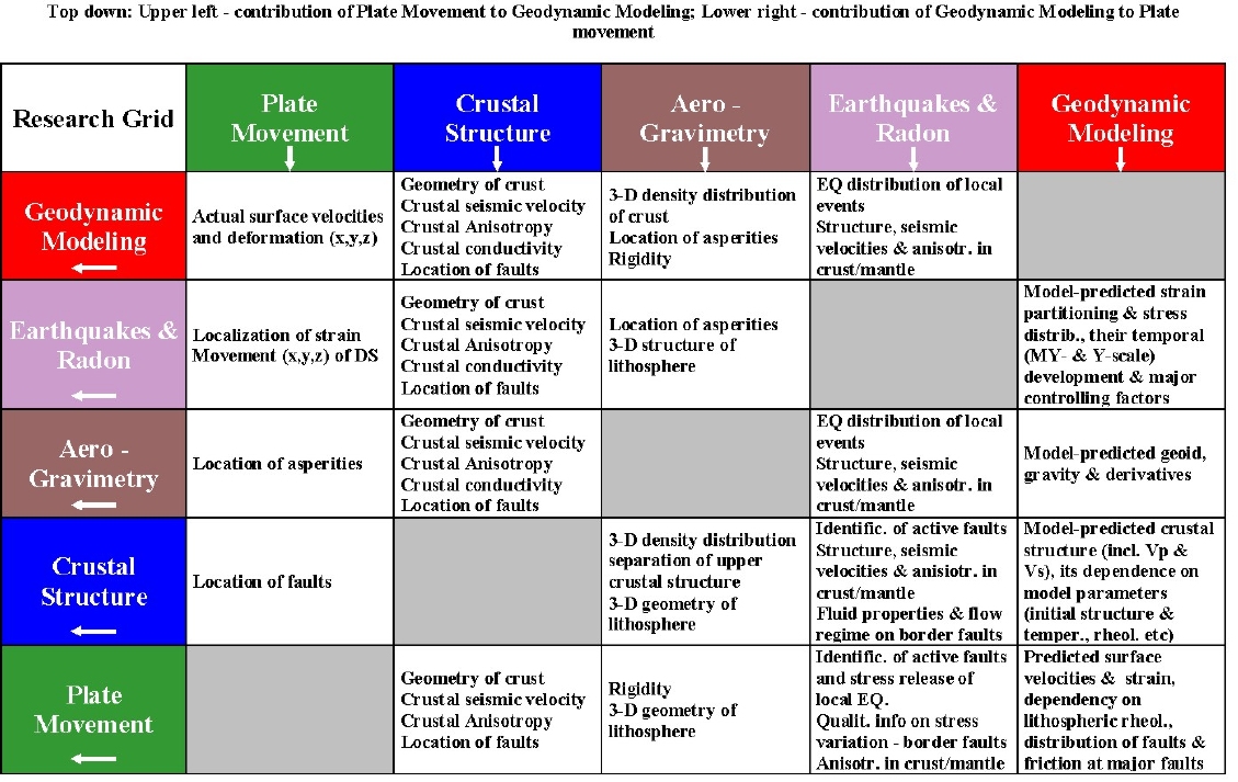
GEO-DESIRE will build on the knowledge from previous geoscientific/geophysical experiments like DESERT and the existing GPS and seismological networks in the Middle East. Fig. 7 shows the areas covered by previous studies, to be discussed in more detail in the introductions of each of the five projects of GEO-DESIRE. Up to date most studies have focused on the region between the Dead Sea and the Red Sea due to the relative simplicity of the DST in this location and the possibility to study a strike-slip environment. In contrast, the projects of GEO-DESIRE aim at studying the corner-stone of the geo-dynamics of the region, the pull-apart basin – the Dead Sea Basin. Fig. 8a gives an overview over the profiles and areas to be covered in the five projects of GEO-DESIRE (see also Fig. 6a). The way the different projects are linked and contribute to each other is shown in Fig. 8b. An overview of the costs (separate for each country) is given in Fig. 9 a,b for Year 1 and Year 2 respectively.
GEO-DESIRE represents an integrated part of an interdisciplinary research program planned by the HGF and participants from universities (Dead Sea Project) covering Earth Sciences, Atmosphere and Climate, Biodiversity and Landscape, Hydrology and Groundwater, Health Sciences and Environmental Technology. GEO-DESIRE is the Earth Science part of this initiative and will provide the basic geoscientific and geodynamic frame for the other disciplines. GEO-DESIRE will also cooperate with initiatives to study earthquake hazard and risk assessment in the Dead Sea Fault Region submitted to the BMWT (Germany) and MOST (Israel). GEO-DESIRE will provide the required underlying crustal and lithospheric structure, an accurate measurement of the seismicity and the geodynamic driving forces.
The GEO-DESIRE project aims not only to provide the best possible geophysical mapping and imaging, but also to allow the use of innovative strategies and technologies with high flexibility.
Answering the questions raised above will allow us to contribute to some of the central questions of plate tectonics:
- Why and how does plate movement open deep holes/basins in the crust?
- How are stress and strain instantaneously distributed in time and space?
- How does this process influence and control the earthquake distribution?