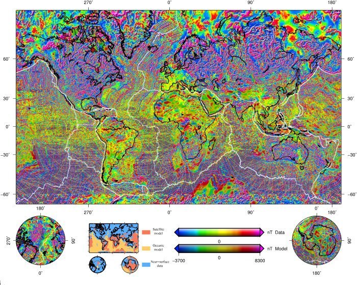
The magnetization of the lithosphere is due to magnetic minerals, primarily magnetite with varying content in titanium. The titano-magnetite rich rocks become essentially non-magnetic above Curie temperatures of 400°C - 600°C and therefore, the lithospheric magnetization is limited to a layer of about 10km to 50km in thickness, depending on the local heat flow. The rock magnetization can be either induced (i.e. the magnetization is proportional to an inducing field, generally well approximated by the Earth's core field) or remanent when the magnetization strength and direction are "frozen in" the rocks and change only on very long time scale.
This lithosphere magnetization gives rise to a magnetic field which strength can be as large as several thousands of nT for the major anomalies like Kursk and Bangui, but in general is not much larger than 100nT. The lithospheric magnetic field is mapped by land, marine or airborne surveys and also from near-Earth satellite missions. A very large amount of marine and aeromagnetic surveys have been made at different epochs, over national or regional areas. However, the global mapping of the lithospheric magnetic field is possible only from satellite and has started with the POGO (1967-1971) and MAGSAT (1979-1980) missions. After 20 years without suitable measurements, significant progress have been made since 1999 with the high-quality data sets provided by the Oersted, SAC-C and CHAMP satellites.
For the lithospheric magnetic field, only wavelengths shorter than 2500km are visible. The longer wavelengths are overshadowed by the much stronger Earth's core field. What is generally referred to as the lithospheric magnetic field anomaly is actually only its short wavelength part. As the strength of a short wavelength anomaly decreases rapidly away from its source, the resolution of satellite data is limited to wavelengths longer than 400km; models of the lithospheric field for wavelength ranging from 400km to 2500km are now available. Information on shorter wavelength features are available only through marine or aeromagnetic surveys, or compilations of such surveys. A significant effort of the international geomagnetic community to merge together all available survey data lead to the first World Digital Anomaly Map, published in July 2007 (include WDMAM)


