Dynamics of Atmosphere and Hydrosphere
Signatures of dynamic processes in atmosphere, oceans, and the continental hydrosphere are present in many geodetic and geophysical observations: ocean tidal dynamics cause periodic variations in both the gravitational and the geomagnetic field of the Earth as measured by satellites. Station positions as measured by Global Satellite Navigation Systems (GNSS) are affected by vertical deformations due to atmospheric pressure loading that depend on the local rigidity of the crust. Large-scale variations of water stored in continental ice-masses, soil moisture and surface water are routinely monitored by gravimetric observations. Re-distribution of mass from the continents into the oceans causes changes in sea-level on global-to-regional scales.
We develop and explore numerical codes rooted in the fundamental theories of fluid dynamics to aid geodetic and geophysical data analysis and interpretation for the benefit of an improved understanding of the System Earth. Central to our work are ocean general circulation models configured to cover global or regional domains that represent processes as ocean tides, self-attraction and loading feedbacks to the ocean dynamics, or surface pressure forcing in addition to the usually considered atmospheric fluxes. We further use numerical models of the terrestrial water cycle that consider vertical water and energy exchange with the atmosphere, and lateral water transport in the soil and through the river network. All models are typically driven by atmospheric data obtained from global atmospheric re-analyses oroperational numerical weather prediction data.
Numerical Model experiments performed in Section 1.3 help to design and characterize future observing systems, as satellite gravity missions of the next generation, satellite-mounted GNSS reflectometry receivers, or innovative oceanographic in-situ sensors attached to newly laid-out telecommunication cables.

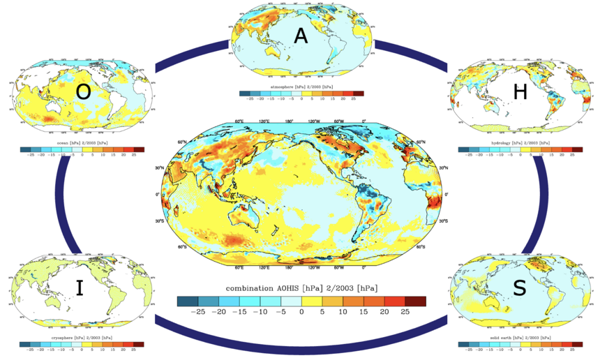
Model results are also utilize to reduce effects of near-surface geophysical fluids from geodetic observations. Products provided to international research communities include the GRACE Atmosphere and Ocean De-Aliasing Product AOD1B,, globally gridded crustal deformations due to surface loading, and geophysical excitations of polar motion and changes in length-of-day.

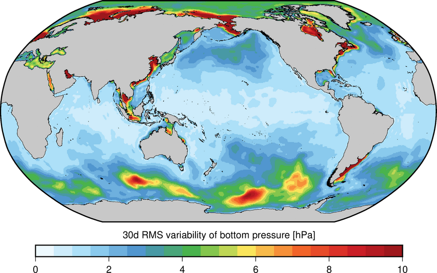
In order to validate numerical models -- and to further explore signals in observations not yet sufficiently understood and included in numerical models -- we also contribute to the processing of observations, most noteably the analysis of in situ ocean bottom pressure, mass transport from satellite gravimetry, or time-variations in the Earth's magnetic field related to ocean dynamics.
To synthesize informations from models and observations, we develop data assimilation approaches in numerical ocean modelstailored to observations taken from satellite observations of the magnetic or the gravity field, and of in situ observations from ocean bottom sensors or trans-basin cable connections.
We also perform Paläo-Simulations s to explore changes in ocean dynamics over geologic time scales. Simulations of deep western boundary currents during the Pliocene help to interprete sediment cores recovered from the North Atlantic. To elucidate meridional heat transports in the ocean on geologic time-scales, the global tidal dynamics of several epochs ranging from the Early Albian (110 Ma) to the Early Pliocene (3.5 Ma) have been simulated.
Experience gained from the analysis of simulations over historic time periods can be subsequently utilized for predictionsof future changes in the Earth System. For example, we currently issue routine predictions of Earth orientation changes on forecast horizons from days to weeks that are important for satellite communications and satellite-based navigation applications.


