

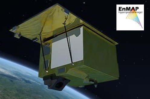
The launch date is becoming more and more concrete: The EnMAP environmental satellite will fly into space on a Falcon 9 rocket from the US spaceport Cape Canaveral (Florida) in April 2022. Under the scientific coordination of the GFZ German Research Centre for Geosciences, EnMAP will take high spectral resolution images of the Earth's surface in more than two hundred narrow and contiguous wavelengths bands, so-called hyperspectral images based on Imaging Spectroscopy.
"We expect this to provide us with detailed information about vegetation and climate change, but also about soil and mineral resources, water quality and environmental pollution," says Sabine Chabrillat, group leader in the GFZ's Remote Sensing Section and science principal investigator of the mission. The project is coordinated by the German Space Agency at the German Aerospace Center (DLR) in Bonn. The Earth observer was developed and built by OHB System AG in Bremen. The SpaceX company is providing the launch vehicle and has set the launch window at 30 days beginning April 1.
"The launch will mark a milestone in GFZ history," says GFZ Scientific Director (interim) Niels Hovius. "Colleagues at GFZ have been working together with the international EnMAP Science Advisory Group on the mission's research program for many years." The Potsdam team is also coordinating the major EnMAP PI science project on the scientific preparation and support of the mission which is jointly supported with the partner institutions Humboldt University Berlin, University Greifswald, AWI Bremerhaven and LMU Munich.
The project encompasses an extensive scientific program including free and open source software developments for the scientific community. Developed tools for independent EnMAP data pre-processing and for hyperspectral data analysis in various application fields such as soil mapping, mineral exploration, agriculture and inland and coastal waters are made available in the EnMAP-Box, a free-and-open toolbox developed within the EnMAP science program and included in the QGIS environment.
Another important scientific task of the current project phase is the scientific validation and data quality assessment of the EnMAP radiance and reflectance data which will be carried out during the commissioning phase and the operational phase. The validation plan is already being prepared in cooperation with several international partners that will contribute measurements over suitable reference sites around the world.
Additionally, a range of training and community building activities are underway, such as the development of online learning resources and online courses on imaging spectroscopy within the HYPERedu educational initiative. The first Massive Open Online Course (MOOC „Beyond the Visible – Introduction to Hyperspectral Remote Sensing“) on the basics of imaging spectroscopy opened in November 2021, addressing potential future users of EnMAP and hyperspectral remote sensing data, such as students as well as professionals in research, companies, public authorities, and governmental institutions, and already received more than 800 applicants. Saskia Förster, scientist in the section Remote Sensing and geoinformatics at GFZ, says: „We expect that the qualitative high-spectral resolution EnMAP data will be employed by a growing number of users for mapping the state and evolution of terrestrial and aquatic ecosystems as well as for natural resource management and assessment of hazards and risks.“
EnMAP - the German environmental mission and its partners
The EnMAP environmental mission is being managed by the German Space Agency at the German Aerospace Center (DLR) in Bonn on behalf of the German Federal Ministry of Economics and Climate Action (BMWK). OHB System AG has been contracted to develop and build the satellite as well as the hyperspectral instrument. The mission is under the scientific management of the GFZ German Research Centre for Geosciences.
Three DLR institutes and facilities have been commissioned with the construction and operation of the ground segment: The German Space Operations Center in Oberpfaffenhofen will conduct and monitor satellite operations. The German Remote Sensing Data Center and the DLR Remote Sensing Technology Institute will archive, process and validate the received satellite data and make it available to the scientific community. Companies and government agencies will also test the data in preparation for future services. The future use of EnMAP hyperspectral data by universities and scientific institutions and the development of special applications will be supported by BMWK funding programs.
Scientific contacts:
Prof. Dr. Sabine Chabrillat
E-Mail: sabine.chabrillat@gfz-potsdam.de
Section Remote Sensing and Geoinformatics
Group Leader
Tel:+49 331 288-1108
Dr. Saskia Förster
E-Mail: saskia.foerster@gfz-potsdam.de
Section Remote Sensing and Geoinformatics
Scientist
Tel:+49 331 288-28615


![[Translate to English:] Hörsaal](/fileadmin/_processed_/e/6/csm_H%C3%B6rsal_f1d7c412b9.webp "[Translate to English:]")


