

Katrin Kohnert is a PhD student in GFZ’s section remote sensing. Her research focus is on North Alaska and the Mackenzie Delta in Canada, where she investigates the emission of greenhouse gases from permafrost soils under the influence of climate change. A few weeks ago she returned from her latest expedition to the Mackenzie Delta.
GFZ: You just came back from the Mackenzie Delta in Canada. Can you tell us about the expedition?
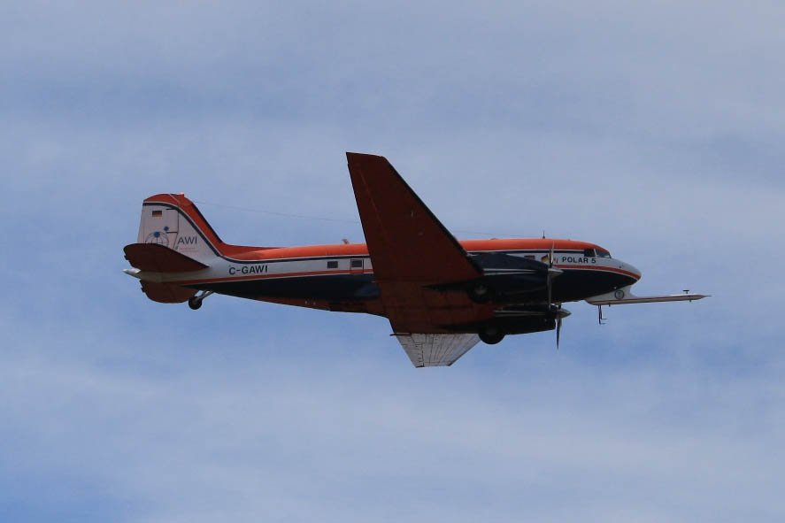
Katrin Kohnert: The Mackenzie Delta is a permafrost region where we, the GFZ working group Earth-Atmosphere Interactions, primarily investigate emissions of the greenhouse gases methane and CO2. To do so, we collaborate with the Alfred Wegener Institute, Helmholtz Centre for Polar and Marine Research, AWI, and use the research plane Polar 5 for measurement campaigns of several weeks.
GFZ: Why the Mackenzie Delta?
Kohnert: The area is scientifically highly interesting: It contains both, areas with thick continuous permafrost and those with thin discontinuous permafrost.
There are plenty of data available for the area by other institutions, mainly from Canada, and the AWI has been doing coastal erosion research there for several years now. This is why we have access to a good data base here to tie our data into.
Furthermore, there are logistic reasons: To be able to operate the research plane we need an airport that provides ground power and fuel. There is one in Inuvik, a city at the Mackenzie Delta, which is why the delta is predestined to do permafrost research there.
GFZ: When was the project started?
Kohnert: The first campaign was in 2011, since 2012 four more campaigns were done in Alaska and Canada, and similar ones in Siberia. I have joined these campaigns in 2013 when I started my PhD project.
GFZ: What was your part in the expedition?
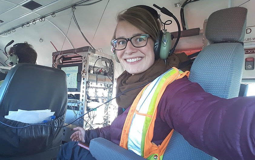
Kohnert: A campaign like this needs a lot of preparation. It needs to be determined what is measured for how long and which routes are taken at what frequency, to cover an area as large as possible – the Mackenzie Delta is huge. This was what I was in charge of.
In addition, priorities need to be set in advance in order to be able to quickly react to bad weather conditions or technical problems. I also monitored the gas measurements in the plane.
GFZ: How does a measurement by plane work?
Kohnert: There is a nose boom mounted to the front of the plane which carries temperature and humidity sensors as well as a so called five-hole probe that we use to measure wind direction and speed. Furthermore, there is an inlet on the top of the cabin to pump air via a tube system into a gas analyser within the plane. We use the gas analyser to measure the concentration of methane and CO2 as well as water vapor with high frequency.
I operate the gas analyser and monitor the measurements on a live-view screen. I need to make sure, for example, that the pressure remains stable.
GFZ: At what altitude do you fly?
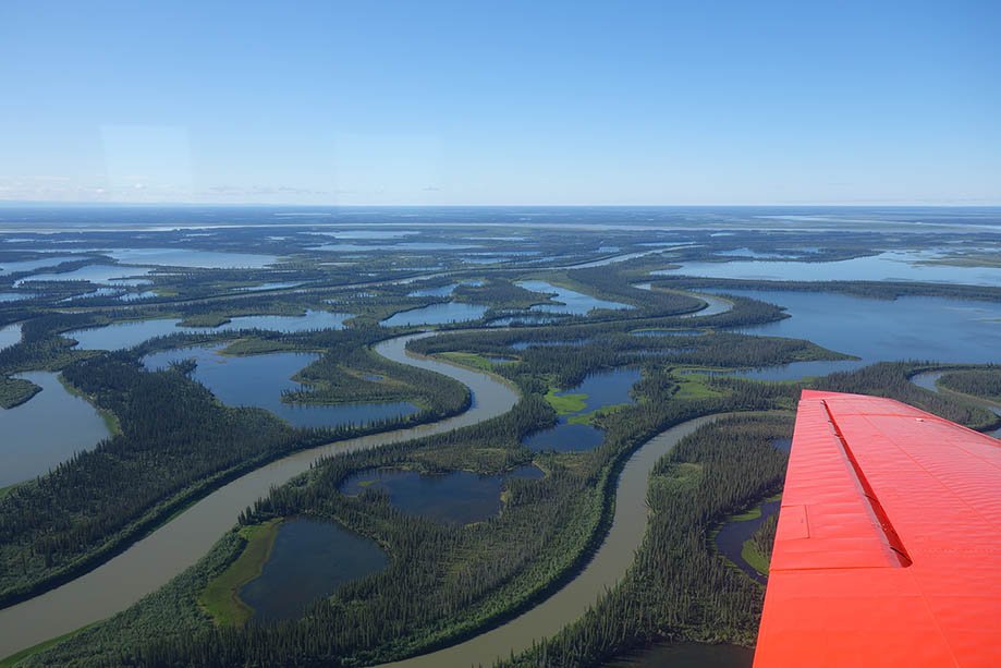
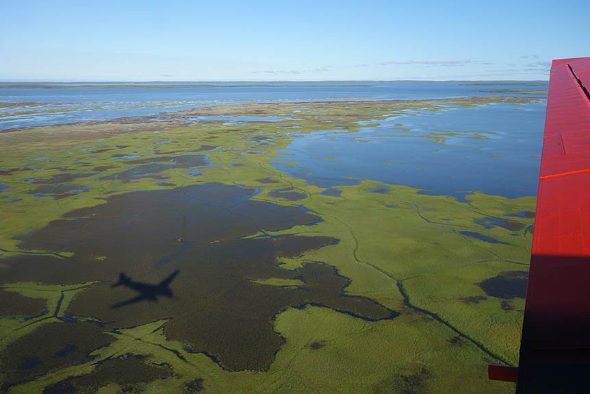
Kohnert: We fly at only about 60 meters above ground to be in the lowermost ten percent of the atmospheric boundary layer.
This is the layer where exchange processes between Earth and atmosphere take place. Here, we are able to measure how much CO2 is removed from the atmosphere via photosynthesis of the vegetation and how much methane is emitted. If we flew higher, our measurements would be influenced by remote areas or other atmospheric layers.
GFZ: Why don’t you use satellites or drones instead of a plane?
Kohnert: In comparison to satellites we are able to determine where we would like to fly. Also, the plane is big enough so that we can fly for five hours. This is important to cover large distances since we are interested in spatial patterns of greenhouse gas emissions.
Satellite data are available for our area, but with the current state of technique they are not applicable for our purpose. They only deliver concentrations averaged through the entire atmospheric column. It is still a long way to go to derive the direct exchange between geosphere and atmosphere from satellite data.
If we used drones, we would only be able to cover much smaller areas. It would, however, be interesting as well, since we would get high resolution data. Within the MOSES project (Ed. note: ‚Modular Observation Solutions for Earth Systems‘ of the Helmholtz research field Earth and Environment) we are currently working on installing the required instruments onto a drone that should be available in the beginning of next year. This will perfectly complement our data.
GFZ: You were also taking photos, right?
Kohnert: Right. This was particularly interesting for our partners. We, for example, took a stereo camera by the German Aerospace Center with us that was attached to the bottom of the plane to take high-resolution photos.
For a working group of AWI, we flew along the coastline since we are investigating coastal erosion - it can be immense in arctic areas. Based on the imagery they can construct detailed 3D models.
Next year we will do the whole thing again so that they can analyse coastal regression based on those models. During past campaigns we have already collected LiDAR data (Ed. note: a LiDAR “light detection and ranging” uses a laser to measure distances and thereby construct surface models). The stereo camera now complements and improves the data base.
GFZ: There were problems with the plane which is why the campaign was delayed. What happened?
Kohnert: Before every campaign there is a test flight done in Bremen, were the plane is based. We were all there for the flight when the pilot – fortunately just in time – noticed an unusual sound in one of the engines and it turned out the engine was damaged.
It needed to be replaced which, together with the delivery time, took so long that we had to cancel the first part of the expedition – we planned to go to Alaska for two weeks before going to Canada. Luckily, we were able to do at least some measurements in the Canada part properly.
GFZ: Which insights would you like to gain with your project?
Kohnert: For me it is about high-resolution data of methane emissions of permafrost regions. The Arctic is so inaccessible that existing data are still sparse and quite possibly not representative for the whole Arctic.
I would like to find out to what extend methane emissions contribute to climate change. Here, aircraft measurements can be of special use since we are able to cover large areas, derive average fluxes across different land surface properties, and study spatial patterns. If the emissions are, for example, especially high in a certain area, we try to find out why by adding other data sources from remote sensing or detailed field studies on the ground.
Right now, an overall understanding of how much methane is emitted in the Arctic and how much CO2 is removed from the atmosphere by photosynthesis, is still missing.
GFZ: Why are you especially interested in the Arctic? Wouldn’t it be necessary to consider the planet as a whole?
Kohnert: Yes, that is indeed necessary, but we as a working group have so far focused on the large arctic permafrost landscapes and peatlands in northeastern Germany. The latter, we investigate within the TERENO project (ed. note ‚TERrestrial ENvironmental Observatories‘ of the Helmholtz Association) – where CO2 and methane emissions are measured via a permanently installed measuring tower over rewetted peatlands and a lake.
Last year we also began airborne measurements here in collaboration with the FU Berlin after having prepared their motor glider. It will be exciting to see how the stationary and large scale measurements compare.
Next year we plan to use the new MOSES drone and the glider in the Eger rift in the northwestern Czech Republic to measure CO2 degassing in collaboration with many other GFZ sections and many more partners.
GFZ: You work within several projects. Can you give us further examples?
Kohnert: I mainly work within the EU project INTAROS (ed. note ‚Integrated Arctic Observation System‘), funded within Horizon2020, where GFZ is a participating partner. The aim of the project is to develop an Integrated Arctic Observation System.
One aspect is to gather and catalogue all the data collected on the Arctic so far – from atmospheric and marine observations to sea ice coverage and terrestrial greenhouse gas emissions – and make it easily accessible by other scientists.
Within our group I am in charge of gathering the data and coordinating our part, which is rather exiting. I gain an overall insight beyond my own measurements. This helps me to better interpret also my own data set and in addition I gain experience in project management.
GFZ: You are still at the beginning of your scientific career. Is there a scientific question that you would like to solve?
Kohnert: Yes, there is indeed. What is still missing and where we are only starting to think about is an elegant way to bring all our data together, quantitatively: from the very small scale, continuous ones to the large-scale temporal snapshots such as those from our campaigns.
Together with colleagues I work on this question. This task is quite complex and first of all we need to implement an appropriate method. However, this is really needed to gain a comprehensive understanding of arctic emissions.
Interview: Ariane Kujau


![[Translate to English:] Hörsaal](/fileadmin/_processed_/e/6/csm_H%C3%B6rsal_f1d7c412b9.webp "[Translate to English:]")


