

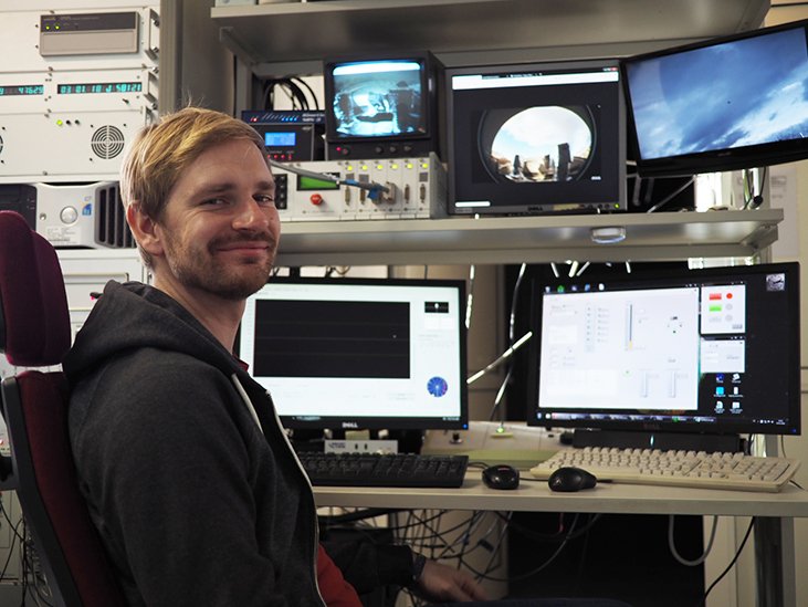
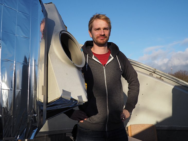
Sven Bauer is head of the Satellite Laser Ranging (SLR) station at the GFZ. The observatory measures the distance to satellites to calculate the trajectory as well as parameters like the rotation of the Earth or the deformation of the Earth’s surface. Also space debris has already been measured. In the past year, the station performed more than 5300 measurements: an all-time record for this station.
GFZ: What do you measure at the Satellite Laser Ranging station?
Sven Bauer: We primarily measure the distance to satellites that pass our station by targeting them with our laser. The time interval between shooting the laser pulse and receiving its reflection gives us the distance between the satellite and the station. With many of these distance measurements its trajectory can be estimated.
GFZ: What else are the measurements used for?
Bauer: Besides calculating trajectories they are used to calculate parameters like: the centre of the Earth, the Earth’s rotation and its deviations or the Earth’s orbit, and deformations of the Earth’s surface.
GFZ: Do satellites actually fly that precisely so their trajectories can be used for these calculations?
Bauer: When satellites circle the Earth their trajectories are influenced by several effects, like the Earth’s rotation, the gravity field, or the atmosphere. This needs to be considered when the trajectories are used for the calculation of the Earth related parameters.
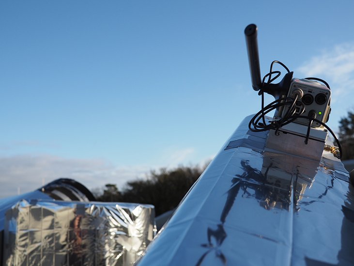
Modern satellites are equipped with a GPS for positioning. This makes the tracking much easier. If no GPS is installed, the position of a satellite needs to be estimated which requires more effort, however.
GFZ: How do you run a measurement?
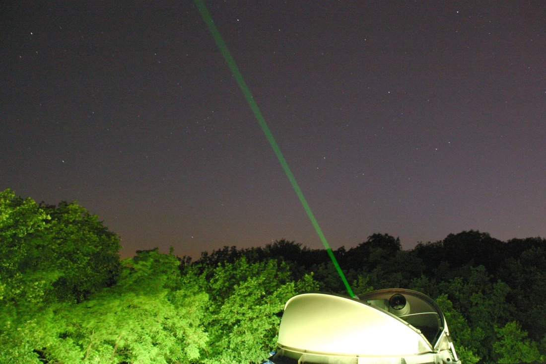
Bauer: When a satellite overflies the station and has a special type of mirror on board we target it with our laser. Since trajectory-forecasts are not perfect, we need to search a little for the satellite.
The mirrors reflect the laser beam, we receive the reflected pulse and thereby trace the satellite’s trajectory and then follow it for as long as it is visible for us in the sky.
The GFZ developed a mirror like this, a so called laser reflector that is very powerful and is installed on board of several satellites, like for example CHAMP, GRACE, GRACE-Follow on or Swarm.
GFZ: Are there stations like yours all around the world?
Bauer: No. Well covered are Europe and Southeast Asia, the northern hemisphere better than the southern hemisphere.
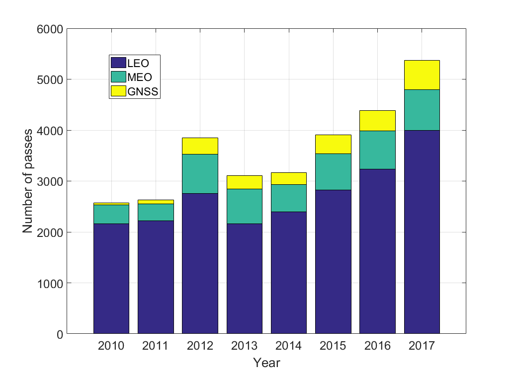
GFZ: Last year the station in Potsdam reached a record by tracking more than 5000 objects. Can you explain this number?
Bauer: On 4 December 2017, we reached the mark of 5000 measured passes, more than ever before within one year. At the end of the year we even reached 5300 measured passes. One reason is the increasing number of satellites in the orbit. But more important was that we were two station operators and hence more personnel during the last year. The former station operator Ludwig Grunwaldt introduced me to the station before he went to retirement.
Furthermore, we empowered our station, which is something that we are especially happy about.
We are not as good as the “front-runner” among the SLR stations: Yarragedee in Australia, but with regard to the poorer visibility conditions we have to deal with, we are pretty good.
GFZ: Why are the Australians so much better?
Bauer: Yarragedee lies in a desert with the advantage of a blue sky for about 275 days a year. In Potsdam, however, we have clear weather conditions only for about 110 days a year. We are just not able to pass a cloudy sky with our laser.
Moreover, our station does not yet run completely automated, which further decreases the performance. It also means, however, that we will probably be able to still reach these good results in the future, since we started to modernize our station and keep on with it.
GFZ: How did you improve the station already?
Bauer: Last year, we laid the foundation for automating the station. Automation is present-day standard and some other stations have it already implemented. As soon as it is implemented it allows for a more effective operation of the station. To secure the system in case of drop outs we still have to implement several safety features, but a start has been made.
Last year’s highlight was an empowerment of our laser. It now runs with a higher power which means its pulse energy is higher and thereby allows for more measurements, also during the day. Day-time measurements are in general more difficult to run since the background noise is higher: there is much more light during the day.
GFZ: You are using a green light laser. Would it be possible to use a laser with a different wave length?
Bauer: Yes, best would be an infrared laser. But infrared detectors are not yet technically mature compared to green ones. Further you cannot see this laser with the naked eye and so working with it would be more dangerous, though.
GFZ: How are the measurements organized?
Bauer: Currently, we perform the measurements manually. The personal commitment of all observers of our station enabled last year’s success. Especially my predecessor Ludwig Grunwaldt, who retired last year, has shown immense dedication.
During the time the station was „handed over“ to me, it was double-crewed, which is why we were able to perform more measurements than before. Often, Ludwig Gunwaldt did measurements from 4 am to 9 am, I took over from 9 to 6 pm, followed by the night shift. Altogether we are, without Mr. Grunwaldt and including one student helper, seven people at the moment.
But more of them are retiring soon, which is why it is even more important to move towards automatisation.
GFZ: Is there a central storage of all the data?
Bauer: Yes. All data are transferred to the International Laser Ranging Service (ILRS) data centers where they are collected and provided for the calculation of the satellite trajectories and Earth related parameters.
GFZ: Together with Jens Steinborm from the DiGOS GmbH, also located on the Telegrafenberg, you developed a software for a time bias-forecast. What does this software do?
Bauer: Trajectory forecasts are error-prone. Especially low-flying satellites are a problem since the Earth’s atmosphere slows them down, which is complicated to calculate. We call this the „time bias“: the satellites reach the observe position earlier or later than predicted. If this deviation becomes too large it can be difficult to even find a satellite.
Our software allows to calculate this deviation based on the last available data of a satellite. This works fine and considerably improved the productivity of the station, since the satellites are easier to find and hence we lose less time with searching for the satellites.
Last year we introduced our software on an ILRS workshop in Riga. Now, a lot of other stations use and appreciate it. This means that at the end more data are available for the calculation of the trajectories and Earth related parameters that accordingly becomes much more precise.
12.01.2018, Interview: Ariane Kujau


![[Translate to English:] Hörsaal](/fileadmin/_processed_/e/6/csm_H%C3%B6rsal_f1d7c412b9.webp "[Translate to English:]")


