

Integrated Seismic Experiment Oberpfalz: 3-D Reflection seismic survey of the area around the KTB drilling site
ISO '89 was an integrated seismic project in the area of the KTB drilling site (Oberpfalz) with the aim to extend the pilot borehole results to the surrounding area and clarify the relationships between the geological structures.
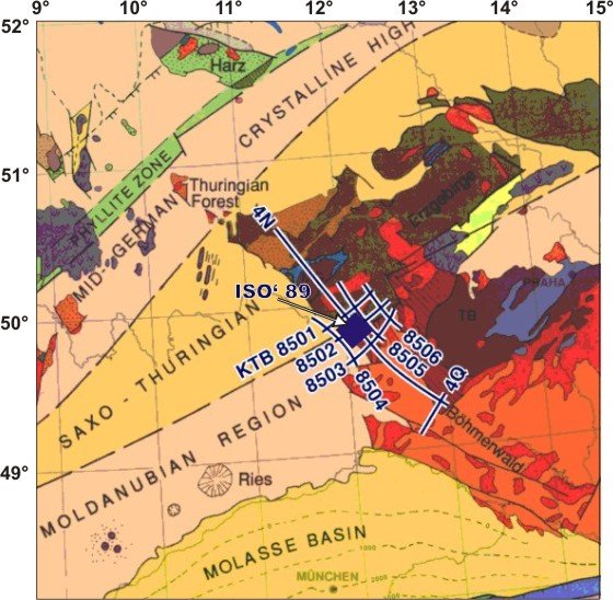
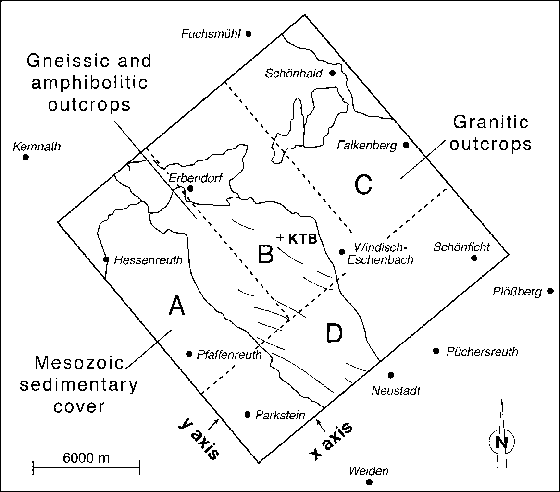
The ISO '89 3-D experiments have been done at an area of about 20x20 km with the KTB drilling site in its center. The survey area includes crystalline units of the Bohemian Massif in the NE as well as mesozoic and paleozoic sediments in the SW, separated by the Franconian Line. This NW-SE striking fault zone gives the orientation of the nearly rectangular survey area. The perpendicular direction runs parallel to the Variscan transition zone between Saxothuringian and Moldanubian.
The ISO '89 survey area is embeddet into the network of seismic lines of DEKORP 4 and KTB 8501-8506.
Experiments
Design of the 3-D Experiment
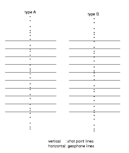
The array set-up consisted of two types of single set-ups which differed only in the sequence of shot point separation. Both types were alternated and shifted so that the shot points of type A are neighboured by the shot point gaps of type B. Each set-up consisted of 10 geophone lines with 48 geophone groups. The total length of a geophone line was 4.8 km, the distance between the lines was 400 m. The shot point lines run perpendiculary to the geophone lines (cross array) and parallel to the y-axis. Their length was 8 km.
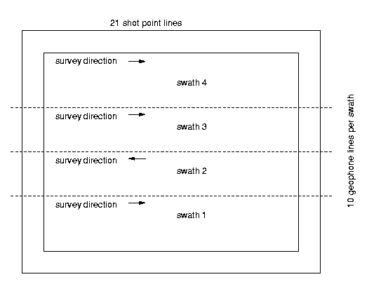
Each shot point line included 40 shot points which were spaced in a recurring pattern of 200 m, 300 m, 200 m and 100 m. For each swath of 10 geophone lines across the survey area of 17.8 km x 18.4 km parallel to the x-axis there were 21 shot point lines 800 m m apart. Four swaths of 10 geophone lines covered the entire survey area, giving 3360 shot points.
The survey has been done with the described scheme. Naturally, field work produces deviations from the exact experiment design. For real number of shot points, seismic traces etc. please look at the Field/acquisition parameters of ISO '89.
