GFZ's HART-Team going Down Under: Tracking the enigmatic Earthquake in Kaikoura (New Zealand)
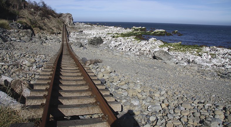
Enigmatic – the attribute is often used to describe the Kaikoura-Earthquake on November 14th 2016. Though, a lot of energy was released (magnitude 7.8) and there is widespread damage of roads and buildings, only two people were killed. It was not just one Earthquake on one fault. Around 20 known and unknown faults were activated, ruptures can be found all over the landscape, hills and valleys were displaced by up to 10 meters.
One week ago the GFZ's HART-Team (Hazard and Risk Team) lead by Vasiliki Mouslopoulou, GFZ section Lithosphere Dynamics, went to the South Island of New Zealand to investigate the enigmatic Quake. The results are relevant to the region down under. Moreover, the research questions are central to ongoing work in Chile and Eastern Mediterranean as well.
The team from Germany, Crete and New Zealand has to cope with damaged infrastructure, felt strong aftershocks – but is on target.
Here you will find the “Letter from the Field” of Vasiliki Mouslopoulou:
Kaikoura, February 8th 2017: Hello to Potsdam!
Mission progresses successfully and according to schedule. Other than challenges relating to access in several areas hit severely by the earthquake (damaged infrastructure), we have not faced other major problems or surprises. All team members have been working hard to derive uplift measurements that span timescales that range from seconds to 100’s of thousand years. Specifically:
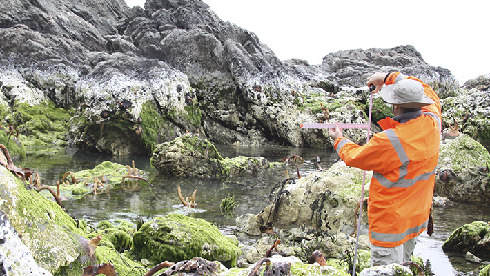
- We mapped the coseismic deformation along 55 km of coastline (the middle and the southern section of the earthquake rupture). This is done by using different methods - among others GPS measurements, drone-mapping of key uplifted shorelines, and analyzing instrumentally recorded InSAR and LiDAR measurements.
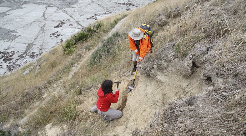
- We logged a Holocene section (10.000 year old) sea-platform at the Kaikoura Peninsula trying to define former large-magnitude earthquakes.
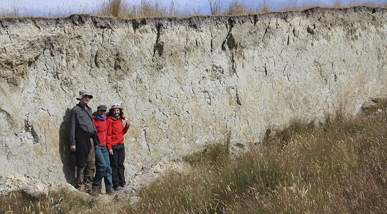
- We studied and sampled for optically stimulated luminescence (OSL) dating the Pleistocene marine terraces along the Kaikoura coastline to capture long-term deformation.
- We visited by boat sections of the fault rupture which are restricted to the public in order to derive further co-seismic measurements.
And to our excitement, so far, we have felt three quite large aftershocks, reminding us that this earthquake is still not over!
Today one of our group members will deliver an open talk to the public at the Kaikoura city council.
Many regards from shaky Kaikoura!
Vasiliki Mouslopoulou and colleagues
Team members:
- Dr Vasiliki Mouslopoulou (GFZ, team leader)
- Prof. Onno Oncken (GFZ)
- Dr Sofia Kufner (GFZ)
- Prof. Andy Nicol (Canterbury University, NZ)
- Dr John Begg (Institute of Geological and Nuclear Sciences, GNS, Neuseeland)
- Assist. Prof. Panos Partsinevelos (Technical University of Crete)
- M.Sc. Sarantis Kyritsis (Technical University of Crete)
---
Ralf Nestler, 09.02.2017


![[Translate to English:] Torsten Sachs in front of a climate station on a field](/fileadmin/_processed_/3/9/csm__TorstenSachs_bearbeitet_GS_4a1365ef84.jpeg)
![[Translate to English:] left image flood at the Ahrtal: image from above, several houses are flooded; left image:: Heidi Kreibich;](/fileadmin/_processed_/4/4/csm_Bild2_9af0130e9f.png)
![[Translate to English:] Start der Vega Rakete](/fileadmin/_processed_/6/4/csm_20231201-kachel_Vega-VV23-launch_ESA-CNES-Arianespace_706716b68c.jpeg)
![[Translate to English:] Poster exhibition at the Brandenburg Hydrogen Day at the GFZ, some participants in the foreground](/fileadmin/_processed_/6/5/csm_Erster_Brandenburgischer_Wasserstofftag_GFZ_402fcec95e.jpeg)
![[Translate to English:] Group picture of the participants](/fileadmin/_processed_/9/4/csm_20231108_CAWa-Workshop-Tashkent_Gruppenbild_99ea779d8a.jpeg)
![[Translate to English:] [Translate to English:] Hörsaal](/fileadmin/_processed_/e/6/csm_H%C3%B6rsal_e21ac645fb.jpeg)
![[Translate to English:] The Delegations in the Historic Library on the Telegrafenberg. In the back there are from left to right, the Dutch Ambassador for Germany, Ronald van Roeden, the Dutch Minister for Education, Culture and Science, Robbert Dijkgraaf and the scientific director of the GFZ, Susanne Buiter.](/fileadmin/_processed_/d/b/csm_Kachel-2_9eba4b4212.jpeg)
